Foreword
900 km fra the North Pole there exist an almost hidden land in the Russian high arctic. This land, or more specifically archipelago, is “hidden” by glaciers covering as much as 85 % of the land mass. The nearest point on the mainland, Yamal Peninsula, is 750 km away. There are no natural settlements, no remnants of inuit or prehistoric people once living there, only a few abandoned Soviet military and scientific stations.
We are talking about Franz Josef Land, the northernmost archipelago in the world. An apparently desert of ice and stone, often covered of mist.
The archipelago was originally discovered by the norwegian sealer Nils Fredrik Rønnbeck with the schooner “Spidsbergen” in 1865. He gave the land name “North-East Spitsbergen”, or “Rønnbeck Land”. The official discovery of the archipelago was done by the Osterreich-Hungarian polar expedition lead by Julius von Payer and Karl Weiprecht in 1872-74. They named the land after their emperor, Franz Josef.
Later on, several hunting expeditions as well as a few explorer/science expeditions took place. The first Russian expedition to Franz Josef Land took place in 1901. There were a certain dispute between the Soviet Union and Norway to whom the sovereignty should belong, ending up being Soviet territory in 1926.
For many years this archipelago was totally closed for people that had nothing there to do exept for work at the Soviet stations. Later, many years after the Soviet leader Mikhail Gorbatsjov introduced “Glasnost”, they allowed certain foreign researchers with special science missions to visit Frans Josef Land. Later on the hold of secrecy loosened, -to a certain degree, slowly up and allowed a very few foreigners without special tasks to visit the archipelago.
The travel
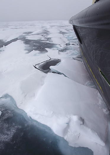
Due to traditional heavy sea ice around the archipelago even in summer time, the start of this expedition northwards by boat was not planned to take place before the end of July month, at the time when the sea ice normally start to break up around the archipelago. One of the reasons for the traditional late sea ice break up is that the temperature of the sea never rise over -1 deg.C here (vs -4 deg.C for the sea ice around the neighboring Svalbard islands).
July 27th 2010 we went by car from the Norwegian/Russian border near Kirkenes, heading for the Russian city of Murmansk. After a 4 hours drive and 3 check points controlled by the federal security service FSB we arrived Murmansk in the afternoon. Murmansk is Russia’s most important harbour at the northern seas, -this because the sea here is normally free of ice year around. Here, and on the Kola Peninsula in general, there are great military Russian activity with naval ship yards, submarine bases and numerous military camps.
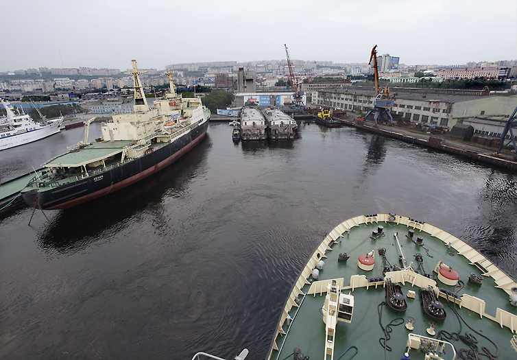
The last check point for us is at the harbor itself, and entering beyond there we are close to the ships. Kapitan Dranitsyn which is “our” ship is one of he biggest ships at the harbour, both this and the nabor ship, the nuclear ice breaker “Lenin” are from the Soviet era. Well on board the Kapitan Dranitsyn, they start up the (in total) 24.000 hp diesel engines and loosened the moorings. It was a beautiful evening, calm and sunny with temperatures around 20deg.C, so nice that we stood on the top deck watching the scenery while we slowly went out the Murmansk Fiord.
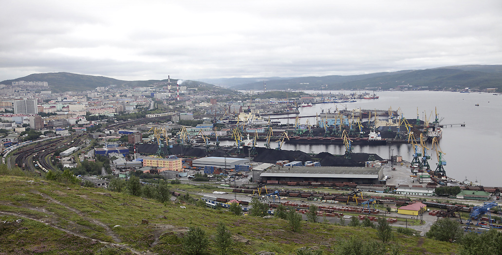
Murmansk harbor
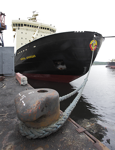
Our powerful expedition ship, -the ice breaker “Kapitan Dranitsyn” in Murmansk harbor
The Kapitan Dranitsyn is leaving harbor. The nuclear powered ice breaker “Lenin” beside.
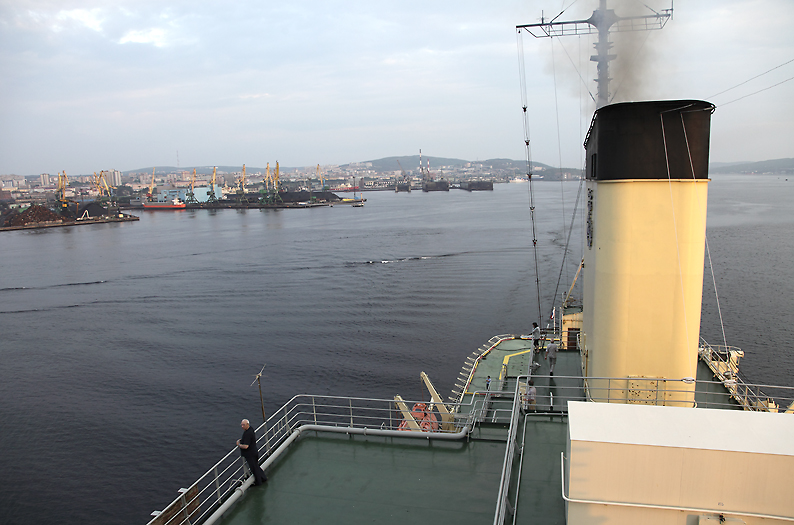
A nice and sunny evening the “Kapitan Dranitsyn” begin the voyage northwards.
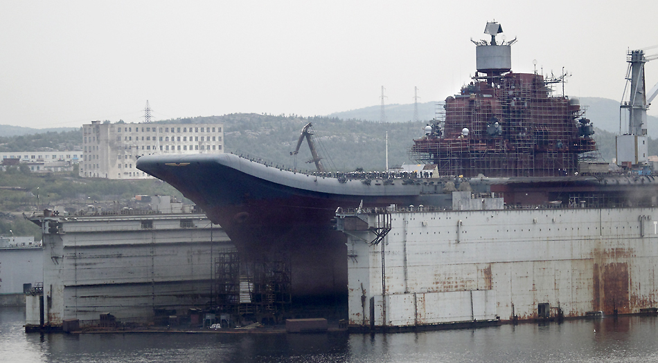
Passing the Severomorsk Naval shipyard further out in the Murmansk Fiord. Here we see the Soviet Kiev-class aircraft carrier.
In the open sea, the next day, we for sure felt that we were on our way to higher latitudes because the temperatures dropped to 7-8 deg.C and we became surrounded by mist.
The first officer at the bridge informed us that they expected to reach the southernmost part of Franz Josef Land tomorrow evening. I told him that the latest updated ice charts show unusual little amount of sea ice around the archipelago. He said that he had no info about that, -but did not care at all because the ship can force through sea ice up to 3m thick and of this reason did not use ice charts in the summer time. The ship is strongly built with 45mm, hull thickness.
At 21:00 hrs the ship reached 74deg, 3′ north.
Next morning we passed 77deg north, and the temperature decreased further. The mist had disappeared and the sun was back again and shined from blue sky.
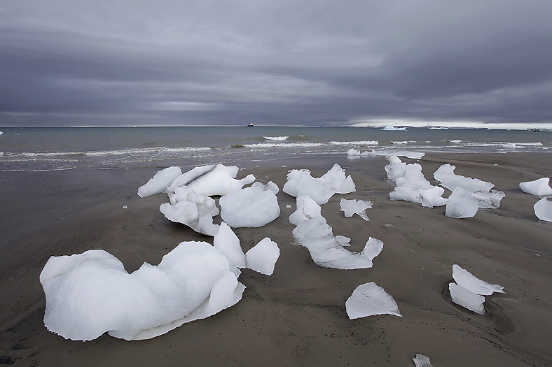
During the day, we passed an increasing amount of icebergs-bigger and bigger ones.
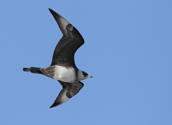
The Pomarine Skua is one of the typical arctic birds that follow the ships here in the eastern Barents Sea.
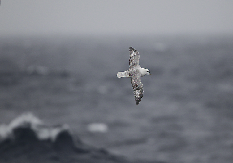
Fulmars follow the ship as usual in the northern seas.
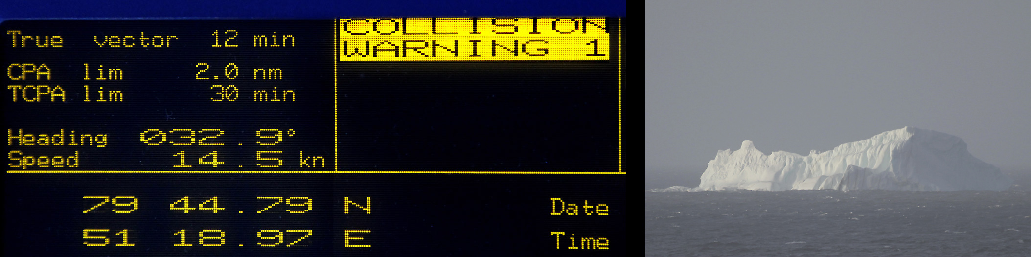
“COLLISION WARNING” suddenly flashes on the screen at the ship`s bridge. Ice bergs ahead! We clearly understand that we are now in icy waters where it is important to keep a constant look-out for icebergs.
Arrival Franz Josef Land
As predicted, we arrived Franz Josef Land today July 29th at 21:00 hrs. In a very local storm we entered the archipelago at the 80degree in the Bruine Sound between Northbrook and Hooker Island. It was great to see this former closed land that we had read about and so hard to be able to travel to.
Due to the heavy winds we could unfortunately not reach the exposed shore at Cape Flora. Here there should still be remnants after Jackson`s expedition in 1894-97 arriving with the “Winward”. This was also the place of the famous meeting between Jackson and Fridtjof Nansen in 1896. Huge bird colonies in the cliffs above the make the this place to be the most fertile and green in all the archipelago (…and made the name here Cape Flora).
After two days at sea, we arrived Franz Josef Land through Bruine Sound.
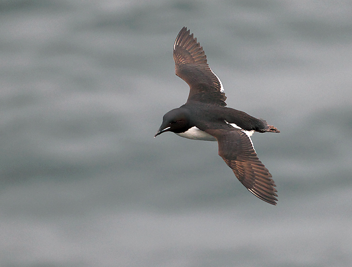
Brunnich Guillemot at Cape Flora.
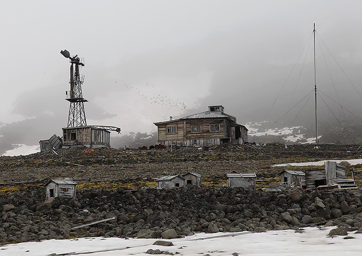
The ship set course against Hooker Island in the east to more sheltered waters. Then we plan to anchor up in Tikhaja Bay with the bird cliff Rubini Rock and the abandoned Soviet Polar Station.
Early next morning we was on deck watching the huge basaltic bird cliff with about a hundred thousand birds, mainly Brunnich Guillemots, Kittiwakes and Little Auks. The noise from the birds here was the reason for naming the “rock” after the famous Italic opera singer Giovanni Rubini. Two Walruses (mother and calf) was also seen swimming in the bay here.
Reindeer bones and antlers have earlier been found on the island, and it is anticipated that they origin from failed winter reindeer immigrants from Novaja Zemlja.
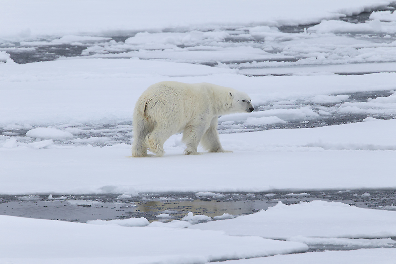
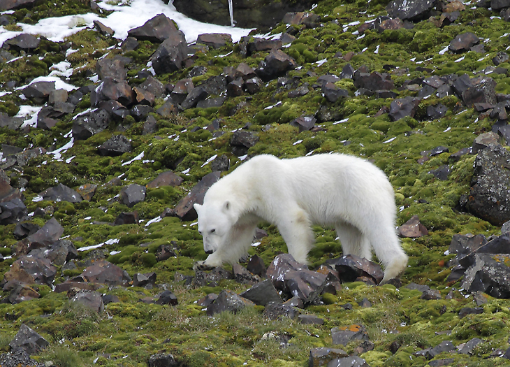
We see a Polar Bear with a 2 year old cub between the station and front of the Sedov Glacier innermost in the bay, so we avoid walking in that direction.
During World War II the bird cliff saved the polar station inhabitants from scurvy and we still can see ropes hanging down on the rock as a reminder of that period.
The station was manned from 1929-59, and was the first soviet research base an then the northernmost one in the world.
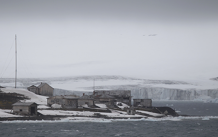
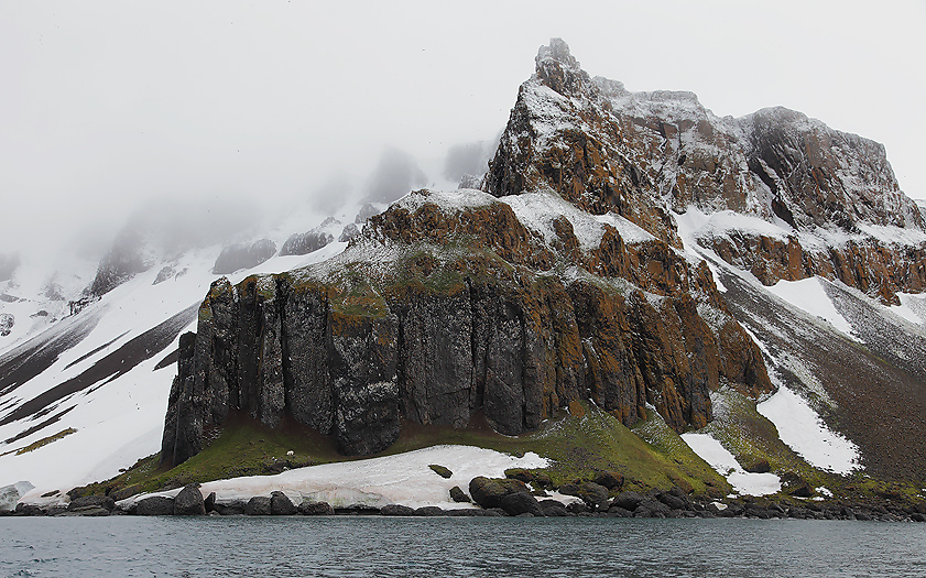
Part of the abandoned RussianTichaja Bucta Station. Sedov Glacier in the back ground.
From the Tichaja Buchta Station
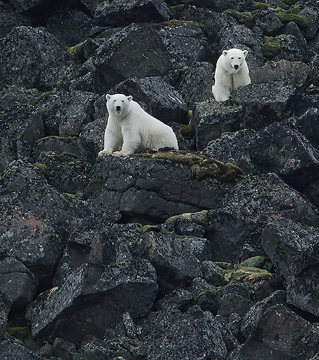
Polar Bears at Tichaja Buchta
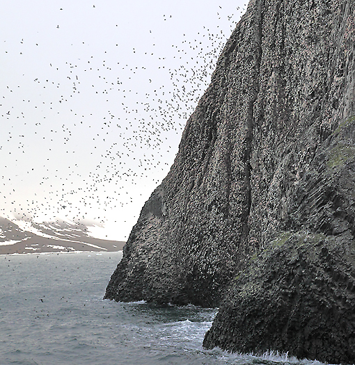
Tichaja Buchta bird cliff
Just passed midnight we leave Hooker Island and heads for Cape Norvegia at Jackson Island. We want to visit the place were Fridtjof Nansen together with Hjalmar Johansen wintered in 1895-96 in an extremely simple dwelling after returning from a failed attempt to reach the North Pole. The following morning we make an attempt to land at the cape, but it is very difficult with a rubber dinghy when the western heavy seas are roaring white. This year in is until now, one of the few years with very little sea ice present at the archipelago. For us causing limited absorbing of waves and make landings with dinghies difficult. The ship inhabits a helicopter, but the clouds are to low for flying in poor visibility. We therefore leave the place until later on the expedition and set course for Wiener Neustadt Island. This island is almost completely glacierized, only Cape Tyrol on the NE side is ice free. The landing goes smoothly and we can explore this beautiful place. We are met by fresh Polar Bear tracks at the beach, so we need to be careful when walking around. There are not any signs of former human activity here, so the focus are on the land itself. Some high arctic bird species were seen here, as Ivory Gull and Pomarine Skua.
The shore at Cape Tyrol, Wiener Neustadt Island
From Cape Tyrol
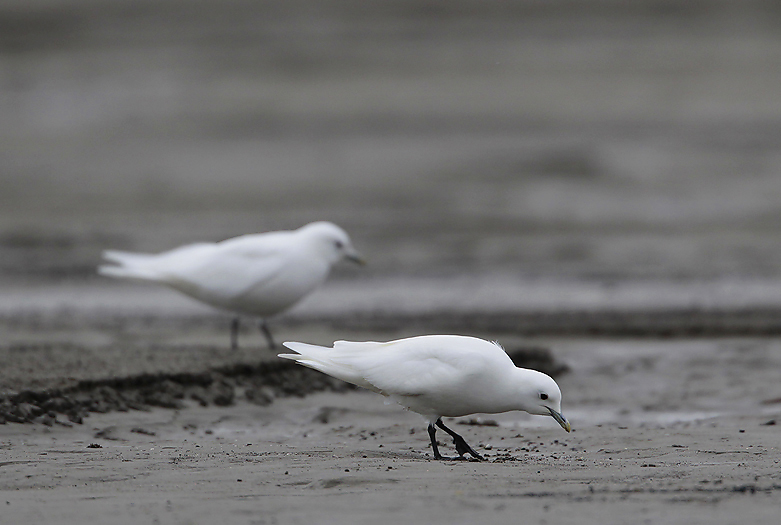
The beautiful high arctic Ivory Gulls are to be found at Cape Tyrol
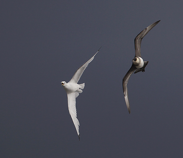
An Arctic Skua is harassing a Kittiwake at Cape Tyrol
Later on the expedition we can see what excellent ice breaker Kapitan Dranitsyn is when we in the NE part of the archipelago run in 7-8 knots speed through up to 2m thick unbroken winter sea ice. The ship is built for the heavy sea ice in the oceans north of Siberia, and is among the most powerful icebreakers in the world. When the ice is extremely thick the ships air bubbling system can be taken in use for helping breaking the ice. Air can be forced under pressure from 2m above the keel from the bow to halfway down the ship.
We see lots of fresh Polar Bear tracks on the sea ice here, and also some of the bears on the ice.
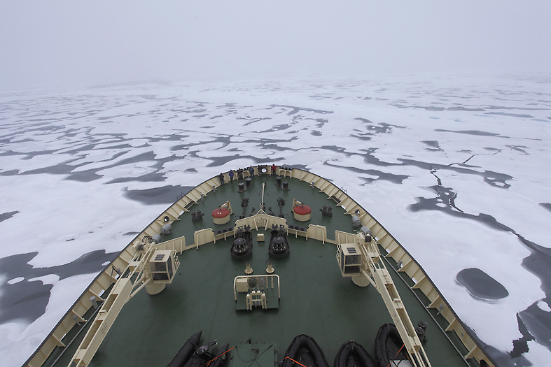
Into the unbroken winter ice. Parts of this ice is up to 2 meters thick
Breaking the ice seems to be no problem for the expedition ship
Polar Bear in the drift ice north of Kane Island
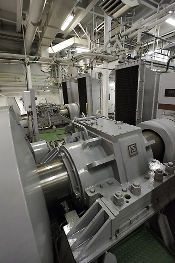
Part of Kapitan Dranitsyn`s engine room with propeller shaft houses
We are in the area east of Jackson Island where the water surveys are far to from complete, and in partly shallow waters the captain must keep slow speed and actively use the sonar to check the sea depth. In these parts of Franz Josef Land we find huge Walrus haul out places. The waters here are nutritious and there are numerous sea birds around us. We anchor up and intend to spend quite some time here.
There are Walruses in the sea around us, and they seem to be quite curious. Due to both the remoteness and traditional extremely rough sea ice conditions, the Walrus population did not decline in the same way here as the Svalbard population that once was near extinction in the 20th century. In the 1950’s there were only approximately 50 individuals left at the Svalbard archipelago to the west compared to here where between 500 and 1000 of them lived. Today there are between 2-3000 Walrus at the archipelago. It is estimated that the reason for the success of todays high population of Walrus in the Svalbard archipelago is emigrated animals from Franz Josef Land.
Overview of the he Walrus haul out place at Appolonoff Island
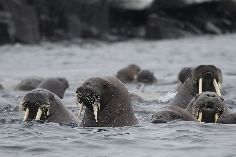
Curious Walrus
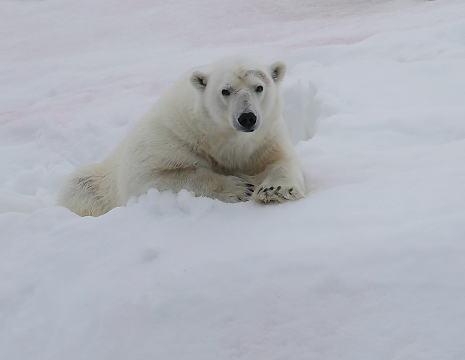
Polar Bear resting on a snow patch just beside the Walrus Haul-out place. The bear will certainly try to take one of the Walrus calves
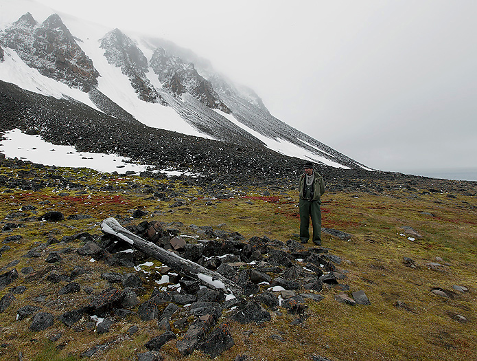
While being in the NE part of FJL, and due to that my brother and myself are the only Norwegians on the ship, we make a second attempt to land at Cape Norvegia on Jackson Island. In the early morning when the seas have calmed down we successfully land with the rubber dinghies on the beach. With great awe we slowly walk up to the remnants of Nansen and Johansen`s wintering dwelling site. I have only seen photos of this place when the norwegian polar historian Susan Barr together with Soviet scientists found the place in 1990, -took photos and compared them from exact same angle with a photo taken by Nansen in 1895/96 (photo on the right side below).
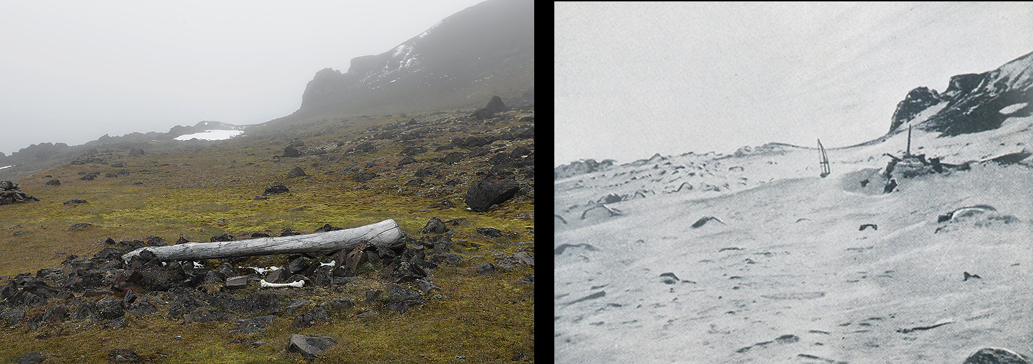
Left: Contemporary photo taken on the expedition of Fridjof Nansen and Hjalmar Johansen`s winter hut at Cape Norvegia.
Right: Nansen`s original photo of the winter hut taken in 1895/96.
Nansen`s and Johansen`s winter hut at Cape Norvegia seen against south.
A curious (and hungry?) Polar Bear had to be scared and kept away with gunshots from the site while we was there. I suppose Nansen and Johansen also had to be constant wary for Polar Bears while staying here.
Nansen and Johansen left their ship “Fram” in mid March 1895 with the effort to reach the North Pole. Nansens main goal with the “Fram” expedition was to prove the theory of icedrift from east to west and to explore the physical and geographical conditions of the area. He hoped that the ship would drift over the North Pole, but as so did not happen he and Johansen left the ship at 84*4’N and set course for the Pole.
In April 1895 they reached their furthest north point at 86*14’N and headed southwards again, well knowing that finding the ship again was close to impossible. After a dramatic walk they saw land late in July, and in mid August they sat their feet on land for the first time in 2 years. However, they did not know for sure where they were, but thought they could be on he west part of Franz Josef Land. Nansen’s plan was to use their kayaks to paddle further west to Spitsbergen. As they travelled further on they discovered that they could not be on the west part, and understood that they could not reach people this year, but had to prepare for wintering. The date for this decision was August 28th 1895, and they was at the south west side of Jackson Island, later named Cape Norvegia. The winter was very soon to come and they had to make a dwelling, and also to achieve food for a long, dark and cold winter. A hollow was scraped in the ground, and they dug using a walrus shoulder-blade and a walrus tooth. They built walls of stones around the hollow and a large driftwood log was placed across the top walls to support the roof of walrus hides. The size of dwelling was no larger than 2×3 m and 2m high. Throughout the long winter they used a small blubber lamp for light and also for warming of food. These two men lived almost exclusively on walrus and bear meat and blubber. They slept and lay long hours in the double sleeping bag in order to keep warm. They had little exercise apart from occasional bear shooting in the immediate neighborhood of the dwelling. They lived here until May 19th 1896 when they continued their travel for reaching people and to finally come home to Norway again. As end of this story they met Jackson with his expedition at Cape Flora (south west at the archipelago) June 17th 1896. They arrived Norway (Tromsø) in the autumn of 1896, only days apart from the return of the ship “Fram” which they had left 1,5 years earlier.
Nansen and Johansen mapped and named the NE part of Frans Josef Land, were i.e. the first islands they had seen were named Eva Island and Liv Island after Nansen’s wife and babydaughter. The extreme NE area with several other islands he called “Hvidtenland” (the White Land).
Polar Bear searching for food under the bird cliff north of Cape Norvegia.
The bird cliff north of Cape Norvegia. The Polar Bear is on the green hill under the steepest part of the cliffs.
The expedition continues and we head for the central islands. Here we plan to study a phenomena with peculiar stone spheres, “stone balls”, that has been detected on Champ Island. The balls are most concentrated on the south east corner, near Cape Triest. We still have calm weather, and the landing goes smoothly.
At the hill side, after having walked for 15-20 minutes up from shore we see the first stone balls on the ground. Here there are thousands of them, ranging from a couple of millimeter up to 3 meter in diameter, where the 1 cm in diameter balls totally dominate over the other sizes. Since the discovery of these stone balls there has been several theories of how they got their shapes, but there are still no official explanation about this. The geology on Champ Island is as for most part of Franz Josef Land horizontally Mesozoic sediment layers, separated by partly intrusive magmatic rocks. Therefore it is anticipated that the balls are concretions (geodes) which are formed by accumulation of sedimentary material, and further processed chemically by nature. The details here are though unknown.
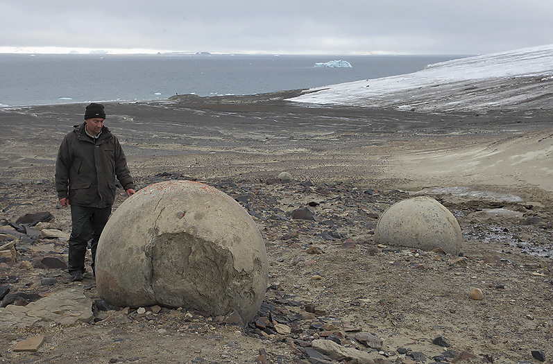
Medium sized stone balls (concretions) on Champ Island
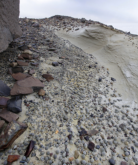
Hundreds of small concretions between 0,5 and up to 3cm in diameter
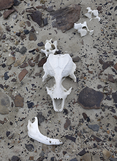
Parts of a Polar Bear skull on Champ Island
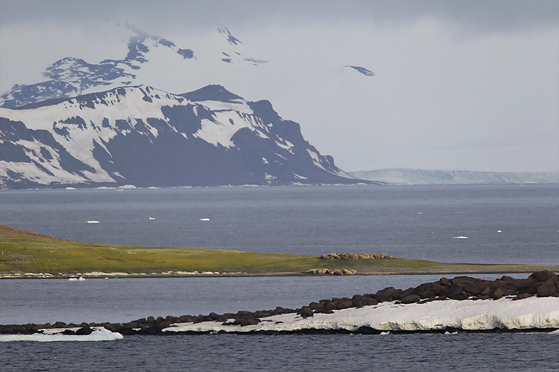
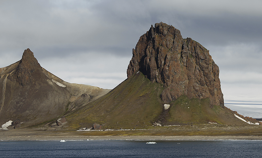
Cape Tegetthoff on Hall Island at the southern part of the archipelago is characterized by dramatic rock structures. Geologically speaking, -a horizontal top magmatic rock layer ends here, a ridge descends down to the sea with a series of magmatic funnels from long-ago volcanism, having eroded out of the surrounding colourful weaker sediment layers, this causing spikes of rock sticking vertically up from a mountain ridge.
Part from Hall Island`s south side
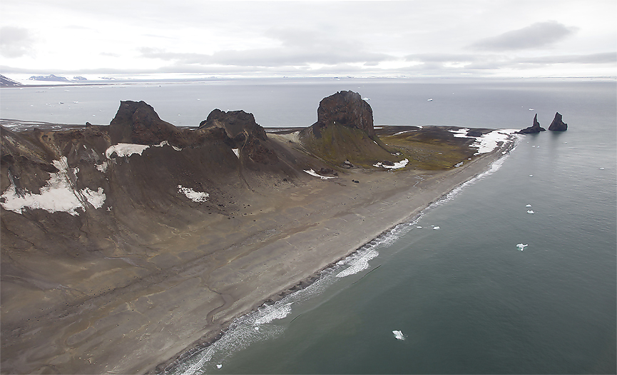
The magmatic peaks at Cape Tegetthoff on Hall Island seen from the air
Also here the landing onshore are complicated by Polar Bears. See the Polar Bear family on the grass hill slope to the right
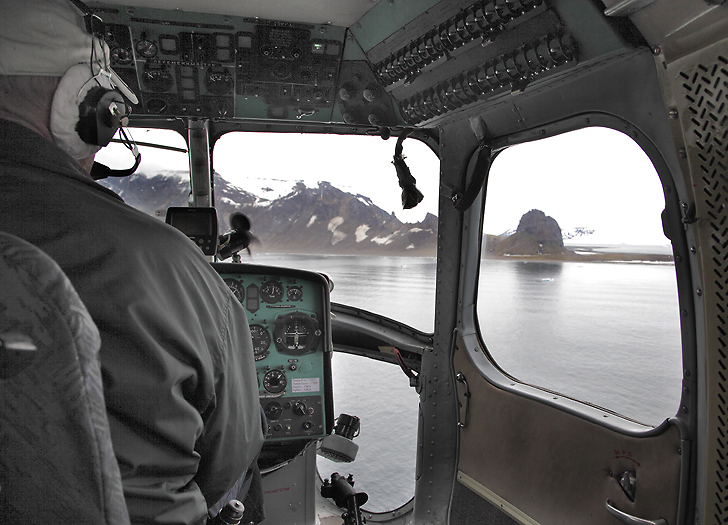
The expedition helicopter flying against Cape Tegetthoff
The spectacular rock scenery of Cape Tegetthoff was the first land to be seen from the ship SS Tegetthoff (scooner) with the Austrian-Hungarian 24 men expedition on August 30st 1873. The ship became trapped here in a drifting ice field some tens kilometers away from nearest land. Further approaching this newly discovered land was possible only months later for the expedition members when the drift ice had frozen solidly together all the way to the land. The ship came to a rest south of Wilczek Island, where they made their first landing on the archipelago November 1st. On the following day, Payer (one of the 2 leaders of the expedition) took possession of the land in the name of the reigning monarch, Franz Joseph, with the Austrian-Hungarian flag in hands.
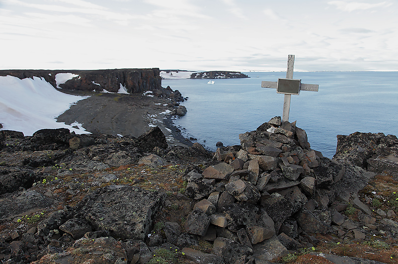
Otto Krisch’s grave on Wilczek Island. He was weakened of scurvy and died of tuberculosis in March 1874. He was the only person that died on the expedition
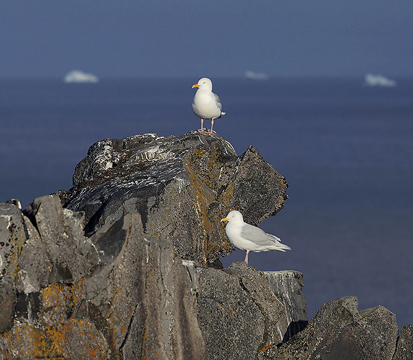
Glaucous Gulls on Wilczek Island
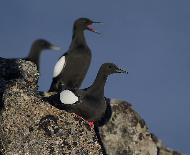
Black Guillemots was quite common on Wilczek Island
The following spring the Tegetthoff expedition started to explore and map the land. The mapping itself was immensely difficult due to the extreme glaciation (which was far greater than today) and where snow and sea ice also made it difficult to get correct appearance of the land.
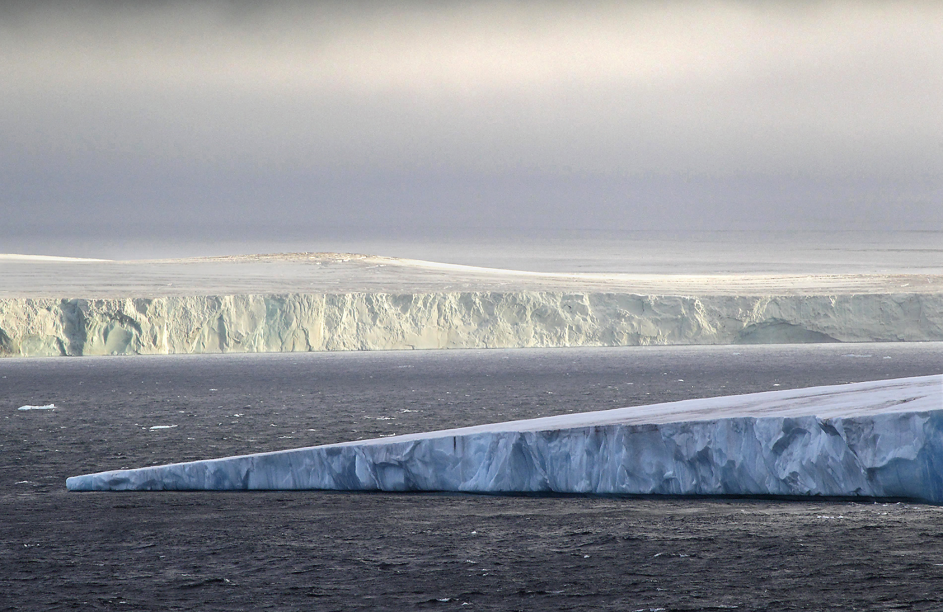
For curiosity it can be mentioned that today the average glacier thickness at the archipelago is 180meter This mean storage of 2500km3 of water, and would represent a ca 6mm rise in sea level of the worlds oceans if the ice were to melt completely.
The primary goal of this trip with the SS Tegetthoff was not to reach the North Pole but to explore the still unknown areas of the northern Arctic Ocean. They planned to start from the northern coast of Novaja Zemlja, -and in the event of favorable ice conditions – to venture as far as the Bering Strait.
To end the history about the Tegetthoff expedition: The ship never loosened from the ice grip at the archipelago, and though the ship was in good condition she was abandoned by the expedition members on May 20st, 1874. To rescue themselves they dragged the ship’s minor boats over the pack ice for over 2,5 months until they reached open water. They then sailed against south, and reached Novaja Zemlja around August 20st. Four days later they was rescued by russian fishermen in the remote Dunen Bay. This return was an extremely hard journey where the men was constantly wet, suffered with thirst, hunger, cold, sleepless nights and diseases. It almost borders on a miracle that the whole crew was able to return back home (except for Krisch that died at the archipelago in March 1874).
Despite the loss of the ship, the Tegetthoff expedition had been a great success.
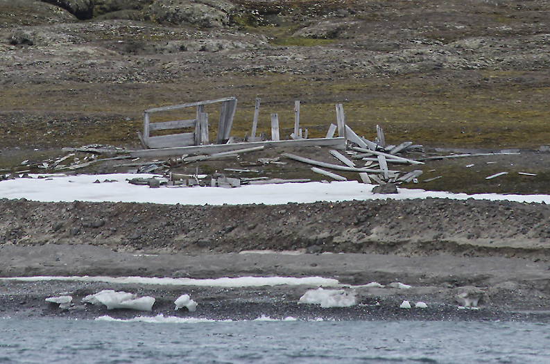
Remains of Wellman’s base at Cape Tegetthoff. This was used in conjunction with Wellman expedition (1898-99) with attempt to reach the North Pole in the spring of 1899. The attempt failed already within the archipelago
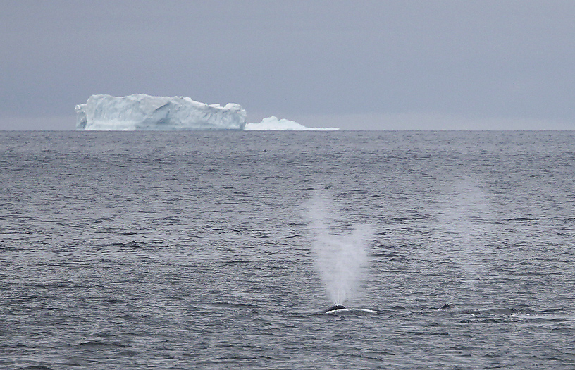
South of Wilczek Island we see 6 Greenland (Bowhead) Whales. These belongs to the original North Atlantic population that has been on the edge of extinction. Only some tens animals was left after the whaling industry that lasted from the 17th to the 19th century. The population are now slowly increasing
View against Mc Clintock Island’s southeast part
As a second attempt to land on the shore at Cape Flora we set course westwards against Northbrook Island. Our ship Kapitan Dranitsyn anchored up beside the cape during the night. Next morning there was unfortunately big rolling swells that complicated any landing. In addition to this there were several Polar Bears walking around at the cape that perhaps could cause dangerous situations. Of these reasons it was decided to cancel the landings.
The Return
Our time here at Frans Josef Land goes soon to an end, and a couple of days later the ship sail southwards against Murmansk.
Russian authorities had given instructions where our ship was allowed to sail, and a special (sealed) GPS unit was mounted at the top of the bridge. This for logging (also live) of the route along the journey. Even if the so called “Cold War” was over many years ago, there are areas that are not allowed to be shown for others outside certain military organizations up here.
Including this, Russian authorities had their own representative on the ship during the expedition.Kapitan Dranitsyn are 2 days at sea before we return to Murmansk again.
As for the way to FJL there was many seabirds along the way, especially between 77-79 deg north.
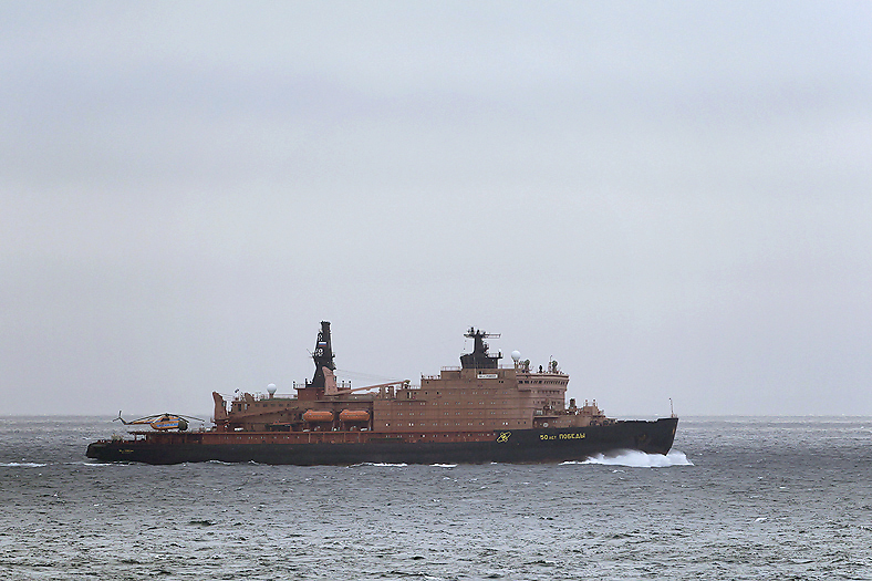
The nuclear powered icebreaker “NS 50Let Pobedy” (= “The 50 Years of Victory”) return from the arctic oceans and head for Murmansk
The sister ship “Arktika” was the first surface vessel to reach the North Pole (August 1977). These extremely powerful ships can cruise at 10 knots through an average ice thickness of 2,5 meter. They have 2 reactors of 171 Megawatt each which give the ship 75.000hp in total for the propellers.
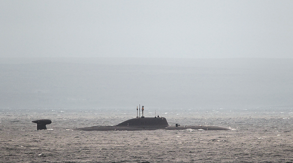
It is not only us with the icebreakers that has set course to the mainland on the Kola Peninsula, but also this nuclear powered Victor III class Soviet attack submarine
After well over 50 hours at sea when sailing southwards we arrived Murmansk again at August 6th. After a farewell meal on board the ship together with the other expedition members, we thereafter drove on westwards the Kola Peninsula to the Norwegian border at Kirkenes.
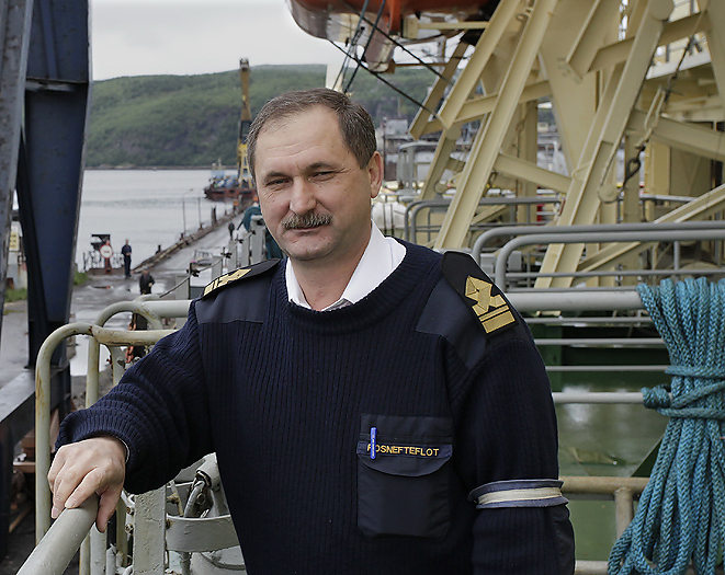
Kapitan Dranitsyn’s Helmsman
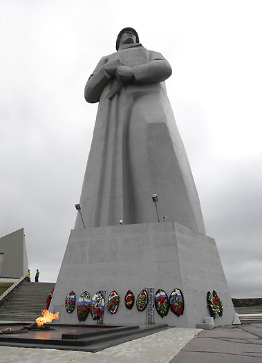
Alyosha soldier monument in Murmansk
An eternal flame burns at the base of this 35 meter high memorial monument to honor the fallen soldiers defending the Soviet Arctic during the Great Patriotic War (1940-45).
When we finally arrived the Norwegian border and got telephone coverage my brother and myself received a message telling us that our dear Father had passed away yesterday. Inexpressibly sad.
Per Michelsen