Foreword:
As we all know is Greenland the world’s largest island, -and where over 80% is covered by glaciers which can be up to 3km thick. Great parts of the coasts are only navigable for a short period in late summer, and farthest north there is always sea ice. From the Arctic Ocean of the north, the ice is carried with the ocean currents to the south, -near all along the east side. This have made sailing to the north-east side almost impossible before modern ice classified ships was built and used. This except for HMS Griper led by commander Douglas C. Clavering which in late August of 1823 as the first ship ever managed to force itself through these extremely heavy icy waters and where the sailors could set their feet on the north-east Greenlandic shores. There, on what later was named Clavering Island they met a group of 12 inuits. The group consisted of men, women and children. Clavering described their seal-skin tent, kayak and clothes, their harpoons and spears tipped with bone and meteoric iron, and their physical appearance with light yellow-brownish skin color, black hair and rounded faces, their hands and feet was fleshy, and “much swelled”. Later that day Claverings men demonstrated a musket to the inuits and they was extremely surprised. They became obviously scared of this magic “thing”, because next morning they were all gone. This was the first and last time ever the indigenous people of north-east Greenland was seen. When the next ship managed to arrive the land here (the German schooner “Germania” in 1869) no inuits was present, -they had became extinct. It is not known the reason for the extinction of the natives here in north-east Greenland, whether it was disease, lack of food sources or others. It is anticipated lack of food because around the time 1700-1800 AD it has later been stated that the Dwarf Reindeer population decreased in numbers and the Muskox population also was at low numbers. The transition times between fluctuating numbers of Reindeer/Caribou and Muskoxen in the Canadian high Arctic have historically several times caused starvation and death of native populations there when both species in this cycle were low in numbers.
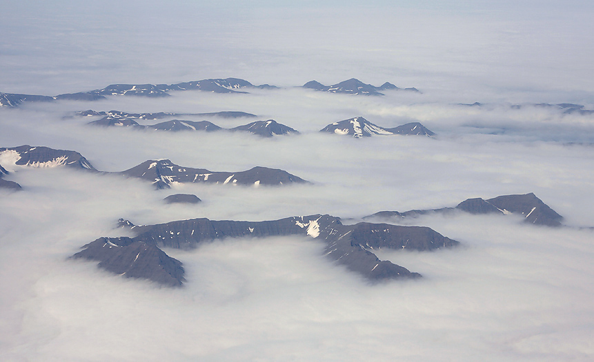
As we leave Iceland on the way to north-east Greenland the last sight of Iand is the mountain peaks bathed in thick fog.
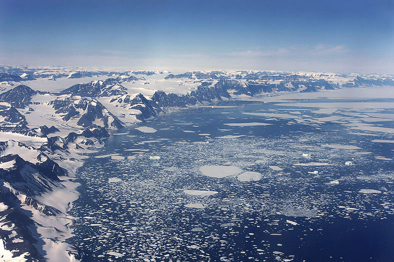
Arriving east Greenland we see the Scoresbysund Fiord below us. This impressive fiord is the biggest and deepest fiord in the world. Volquart Boon Coast to the left.
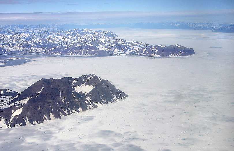
Flying further north entering the fiord system of north-east Greenland via Carlsberg Fiord (below) Fleming Fiord (in the middle of the photo) and Davy Sound we clearly see that the winter have not left the land below us, -solid winter ice on the sea and some snow & ice on the land.
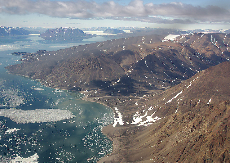
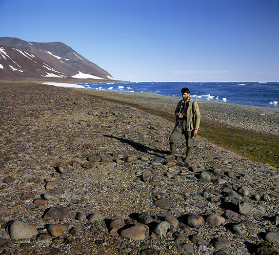
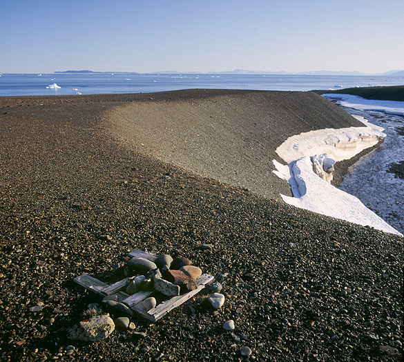
Aerial photo of the Skraellingdalen (Native Valley) that ends in Dødemannsbugten (Dead Man`s Bay). It was here in Dødemannsbugten “modern man” met the natives for the first and last time. This was in 1823 and it was Clavering and his crew on HMS Griper that met them. The natives in North-east Greenland thereafter became considered extinct.
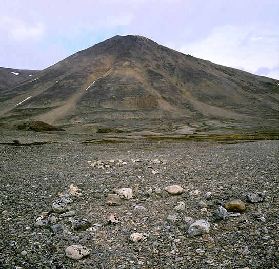
Down on the ground we see tent rings of stones that the natives here in Dødemannsbugten once used to keep their fur tents down to the ground with.
Further on:
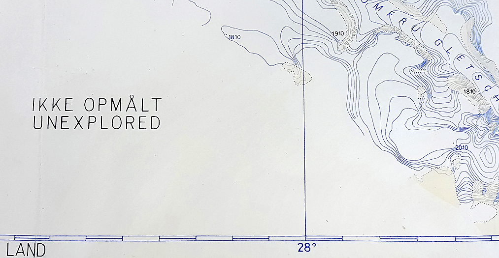
Despite being in the high arctic close to the Greenlandic inland ice a few small parts of this huge land in north-east is remarkable fertile. We plan to stay and explore the most interesting area of those. One of the last updated (in 1978) maps we have brought with us still have big white areas with the letters “Unexplored” on.
We are in early July month, and despite we saw that winter had not left the southern land when flying northwards passing Carlsberg and Fleming Fiord and that it is milder some places further north. So, after several hours in the air The Twin Otter set us off in one of those places; the land of Hold With Hope.
It looks arid, but it is not. The huge wide wetland valley is mainly fertile and rich of insects, a big variety of birds and several mammals species.
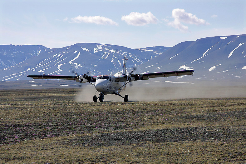
The Twin Otter depart from the tundra and us two are left alone in the Arctic wilderness, -a great feeling!
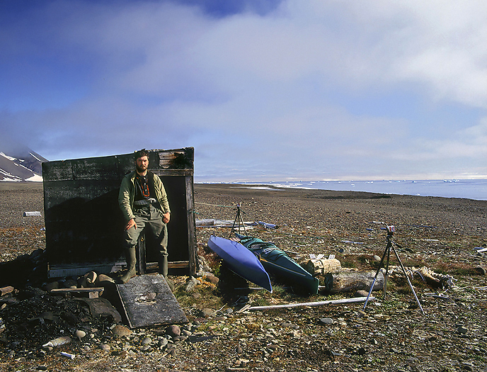
We plan to stay in tent and old trapper huts that is spread all over the land from Liverpool Land in the south up to Skærfjorden in the north. We have brought kayaks for travel along the shores when the ice break up later in the summer. From the 1908 to 1960 Norwegian and Danish fur trappers used the north-east Greenland making a living out of acquire mainly Arctic Fox pelts. They had base stations and small simple satellite stations (“out stations”) as small as approximately 2×2 or 2x3m spread out on the land. Some of the buildings still exists and some are in ruins.
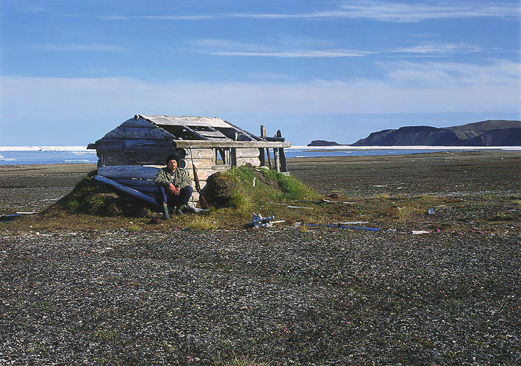
Ruin of a former Norwegian out station built in 1927. This small cabin (2x2m) was built of splitted (axed) driftwood and was originally covered by Muskox fur as isolation / wind protection. Inside we found amongst others, an old Norwegian newspaper from 1933 (Aftenposten).
Before heading out on the land with the kayaks we wander in the big fertile valley and surrounding mountains exploring the land with it’s wildlife. Under here there are a variety of some observations:
This huge Arctic Fox den must have been used for hundreds of years was this year inhabited by a family with 6 cubs.
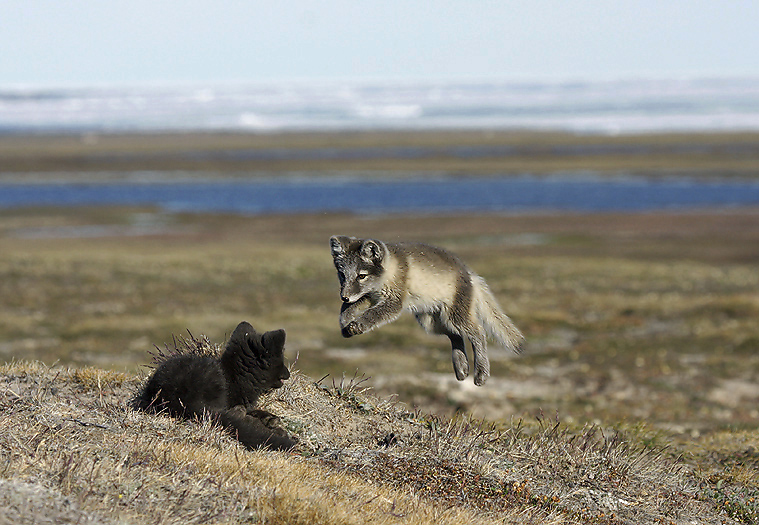
Playful Arctic Fox puppies at the den.
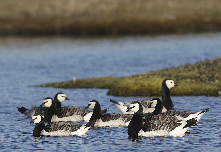
Geese is an important food source for the Arctic Foxes in this valley. Quite some numbers are caught in late summer when the geese are moulting. Here a flock of Barnacle Geese. The nesting place to the Barnacle Geese here are in steep cliffs to avoid always hungry Arctic Foxes.
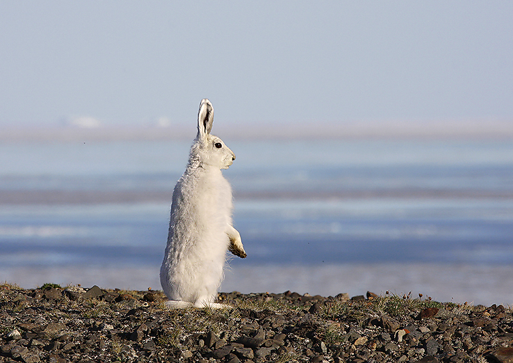
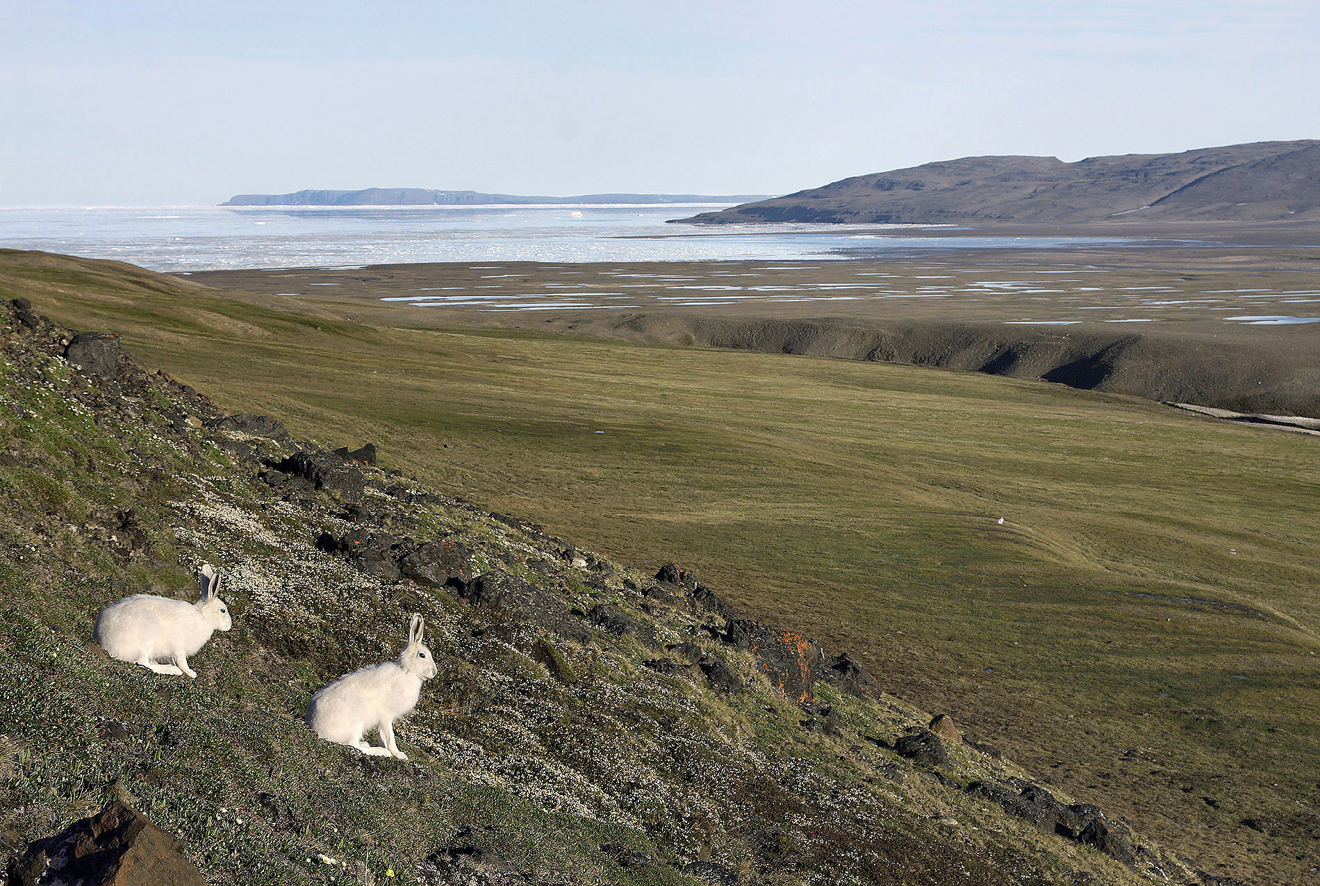
Due to the very short summer the Arctic Hare species do not waste much needed energy by changing from white to brown color and back again. They need as much body mass as possible for the long and cold winter.
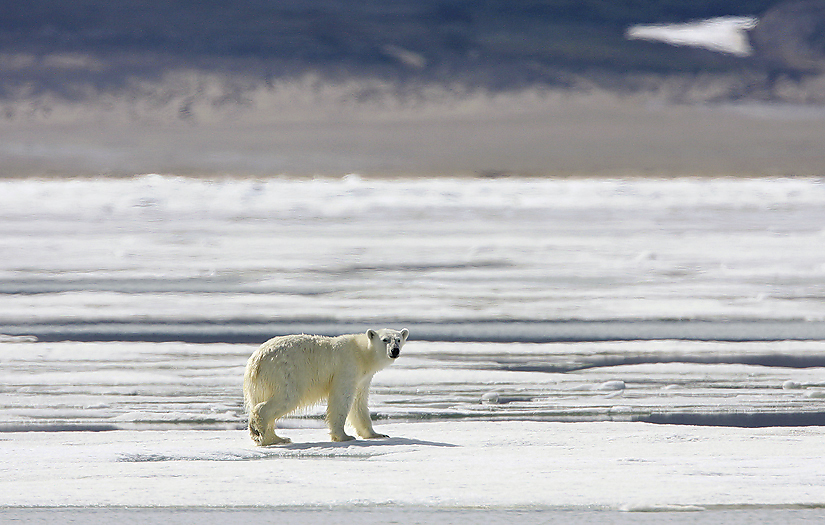
This Polar Bear waited for us to come back to our camp every day for a week, -good to have a rifle on the back to defend ourselves if it should be necessary.
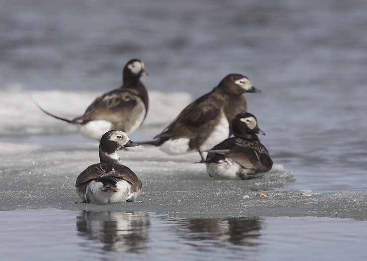
Long-tailed Ducks is one of the most common Duck species here.
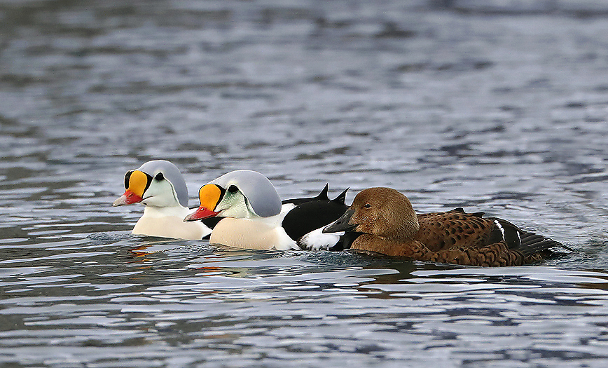
Also the King Eider nest by inland ponds in this valley (PAP).
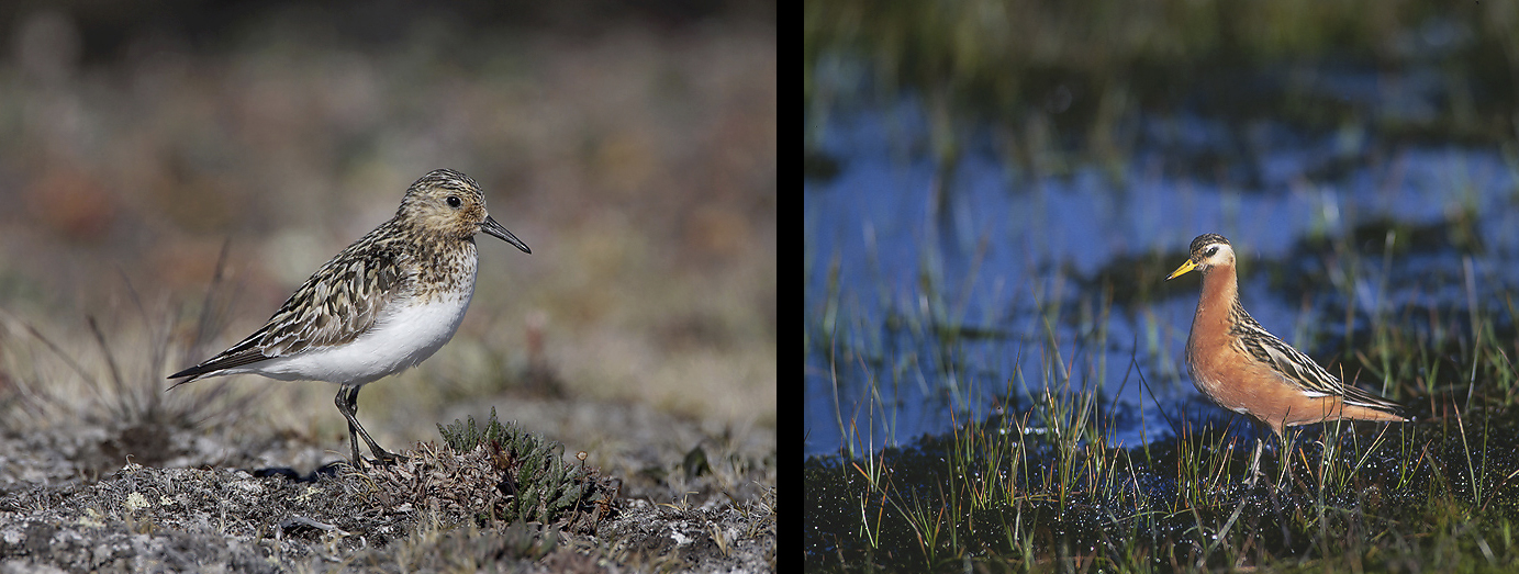
Among the High Arctic Wader species nesting here is the Sanderling (left) and the Grey Phalarope (right).
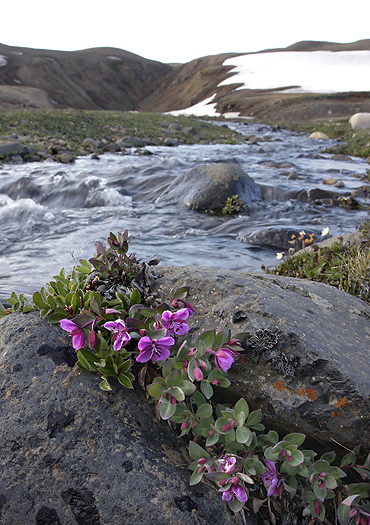
Lapland Rosebay (Rhododendron Lapponicum).
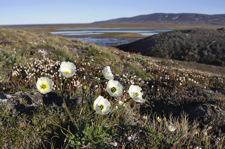
Arctic Poppy. These flowers has parabolic form to concentrate sunlight. This plant is also phototrophic.
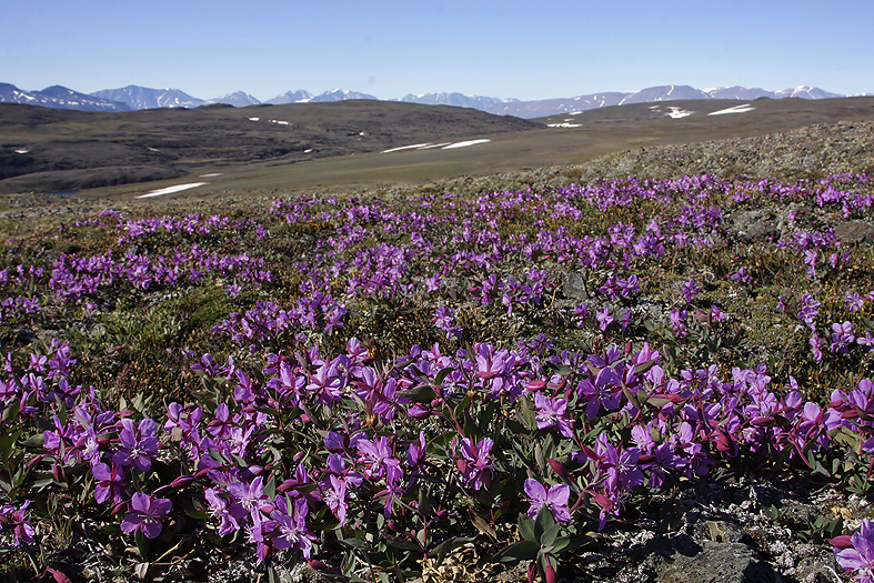
In a very short time in the Summer of the High Arctic, often only for the duration of a short week, great parts of the tundra may suddenly become beautiful colored. Here we see Dwarf Fireweed which is the national flower of Greenland!
Big parts of the lowland here is very humid with numerous marshes, ponds and lakes. Quicksand occurs in some parts so we need to be very careful when crossing sandy/muddy parts.
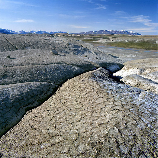
Clay formations caused by sudden heavy rainfall.
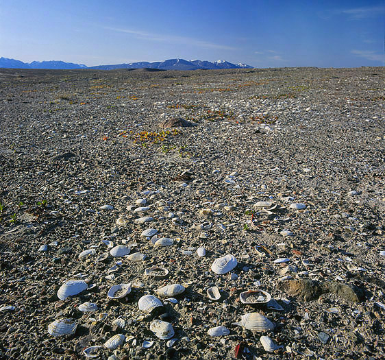
Old sea bed (Quaternary) 10km away from the coastline remember us that the land once raised due to prehistoric retrieval of the ice cap on the Greenlandic coast.
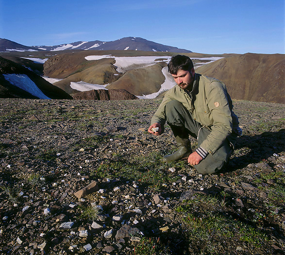
One of the very few “Fossil Woods” on Greenland is found here. It is a bit strange to think that this land once (in Tertiary period) was covered by trees. Here we study small pieces of fossilized wood which the permafrost have forced up to the ground.
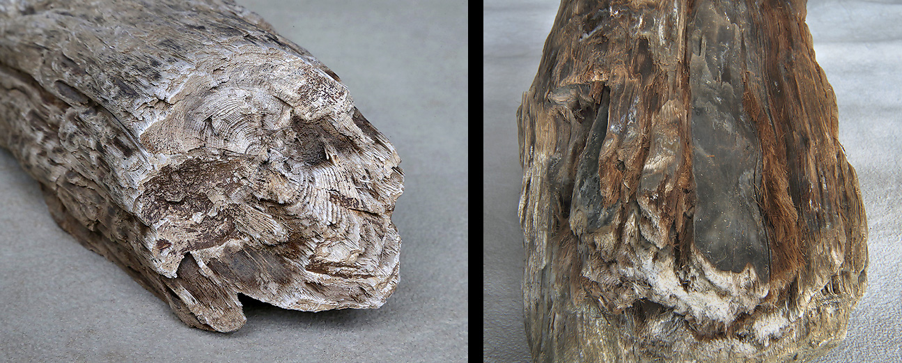
One of the big chunks of wood we found was not totally fossilized, and where soft wooden material was exposed when we dug it out of the ground (see the reddish color in the right photo). Quite remarkable after having been in the ground for up to 60 million years.
The summer goes on and the sea ice is beginning to break up. We can soon launch our kayaks for easy travel around in the area. Another sign for that it is on time to move is because the mosquitos are really beginning to increase in numbers here in the wet lowland. A funny episode to mention about the annoying mosquitos here: The first time we launched the kayaks it was a calm and hot day (around 10°C) and the mosquitos was a real pain. We needed to escape; in a hurry we jumped into the kayaks (which already had reached to become rather dark of mosquitos) and began to paddle in great speed out from the coast between the ice floes against an islet 4km away. Quite exhausted we had a break half way out. The kayaks was now only partly covered by mosquitos, so we luckily got rid of the other “half a million mosquitos”, we thought…. until a minute or two later we heard a low high frequency noise that steady increased in strength. We looked back against land and saw a dark cloud coming against us. The “cloud” was the other half million mosquitos who had taken us again. We set up full speed paddling outwards again, and tired we went ashore on the islet. We never saw the “mosquito cloud” again.
Well back to the mainland later in the afternoon the temperature had dropped below the magic 7°C when the mosquito activity reduces severely.
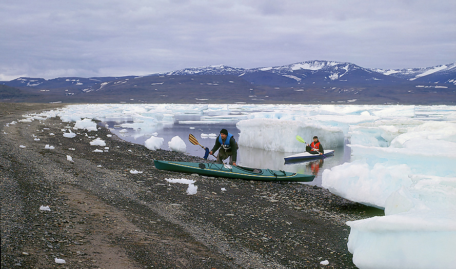
The next day we prepare for a couple of weeks kayak trip, and pack thoroughly for late the same day heading eastwards on the sea.
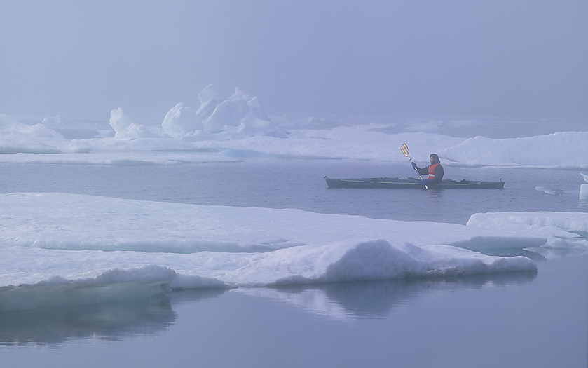
On the way with loaded kayaks. Some ice left as we see.
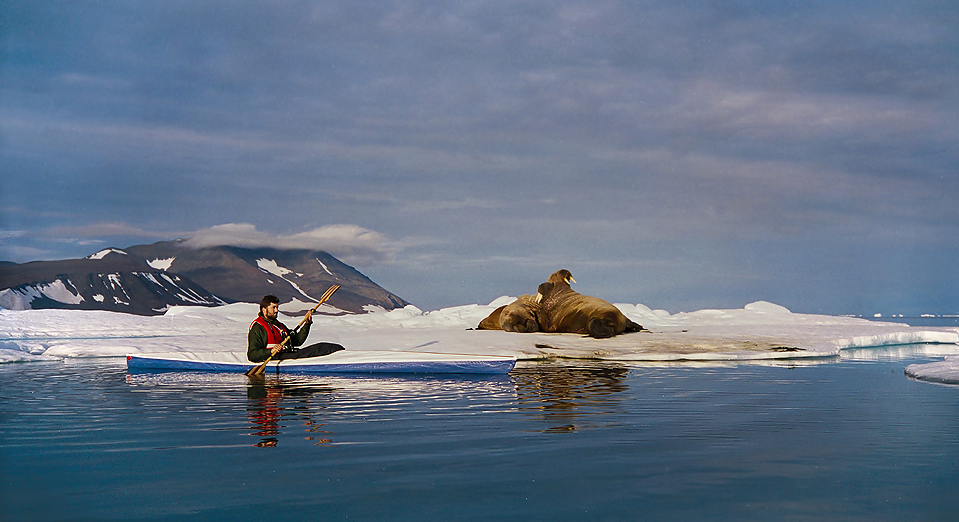
The eastern corner of the peninsula is a good place to see Walrus due to good hunting around the polynyas (fields of open water year around caused by currents etc). We studied the Walrus herd out in the drifting ice for several hours. Very enjoyable.
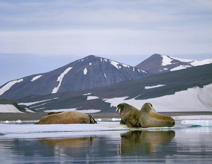
Walrus.
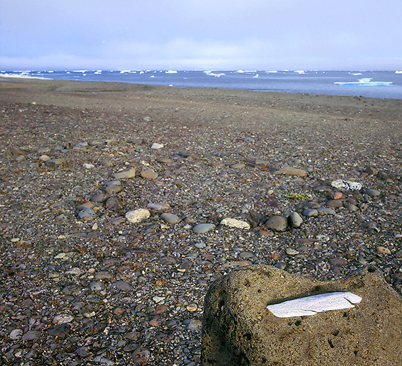
Due to rich marine wildlife out here we find much evidence after the natives that inhabited this huge land for thousands of years. We find 2-3 different camp sites where the biggest one consisted of 20-25 tentrings and 12-15 meat caches. Some of the meat caches contained bones from the extinct Dwarf Reindeer. Arnfinn study one of the tentrings.
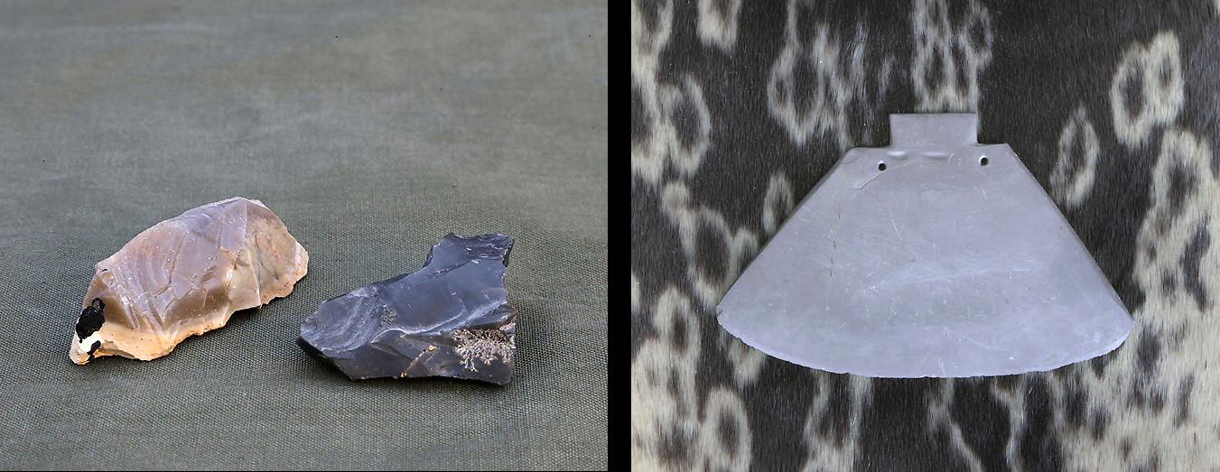
The camp sites from the natives here seem to be untouched with no archaeological excavations performed. The left photo show scrapers of obsidian found inside one of the tentrings. The area here did have olivine-basaltic volcanic eruption in the Tertiary period, and the obsidian is a mineral created through metamorphic transformation of lava. Obsidian can be shaped by human hand to have even sharper edges than flint. The right photo show a slate Ulu that once was used by the natives here for cutting meat, scraping hides etc. The eroded handle was probably made of bone or drift wood.
Just beside one of the sites there was a small river. A fish spear made of Dwarf Reindeer antler from the people that once camped here was found by this small river. There was no sign of winter dwellings in the area so this must have been summer hunting camps.
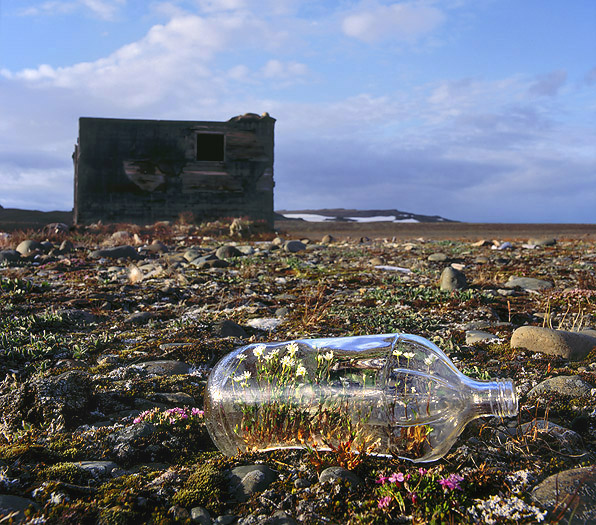
Not only natives of the land hunted here. This former out station was built by Danish fur trappers in 1945 for Nanok. Note the empty glass bottle that is acting as a micro greenhouse.
There were several wooden Arctic Fox traps placed at strategic places around in the land here. This is a typical model from the Danish and Norwegian trapping era. This kind of trap was only used during winter time when the Arctic Fox fur was pure white. An arrangement of 3 wooden sticks kept the trap up from the ground at an angle of about 30 degrees. 70-80kg of stone was thereafter loaded on top of the trap. One of the 3 wooden sticks had bait at the very end (i.e. a Ptarmigan head). When the fox bite at the bait the wooden sticks loosened from each other and the fox got the weight of stones over the body and was slowly killed because the weight was too much for the fox to pry itself out of.
Due to presence of Polar Bears here we used this small outstation as a shelter for a couple of nights. The door was however in ruins (probably torn off by Polar Bears). See the sophisticated arrangement on the right side of the outstation to protect the Kayaks against Polar Bears. An empty Corned Beef box with pebbles inside is placed on top of each tripod and with a rope between the tripods, -this meant to act as an alarm if/when a bear should pass/enter the arrangement.
Further on we travelled around in this vast land to explore and view wildlife and cultural / archaeological sites. We are out in the field at night time as well as during the day, no matter since the difference in daylight is so far not very big yet. Some times we are continuous out day and night due to long walking distances. When we are closer than 2-3 km from the sea we several times see fresh tracks of Polar Bears so we always need to be prepared for encounter with one of them. To carry weapon is mandatory here. By the see we one day observed a Polar Bear out in the drifting ice hunting for seals.
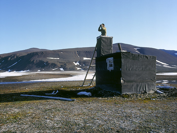
The “tower” on this former Danish outstation from 1945 was once constructed as an entrance in the winter time when the snow was especially deep.
Between the cape mountains we walk by and visit the beautiful Trollvannet lake. Several Muskoxen were grazing on the hill slopes down to the lake and a pair of Loons was crying when we visited the place at midnight. The moon was shining above the mountains, and a pure white Gyrfalcon was flying along the mountain side and out to the open tundra. What a wonderful place. By the outlet of the lake we found a couple of old inuit tentrings, and beside them there were some old bones and a few human teeth..
Trollvannet lake.
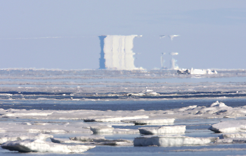
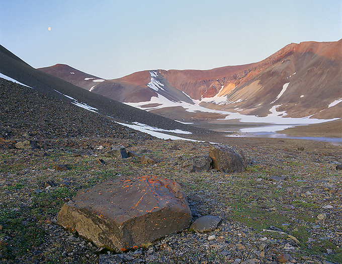
A High Arctic Fata Morgana.
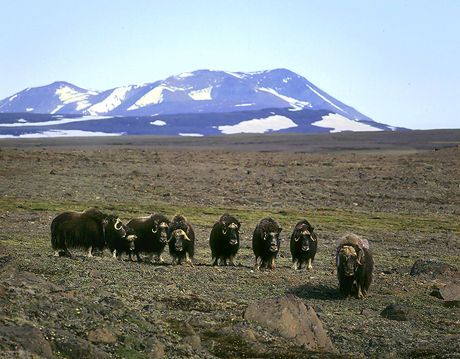
In Wolf inhabited land it is typical that disturbed Muskoxen lines up either on a line or in a more circular shape. This for maximum protection for the calves who are positioned behind the line / inside the circle against attacking Wolves.
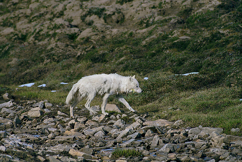
Adult female Arctic Wolf in its territory. Due to rich of prey they have denned in the area for some years. Until lately Arctic Wolves was not present here (killed by Norwegian fur trappers in the 1930’s), but a few of them immigrated from Ellesmere Island in the Canadian high Arctic a dozen years ago and have settled down in north and north-eastern Greenland. They counted per the year 2010 less than 100 individuals. The population does not seem to have increased after this time (PAP).
Updated information in 2021: The scarce Arctic Wolf population in N.E. Greenland that was re-established in 1979 declined later in numbers and disappeared in 2018.

In years with high peak lemming populations the beautiful Snowy Owl is nesting here.
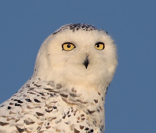
The adult female Snowy Owl.
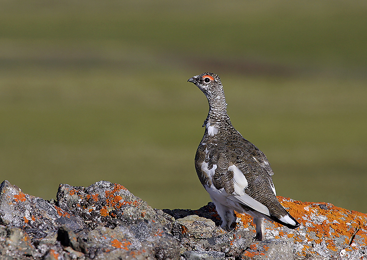
Ptarmigan. Since autumn is on it’s way, these birds will soon begin to change over to white color. The Grouse (Willow Grouse) does not exist up here in the High Arctic.
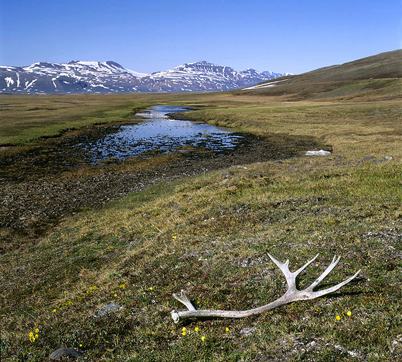
As mentioned above the Reindeer (Dwarf species) that once roamed this land have unfortunately been extinct. But we can still find their antlers here and there. Some very old and some remarkable new, -as fresh looking as if they only should be a couple of years old. The first and last time a white man observed a Dwarf Reindeer in north-east Greenland was in Renbugten by A.G. Nathorst in the year of 1899.
We are now in mid August month, the tundra changes to yellow-brown color and we clearly see that autumn have arrived. This is verified by white caps on mountains higher than 400m above sea level and that the day temperature have become sub-zero. On our return trip with the kayaks to base and later pickup place by the Twin Otter we experienced that the sea had got a thin film of ice on the surface.
The expedition members go ashore for a break on the way back to base camp.
The night after we returned to base camp the wind increased north-east storm and completely filled the sea with packed and crushed ice, some 8-10m in hight, so we arrived back just in time to avoid being stuck by the ice.
Due to the Norwegian fur trapping activity over great parts of north-east Greenland Norwegians meant that this land should belong to Norway. Norway also meant that Greenland was old Norwegian possession and did not recognize Danish sovereignty over uninhabited areas of Greenland.
Therefore Norwegian trappers on behalf of Norway and its government raised the Norwegian flag at Myggbukta Station in 1931, claimed occupation and named the land “Eirik Raudes Land ” after the Viking that discovered Greenland and founded the first settlement there in the year of 985. The borders of Eirik Raudes Land was set from Liverpool Land in the south and up to Bessel Fiord in the north.
This was followed up by Norwegian land mapping over Eirik Raudes Land. Norwegian names was given all over to mountains, valleys, rivers etc in great scale. The start of this was in Myggbukta where the Basis for the mapping was established. Today there exists many published former official Norwegian maps from Eirik Raudes Land.
The Governor of this new land was Solicitor Helge Ingstad who was situated at the Station in Antartichavn in the southern part of Eirik Raudes Land.
The case was brought into the International Court in Haag due to Danish protests of the Norwegian land occupation. When the decision was made in April 1933 Norway lost at all points.
The Basis for the former Norwegian mapping of Eirik Raudes Land at Myggbukta.
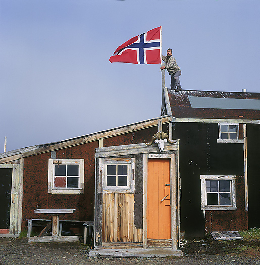
Our 2-man expedition hoist the Norwegian flag on the same place as the Norwegians did in 1931 when they declared this part of north-east Greenland to be under Norwegian possession, something that later should show that this perhaps was not so wise of us to do…
Afterword:
When we arrived north-east Greenland and set off on the tundra with the Twin Otter after the winter snow had melted we agreed with the pilot that we should be picked up on August 20st.
The plane did however not come to pick us up at that specific day.
The 2nd return day, August 21st it did not arrive either. Snowy weather today.
The 3rd return day, August 22nd it did not arrive either. Soon no more fuel or meat left. Well, we have a rifle and can shoot a Muskox calf if our hunger should be too big.
The 4th return day, August 23rd it did not arrive either. Foggy weather.
The 5th return day, August 24th it did not receive either, -until midnight to August 25th when we suddenly heard an increasing engine sound. We quickly went out of our sleeping bags, -looked around and was happy to see that it was the plane coming for picking us up.
The pilot said that the reason for the very late pickup was continuous bad fly-weather south of our activity area.
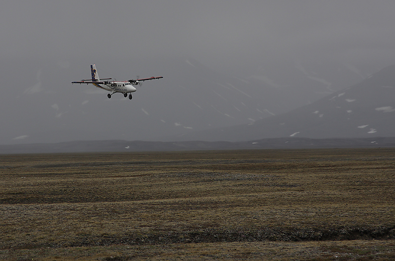
The Twin Otter is finally coming to pick us up. It is midnight and the nights are getting darker.
Due to the lost case in Haag and that we hoisted the Norwegian flag, the undersigned Norwegian person here (Per Michelsen) was arrested by the Police authorized Station Manager at Constable Point airfield at Ittoqqortoormiit (Scoresbysund) on the way back to the civilization after ended trip. A Danish ice reconnaissance aircraft had observed and reported a Norwegian flag hoisted at the Station where Norway once took the land in possession from.
Well, after a short half hour with arguing forth and back the Station Managers face suddenly turned more positive, then smiled, for so to laugh and say; Per, I was joking, I just wanted to fool you a bit. Everything is of course OK and you are free to travel whenever and wherever you want.
We changed plane from the Twin Otter to a bigger one and soon headed further south to Iceland before flying the last distance to Norway the day after. Home after 7 weeks in the field. Quite good with a hot shower then, -agree?
Per Michelsen
Thanks to:
Kjell Tysdal, Arnfinn Nilsen, Sigurdur Adalsteinsson, Aka Lynge.