Foreword
Tunu is the inuit word for the “Back Side”, and it is not the dark side that is ment, but the word for “The Other Side”,- or the side of Greenland were very few people live, -the east coast. The inuits living there are called Tunumiuts.
The east coast of Greenland was unknown territory for the white man before the 1900 century. Only occasionally it was visited in the 1900 century. Ammassalik was discovered by the dane Gustav Holm on a mapping expedition when 4 inuit Umiaqs rounded the southern tip and went northwards along the east coast of Greenland in 1884. Ammassalik was then the biggest community of East Greenland with some over four hundred inhabitants. They were extremely surprised to see foreign “Umiaqs” arriving in the bay. Likevise it was very surprising for the ships crew to see the inuits living here. They seemed to live as in the stoneage, and it was in fact what they did.
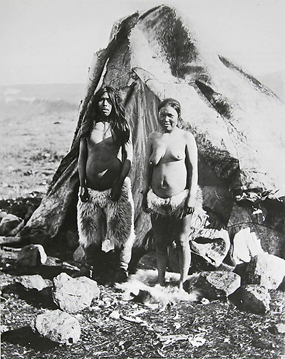
Inuits in front of their Summer Tent.
The main reason for that so few people ever have visited this land (east coast) is that 90% of the pack ice in the north pole basin have its outlet to the open sea here. This means that there is a hundreds of miles wide barrier of continuous slowly southwards drifting multi-year pack ice present here near all year around. The ice barrier stretches along all of Greenlands east coast except for 2-3 months in late summer and autumn when only the southeastern part is ice free.
The barrier have for all times before 1800 century prevented any ship to reach the coast of North East Greenland. The 1900 century with better ships, steam engines and later coal engines made it some easier to travel along the vast coast of Greenlands “Backside”. Even then many ships were crushed by the drifting ice, and great tragedies found place. In 1917 7 Norwegian Sealers disappeared, and in 1952 5 Sealers went under.-together with 78 men. Norwegian and danish fur trappers started their hunt on land in the beginning of the 1900 century. Arctic foxes were their main target, but occasionally they also hunted arctic wolves, polar bears and muskoxen. From the northernmost inuit settlement Scoresbysund (Itooqqtormiut) placed app. “half way up” on the east coast and northwards up to the present danish weather station Danmarkshavn in Dovebugt the trappers built around 40 Stations and many more small huts. The huts (averagely meas. 2x3m) were built with approximately 1 day skiing distance between each other, and were only meant as a night shelter on the trappers hunting and trap controlling trips. The fur hunt ended in 1959 and an epoch was over. All this land in North East Greenland is inside the largest National Park in the world. Today many of the huts & stations are still present, some in decay, while others are in ruin. North East Greenland is a true wilderness with almost no sign of modern mans activity. The climate is high arctic, the landscape is absolutely fantastic with alpine peaks up to 3000 m, prehistoric archaeological sites from ancient inuit cultures, and a rich and diversed wildlife.
Crossing from Svalbard to NE. Greenland
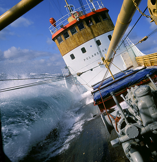
August 19th. It was with great expectancy we entered the old Norwegian Sealer M/S Polarstar in Longyearbyen, Svalbard (Spitsbergen). Due to the pack ice east of NE. Greenland the best time to travel there is in late august. An old well proved
advise is to leave the area by the end of September.
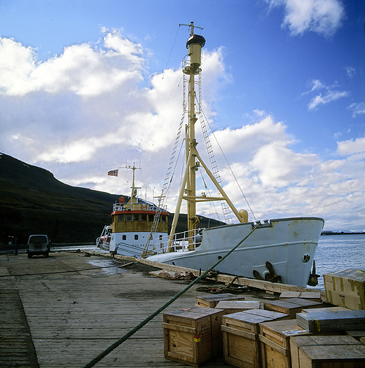
The old Sealer M/S Polarstar in Longyearbyen prior to departure for NE. Greenland.
Before crossing the sea between Svalbard and NE. Greenland we sailed northwards along Svalbards west coast, an often ice free coast line in late summer time. Reaching 80 Deg. north we turned and headed south-westwards. After eight hours in the open sea we reached the barrier of drifting ice. We had expected to see whales out in the open sea, but none of the different species showed up for us today. Despite the Sealers age it is a strong ship and well known to behave good in drifting ice. This was good to know when we on the early morning of August 20st. met the ice barrier.
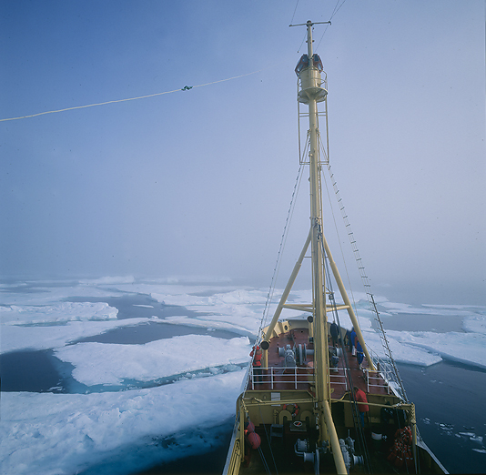
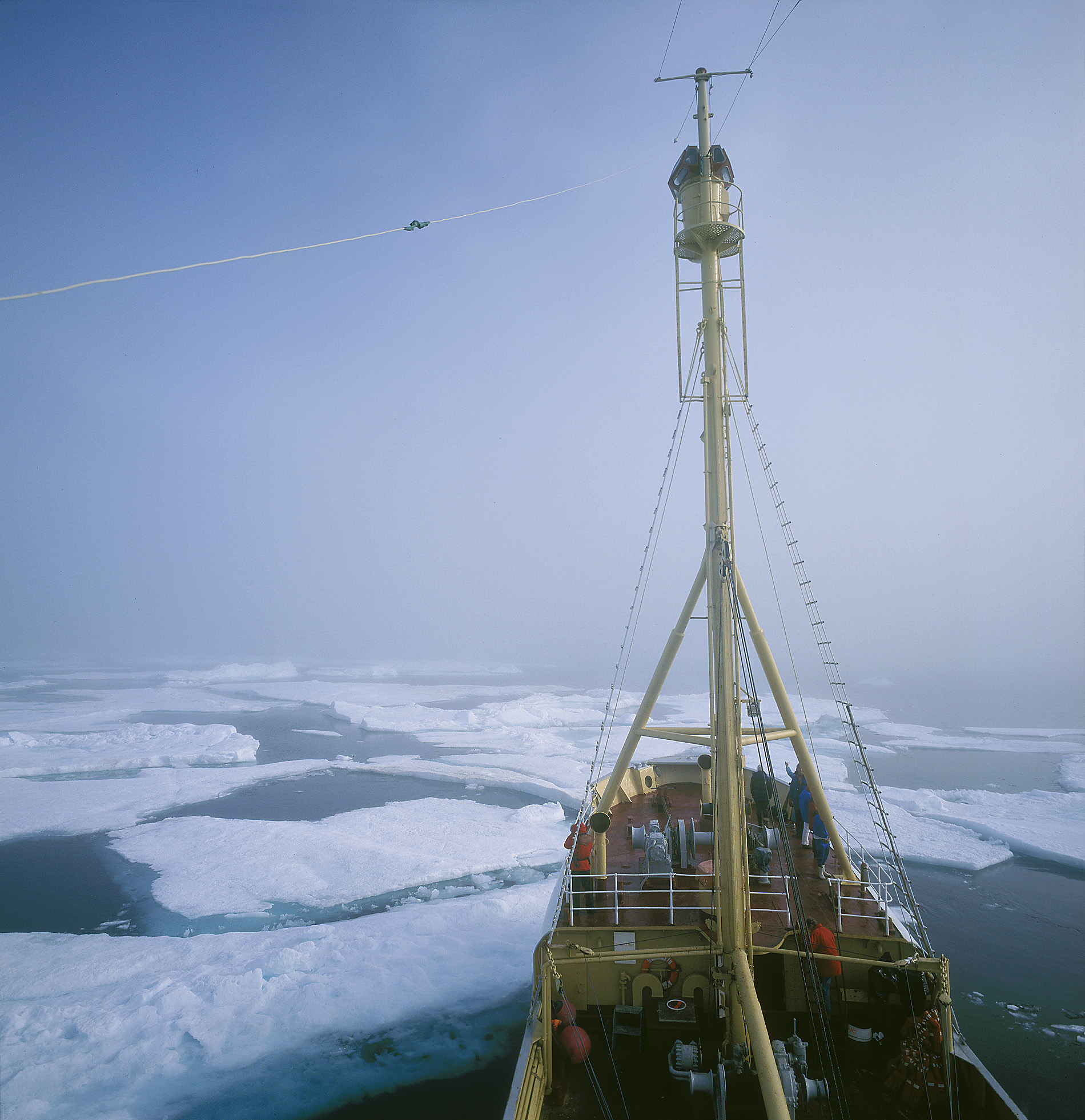
M/S Polarstar reach the ice barrier.
Together with the ice the fog also showed up. At first it was easy for the ship to maneuver in the more open drift ice, but later it was numerous encounters with huge ice floes. The ship reversed, -forward again, to the left,- to the right. Stop, reverse and so it continued for hours. Bump and bang, quite noisy when the ship slowly was working herself through the ice. It is a strange, fascinating and beautiful atmosphere when a ship is going in drifting ice. Beautiful colors and ice figures meets us all the time. The wildlife is increasing in the ice compared to open water. We observed a lot of seabirds, different species of seals, and also a polar bear.
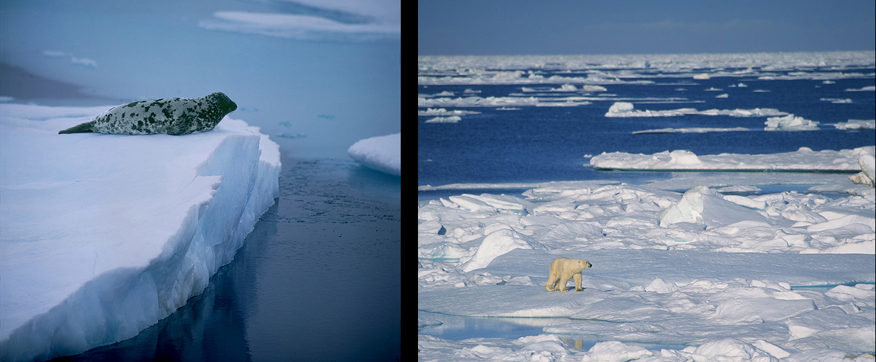
Seals (here: Hooded Seal) and Polar Bears are common in the drifting ice.
Approaching NE. Greenland
August 21st. A local storm swept over the coastline and did it impossible for us to land on either Sabine Island or Hvalross Island. The normal weather situation is characterized by stable high pressure weather with sunshine at the inner parts
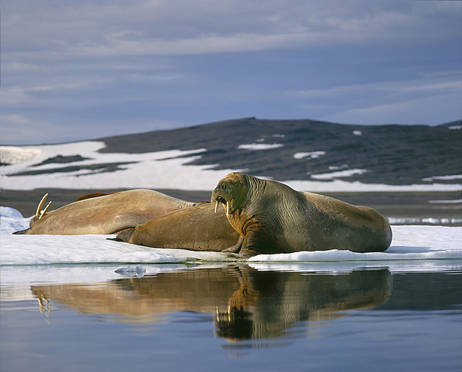
of the fiords caused by the always present high pressure system over the Inland Ice, and more unstable weather at the outer coast line. We head southwards along Wollaston Forland against Young Sund and Clavering Island. We notice that there are no vegetation on the land we pass on our right hand, only yellow-brownish rocks. In Young Sund there is one of the few walrus haul out places in NE. Greenland south of Dove Bugt. On the same place there also are a Sabine Gull nesting colony.
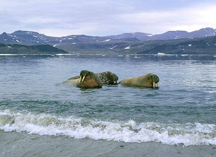
The walruses are curious animals and is closing in to us on the beach at Young Sund. Clavering Island behind.
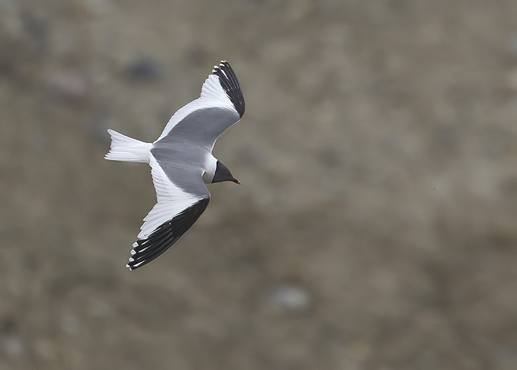
Sabine Gull (PAP).
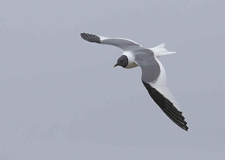
Sabine Gull (PAP).
Innermost in Young Sund there are some more vegetation, and we see many grazing Muskoxen on the slopes at both sides of the ship. Here on Clavering Island we find the mountain that is the evidence of that Greenland once belonged to the Scandinavian landmass. Its geologies is equal, and the two continents were one piece of land for about 300 million years ago (Late Carboniferous). This before the Eurasian Continental shield separated from the American shield. They are still drifting away from each other with a speed of app. 4cm per year.
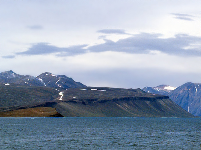
This basaltic mountain was the first evidence of that Eurasia and America was one continent 300 mill. years ago.
Trappers Station
Revet (“The Reef”) is one of the most legendary Trappers Stations at the coast of NE. Greenland. It is placed beautifully between the bottoms of two fiords,- only divided with a shallow water area. The famous Norwegian fur trapper Henry Rudi built and lived here in periods from 1928 to 1942 . Later several other hunters used this station.
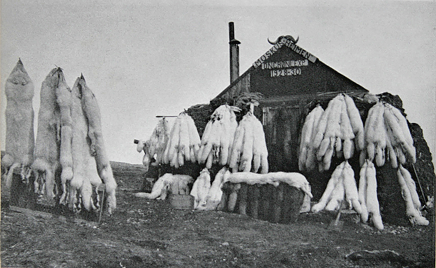
Revet (also called Moskusheimen) in the spring of 1929 with part of the winters fur hunt. 8 Arctic Wolves to the left.
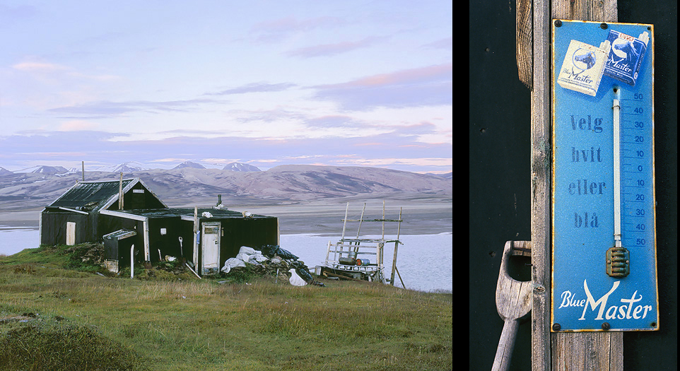
Revet Trappers Station today. The right photo with the Sigarette brand that “all” Trappers on NE. Greenland smoked.
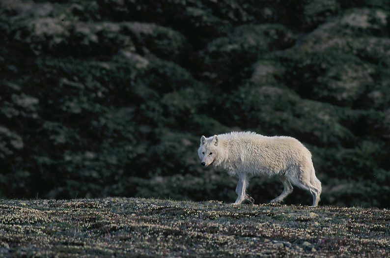
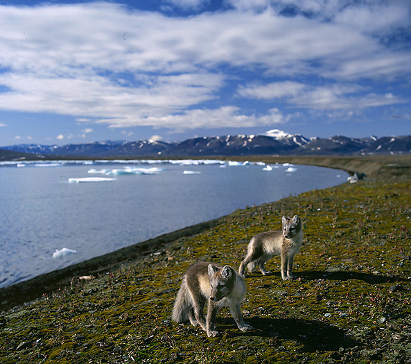
Adult female Arctic Wolf in its territory. Due to rich of prey they have denned in the area for some years. Until lately Arctic Wolves was not present here (killed by Norwegian fur trappers in the 1930’s), but a few of them immigrated from Ellesmere Island in the Canadian high Arctic a dozen years ago and have settled down in north and north-eastern Greenland. They counted per the year 2010 less than 100 individuals. The population does not seem to have increased after this time (PAP).
Updated information in 2021: The scarce Arctic Wolf population in N.E. Greenland that was re-established in 1979 declined later in numbers and disappeared in 2018.
The trappers lived a hard life. Each winter they skied thousands of kilometres when trapping and controlling the fox traps. The winter cold could be strong, were the temperatures could fall down to under -50 Deg.C. The mean annual temperature here is -29 Deg.C. In 1938 the trapper Gerhard Antonsen trapped here alone (which was rather common). One winter day he by accident got a knife in his left eye and was close to be blinded because the other eyes eyesight also got influenced. At the time of the accident he was in one of the small huts out in the field and had severe problems to find back to the Revet Station again. He lived alone for several weeks before another trapper came over from Myggbukta and stayed with him until the yearly boat came in August when he could return to Norway.
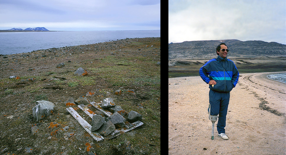
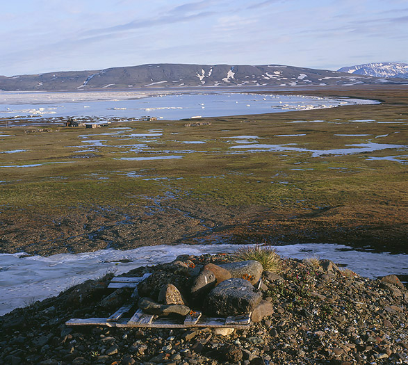
The fox traps were placed on strategic places in the terrain. Richard poses with an old wooden leg found at Eskimoneset Station.
Next stop for the expedition was Dødemannsbugten (“Dead Mans Bay”) on Clavering Island. This island is known for its rich archaeological sites, and not to forget the fact that this is the only place were the original inuit inhabitants were seen before they became extinct. On August 18th 1823 a British expedition lead by Capt. Clavering met a small group of 12 inuits here. The group consisted of men, women and children. They had long hair, were dressed in skin clothes and carried stone tools,- and were actually living in the stoneage. One of the ships crew members showed the inuits a musket and shot a seal. An inuit also tried the musket and was extremely surprised. The inuits were probably scared of these strange white people with this magic “thing”, because the next morning they were all gone. This was the first and last time anyone have seen the original inhabitants of NE. Greenland.
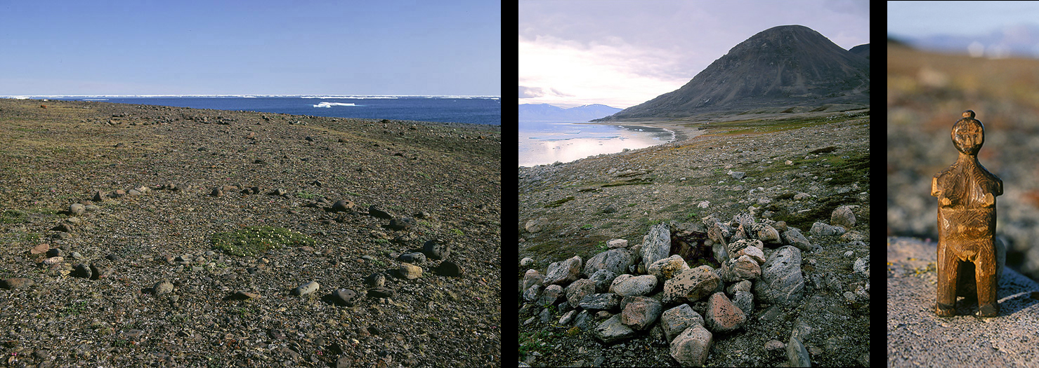
Ancient inuit tentring (note the vegetation in the center where the cooking place once was). The middle photo shows an ancient inuit meat cache in “Dead Mans Bay”. The right photo show a wooden figure found in an old inuit winter Dwelling at Kapp Humboldt on Ymer Ø by former Fur Hunter the Norwegian Magne Råum in the 1930`s.
But there are traces of this culture and earlier cultures spread out all over NE. Greenland. Due to the well-preserving high arctic climate it is possible to find distinct traces as tentrings, dwellings, meat caches and primitive stone tools dating 2800 years back. It is a bit special to see that archeological sites here looks extraordinary similar to those dwellings that some Polar Eskimos in Thule lived in until the 1950`s.
A land rich of wildlife
August 24th. The barrier of drifting is ice very often close to land. Luckily for us, this year seems to be a “good” year with less ice than normal. Therefore we can sail in waters that normally are closed by ice. The ship continue to sail southwards. Late in the evening we drop the anchor in Mackenzie Bay. After a good dinner we prepare ourselves for the trip onshore tomorrow.
It is 5 o`clock in the morning when the zodiac is landed on the beach below Myggbukta Station. This was the Norwegian “Capitol” here in NE. Greenland. It was from this place Norway annexed parts of this huge land in 1931, and here was the only meteological station placed. The ever first wireless radio transmission from Greenland was sent from here (October 14th, 1922). In fact Myggbukta often figures with a dot and name on world maps, it is not a town or a settlement, but only 1 abandoned house (=station).
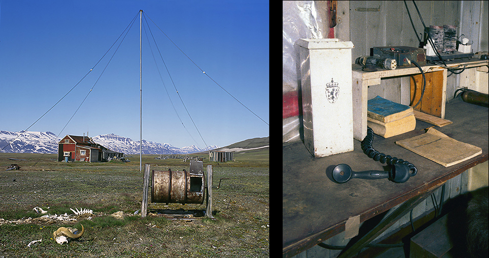
Myggbukta was a combined Trapper & Metereological Station. Greenlands first wireless radio transmission was sent from here in 1922.
Remnants from a bygone era. An old wooden Fox trap placed on a hight above the Myggbukta Station.
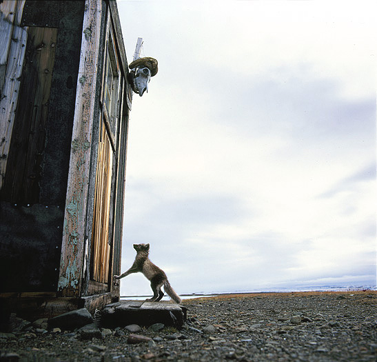
Please let me in said the little fox…
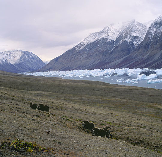
Behind the station there are a big tundra & wetland with numerous lakes and ponds, the vegetation is vigorous. In the summer time billions of mosquitos inhabits this low valley that is stretching 15 by 25 km. It is a beautiful place with snow covered mountain ranges on the two sides. It is old sea bottom, because sea shells are present in the ground many places. Up in the hill side there are parts of fossilized wood that the permafrost is forcing up to the surface. The Norwegian name Myggbukta means “Mosquito Bay”. This is a true paradise for life, here we find a lot of nesting waders, geese, ducks and loons. Muskoxen, Arctic Hare and Arctic Fox are common. Arctic Wolves and Polar Bears are occasionally seen.
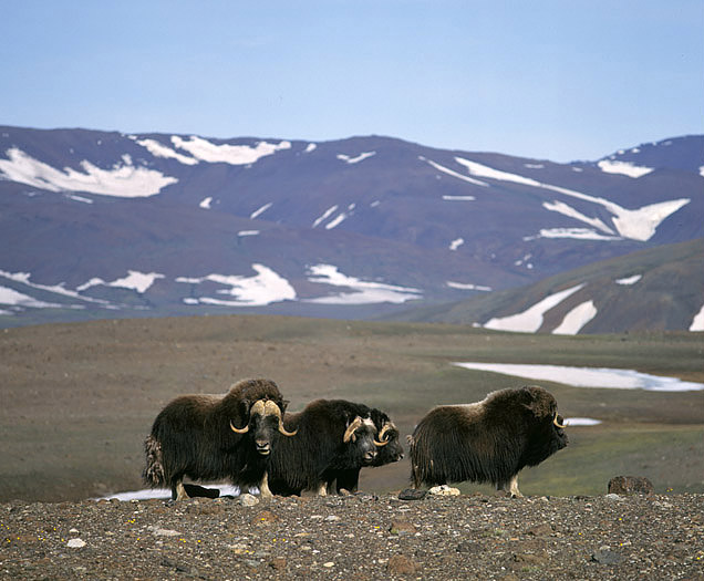
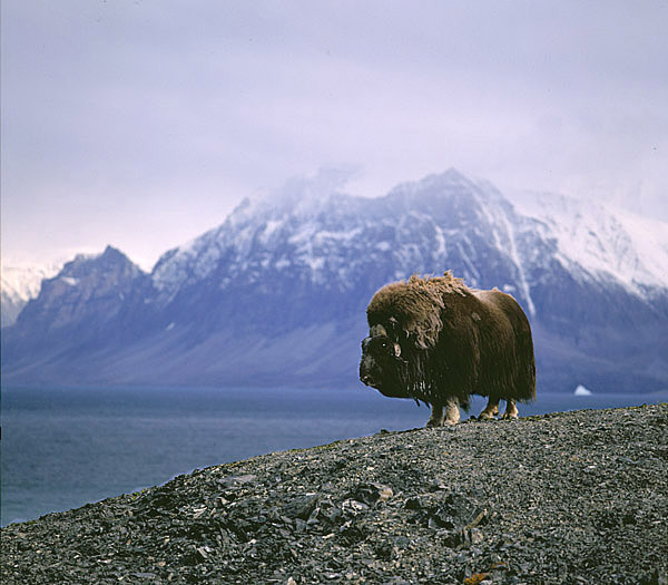
Muscoxen are common in the area, and are one of the most important prey for the Arctic Wolf.
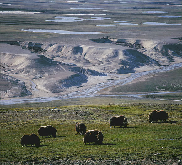
In this huge wetland valley there are small grass pockets which are favorable for the Muscoxen.
Arctic Foxes are also common and wide spread in Greenland, mainly in he coastal areas where it is easier to find food.
Eastwards against Hold With Hope there are shallow waters with polynia in the wintertime. These places attracts Walruses and other sea mammals. Now in Summer these Walruses relax after a meal of mussels which there are plenty of here.
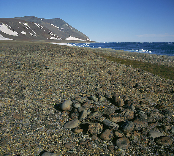
Old Eskimo Tentring (app. 1000 years old) at Hold With Hope which probably once contained Walrus or Whale Meat. In the behind we can see other Meat Caches and Tentrings further back. This have once been an important place for the former inuits where they obviously have made good catches.
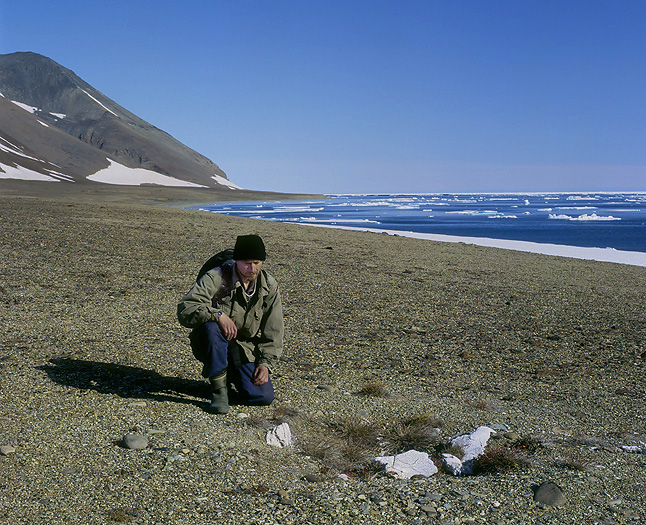
Beside the old Inuit camp site there were old Whale Bones sticking out of the ground. They are either a catch from the former Inuits or small parts of a Whale that stranded here long ago where its bones now are forced up by frost on the raised beach terraces.
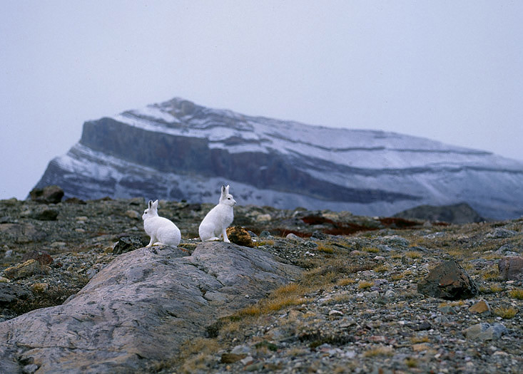
Arctic Hares are white year around, this due to extremely short summers.
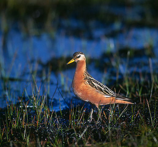
Grey Phalaropes are also typical species of the wildlife here.
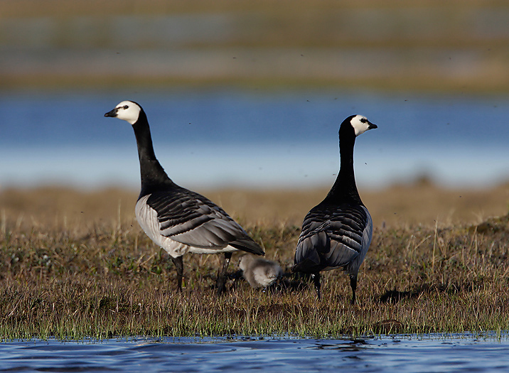
The Barnacle Geese nests in Great parts of NE Greenland.
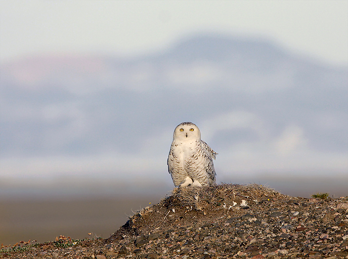
In years with high peak lemming populations the beautiful Snowy Owl is nesting here (PAY).
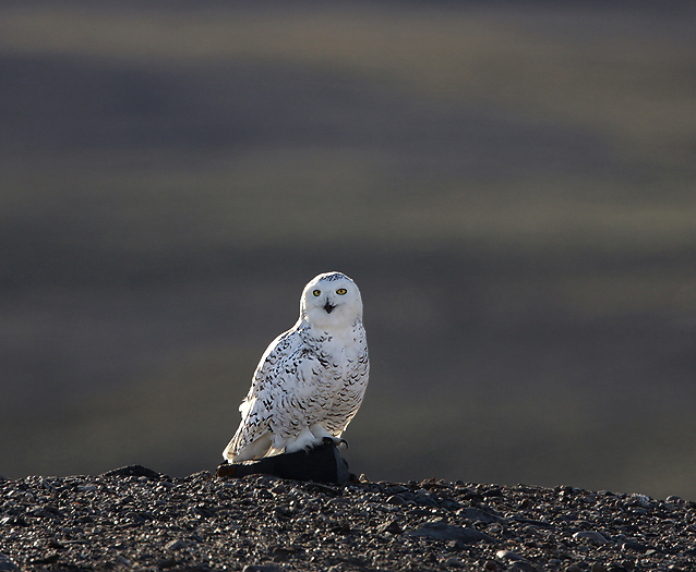
The beautiful Snowy Owl (PAY).
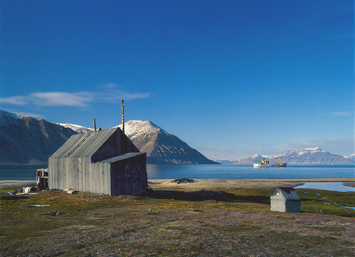
After a long and sunny day onshore we sail into Moskusoksefjorden. This is a long fjord closer to the inland ice. We go ashore and visit NE. Greenlands most well preserved trappers station named Hoelsbu. The original fox cages here are used to capture Arctic Foxes in late summer and autumn, place them in the cages and wait until the fur had turned white. Then they were killed and skinned.
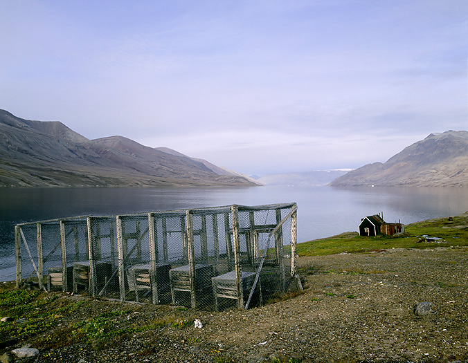
Hoelsbu Trappers Station with fox cages.
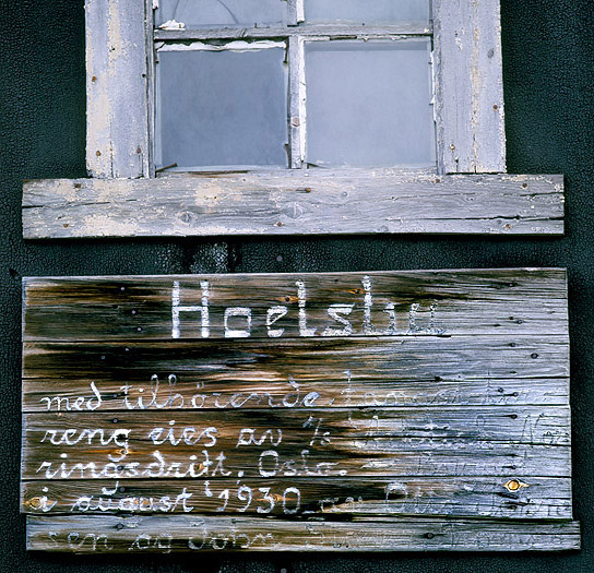
A Territory Occupation Sign nailed up on the wall at Hoelsbu Trappers Station.
The sealer M/S Polarstar on the fiord below Hoelsbu Station.
Autumn Plants in Moskusoksefjorden.
Huge fiord system
August 27th. Keiser Franz Josefs Fjord is the worlds second longest fiord. Only Scoresbysund further south on the Greenlandic east coast is longer, this is also the deepest fiord in the world. Keiser Franz Josefs Fjord is a whole system of fiords and is extremely beautiful. We are at all times close to the inland ice, so the summer climate here is sunny with blue sky. The
landscape is characterized of alpine peaks up to 3000m. They are all top white of snow, or they are nunataks.
Innermost in the system there is a special fiord named Kierulf Fjord. This fiord function as an “iceberg-trap”. Huge icebergs calved of the Inland Ice are trapped and stranded there. In Renbugten, near by this fiord an expedition lead by A.G. Nathorst in 1899 observed the last Reindeer in NE. Greenland. The Reindeer was small an described as a “Dwarf Reindeer”. Over all here in NE. Greenland antlers of this extinct animal can be found, even today. Ringed Seal, Bearded Seal, Narwhal and Beluga can be seen in the fiords here.
Muskoxen at Kjerulf Fjord.
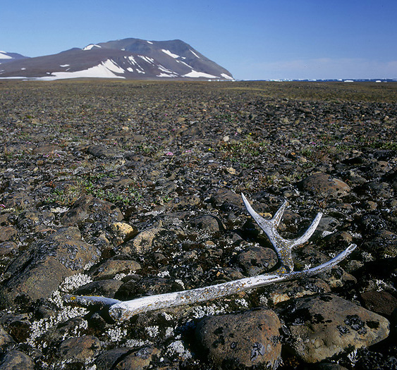
Antlers from the extinct Reindeer species are also to find here and there.
During this expedition we have had many landings ashore, for studying historical & archaeological sites, wildlife, and for only to have a good time in a fantastic landscape. Before we leave the fiords here in NE. Greenland we want to visit one more place. The place is Antarctichavn at the mouth of Kong Oscars Fiord. This was the southernmost Norwegian trappers station. It was built by Karlsbak and Ambak in 1930 (unfortunately it was later blown away by a terrible storm,-in the winter 2001/02). The Norwegian Helge Ingstad was sited here from 1932 to 1933 . He was the official representative from the Norwegian government and had the function as “Sysselmann” (= governor with police authority) in the two years the Norwegian occupation of NE. Greenland lasted (1931-33). The fertile valley behind the station is rich of wildlife with numerous Muskoxen, nesting Snowy Owls (in lemming years), and a colony of nesting Barnacle Geese in the back country. Also here Arctic Wolves and Polar Bears can be seen. Many prehistoric archeological sites are also to be found. They are from the Thule culture and dating back to 1000 AD.
Antarctichavn Station.
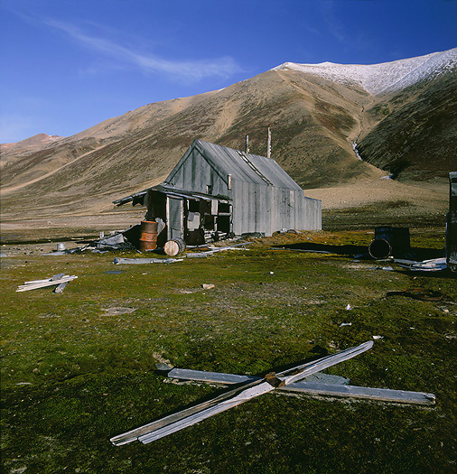
A pair of old wooden skies outside the Antarctichavn Station.
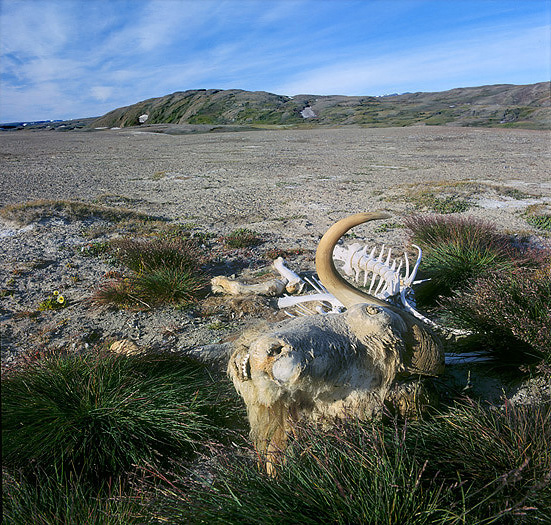
Muskox killed by Arctic Wolves.
Muskox with the mountain Kongeborgen (Kings Castle) in behind.
Leaving the National Park
We clearly understand that the winter is not far away. During the night snow have falled down to 300m above sea level. It is autumn and time to leave this beautiful and fascinating part of the world. When sailing out of Davy Sund we leave the National Park. The Park is huge, 972.000 sq.km, which is as big as Spain & France together. There are no permanent inhabitants in the Park, except for the military Sledge Patrol (named Sirius) in Daneborg and 2 weather stations. It is prohibited to enter the Park without a Permit from the Danish Authorities.
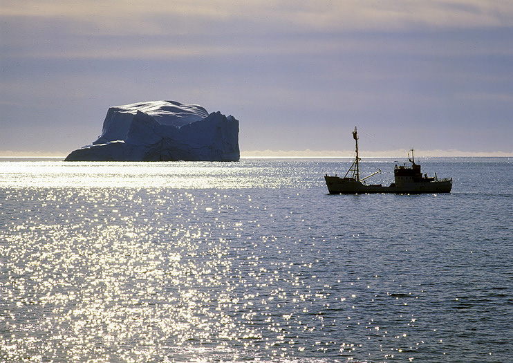
Remember that 9/10 of the icebergs are under the surface…
August 31st. The ship is steaming southwards along the Liverpool coast heading for Scoresbysund. The disreputable Liverpool coast is ice free this year. Lucky for us, because many boats have in ended up being crushed by the drifting ice here. It is a dangerous place that are heavy influenced by strong currents.
Anchoring up in the bay named the same as the fiord here, we enter the inuit village of Scoresbysund. This is the northernmost inuit settlement on East Greenland. Near all inhabitants are Tunumiuts, were most of them are trappers
that live of the surrounding wildlife and fishery. Extremely few boats visits this settlement, so it is a big event with crowding inuits by the shore.
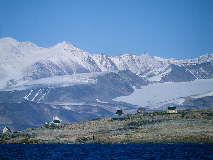
Scoresbysund settlement (here Kapp Tobin) is the most isolated community on Greenland.
Eskimo Meat Cache at Kapp Tobin outermost in the huge Scoresbysund Fiord.
M/S Polarstar has its home in Norway. That means we need to cross the North Atlantic Ocean before we are home again. We leave Scoresbysund and head for the Norwegian Island of Jan Mayen that is placed app. 1/3 of the distance away to Norway. Jan Mayen is named after its dutch discoverer and is a volcanic island on the Mid-Atlantic ridge. Approaching the island also means an increasing numbers of seabirds. While watching the 2277m high snow covered volcano named Beerenberg, we see two huge Fin Whales playing in the sea below the near vertical glaciers on the north side of Beerenberg.
Out in the open sea.
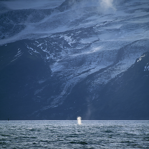
A Fin Whale is blowing beside the glaciated Beerenberg Vulcano at Jan Mayen Island.
Part of the vulcanic island of Jan Mayen.
After over 60 hours on the sea we finally arrive the city of Aalesund on western Norway. I am very grateful for having got the opportunity to make this exclusive historical travel with the last of the “old” legendary Sealers. It was a special feeling to visit this area that is characterized as the most remote land on the northern hemisphere, especially when I see that there still are white (unexplored) areas on the last revised maps over NE. Greenland.
Per Michelsen