CIRCUMNAVIGATE THE SVALBARD ARCHIPELAGO.
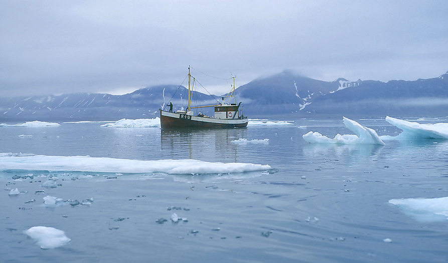
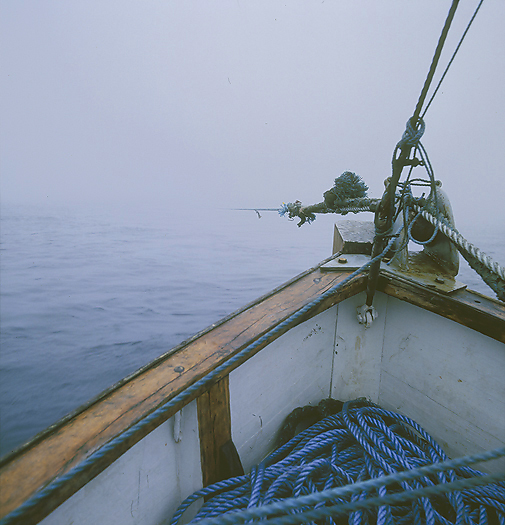
A small ship on a big ocean. The old wooden 49 feet long vessel MS Laksholm is on the Barents Sea heading northwards for the Svalbard archipelago. We are 3 persons onboard that want to do the travel by the old and slow way for really to feel the distances and remoteness of this High Arctic land instead of an hour and a half flight from the Norwegian mainland with a modern jet plane. The intention with this expedition is to explore and document this beautiful and interesting archipelago with focus on wildlife, history and of course enjoy the land itself.
Half way northwards on the Barents Sea the small island of Bjørnøya (= Bear Island) is situated. This island was in the old days called “the Island of Mist”, and was very often not seen by ships passing by due to the foggy weather here. We therefore need to navigate with high precision (within 1°) to hit the island, so without having any GPS onboard we used the ships radio bearing system in addition to map, compass and sonar.
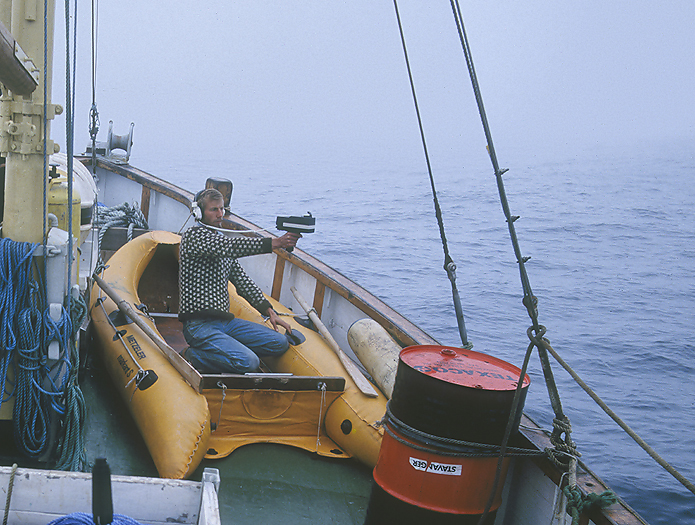
The Captain Kjell with the radio bearing unit determine the position out at the Barents Sea on our way northwards to Bear Island.
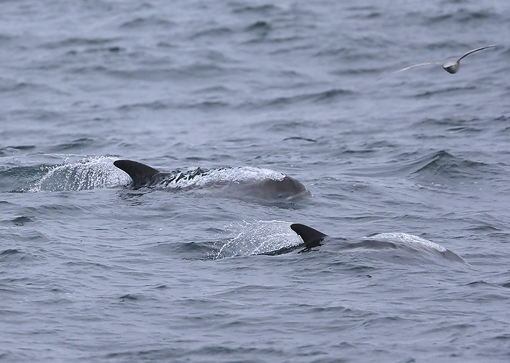
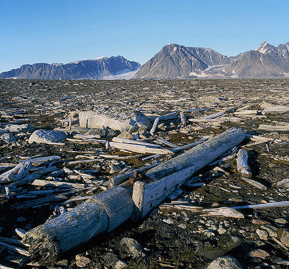
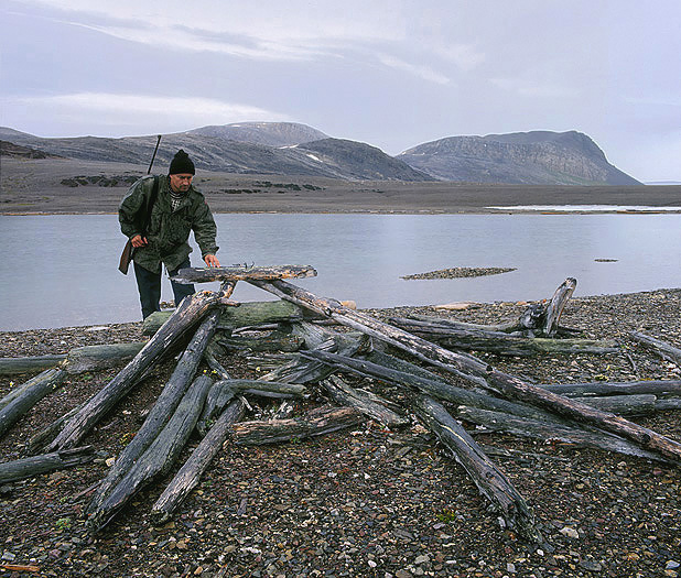
Starting from Torsvåg on the Norwegian northern mainland with calm sea, sunshine and 16°C we had a great day driving northwards against Bear Island. We met playing White-beaked Dolphins several times, and some Minke Whales. We also soon noticed that there where drifting timber on the sea and needed of that reason to be very observant to avoid any collision with the ship. About half way over to Bear Island the temperature dropped to 8°C and the weather deteriorated with increasing strong winds from east.
This meant heavy rolling as we got the waves against the side of the ship. After a rough day in up to 6m high waves with navigation in full concentration we noticed that the amount of seabirds steadily increased while the temperature dropped and was now 4°C. On the evening the second day we suddenly caught sight of Bear Island straight ahead. Excellent navigation by the skipper.
When approaching Bear Island from the south the original plan was to anchor up in the “South Harbour”. But at 2-3 nautical miles from Cape Kolthoff the waves suddenly became extremely narrow & up to 8-10m high, -this due to more shallow water. We kept the front straight against the waves, but then one of the waves grabbed the ship and “threw it” 45° against Port side. This was extremely dangerous and we have to get out of this area as soon as possible. We see that our firmly lashed barrels of diesel is moving too much, and a railing board» is smashed. In addition to this the alarm for low oil engine pressure is activated by the heavy ship movements. It was then not possible for us to stand upright in the wheelhouse, and we fell on the floor. After some struggling we stood up and managed to turn the ship between two of the waves, we then set full speed away from the area with rough sea. The sea and waves was however so “furious” that it reached us from the back and smashed into the boat from the aft. Parts of the ship was damaged and my cabin in the aft became quite wet…
Well, a lesson learned and we anchored up a couple of hours later in Hamnevika at the leeward side of Bear Island (west side). We could then log 53 hours of sailing from leaving the mainland.
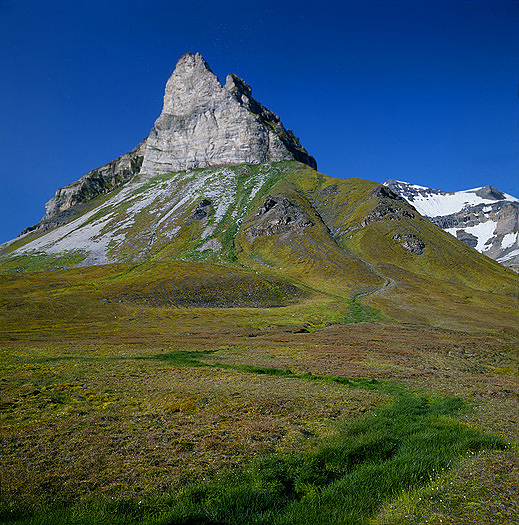
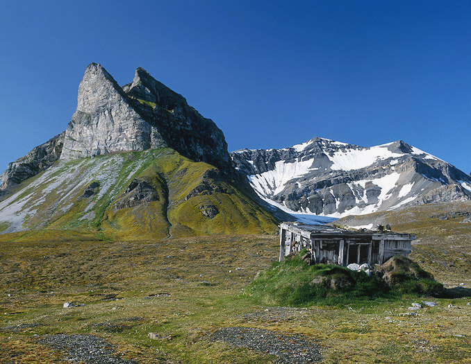
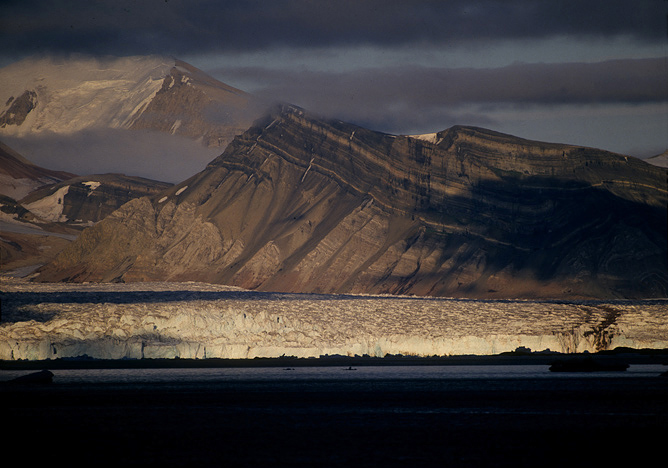
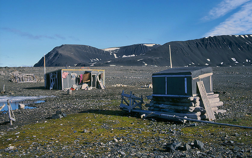
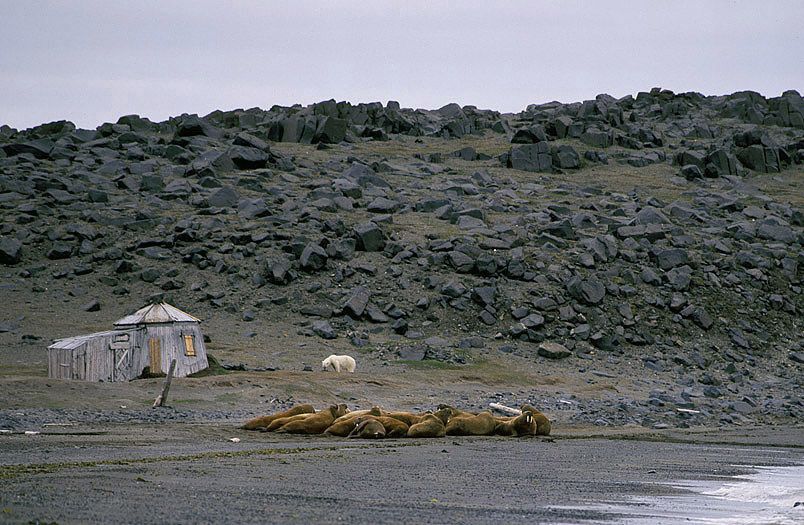
MS Laksholm anchored up at Kapp Harry at leeward side of Bjørnøya (= Bear Island). The characteristic 80m high rock formation “Sylen” in behind.
Inspecting our ship we discover that it is leaking because we find seawater up to the underside of the engine. We immediately begin pumping the water out. To be able to sail northwards to Spitsbergen we of course will have to repair the leakage.
By the way, -3 Russian trawlers is also have anchored up awaiting for better weather some nm north of us.
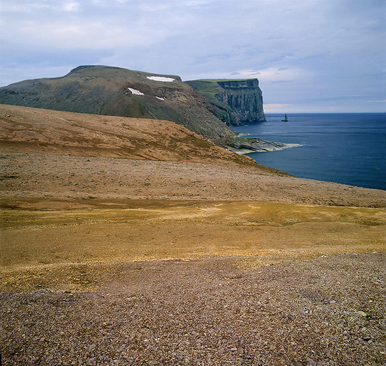
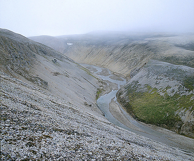
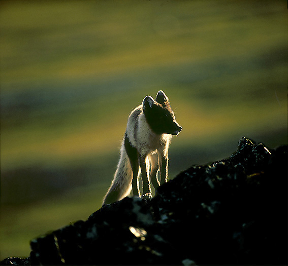
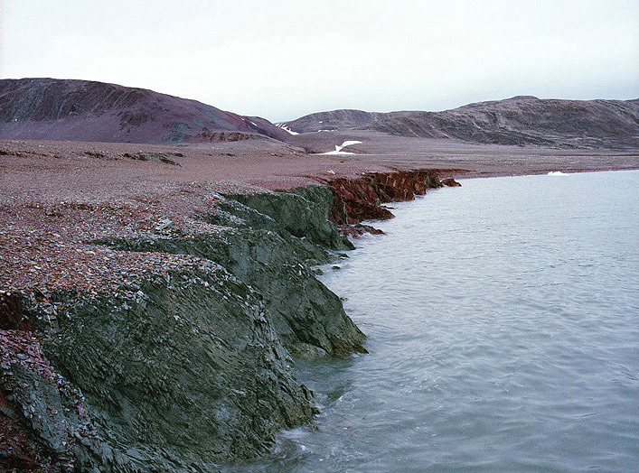
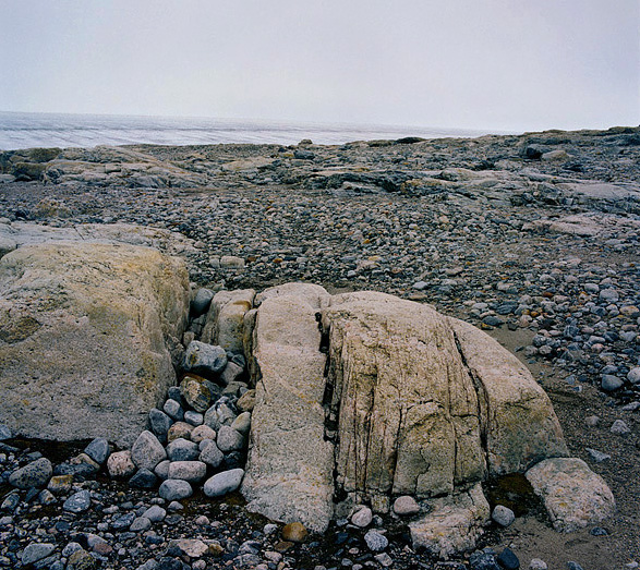
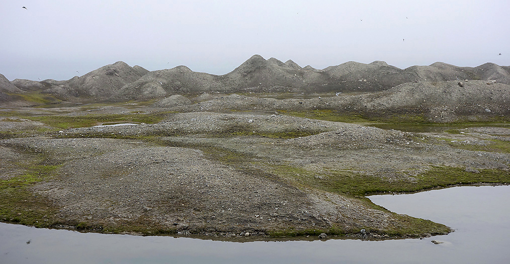
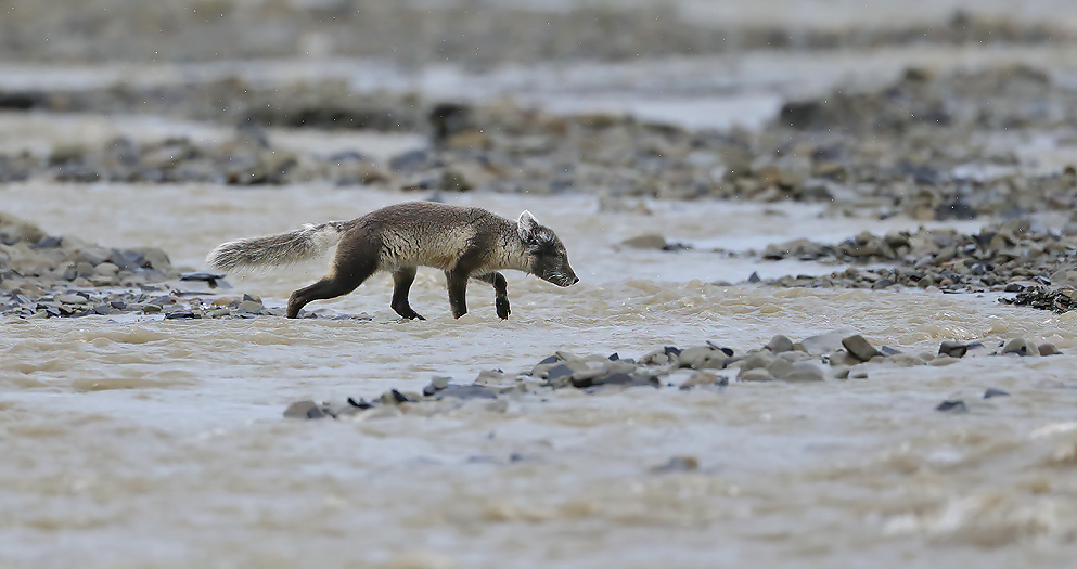
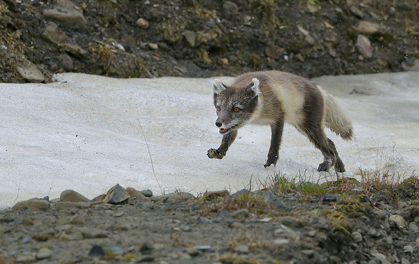
A couple of days later we go ashore for exploring this remote arctic island which is rarely visited by people. We plan to use all day and want to cross the island from west to east and therefore start crossing early in the morning. The interior of the island is a stone desert caused by frost and with little wildlife, -only an Arctic Fox observed there today. Polar Bears are normally not present on Bjørnøya during the Summer time, -only when the drifting ice is coming close or into the island, -which does not happen annually for the last decades. On the west side the different geological layers are very visible, especially when they have different colors.
The west side of Bear Island shows geological layers from Devonian, Carboniferous and Triassic.
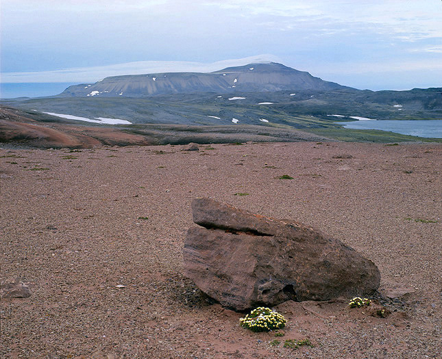
“Old Red” Sandstones. Miseryfjellet mountain in the background.
Part of the desert like landscape in the interior of Bjørnøya. Russelva in the foreground and a cloud covered Miseryfjellet to the right. The ground here is dated to be Pre-Old Red basement (Ordovician to late Precambrian).
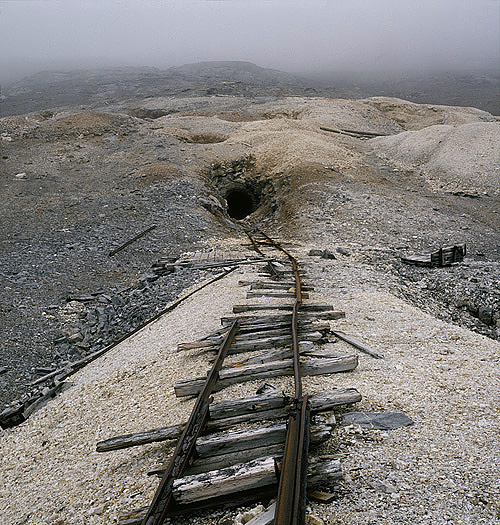
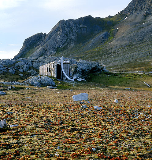
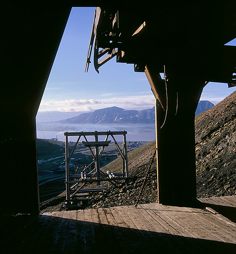
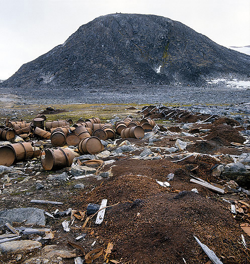
An old galena (lead) mine at Blyhatten in Hecla Hoek basement at the northern foot of Antarcticfjellet. The mine was run around 1920, but was not profitable and all work stopped after some years of mining.
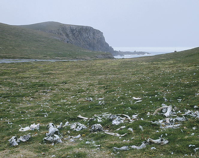
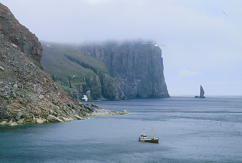
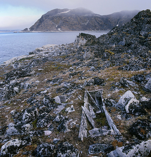
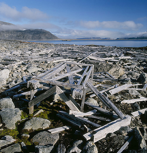
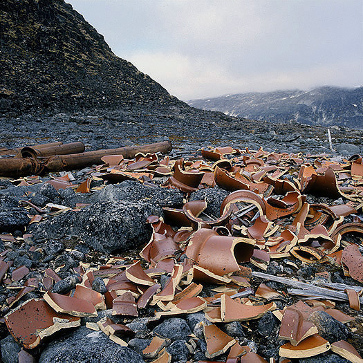
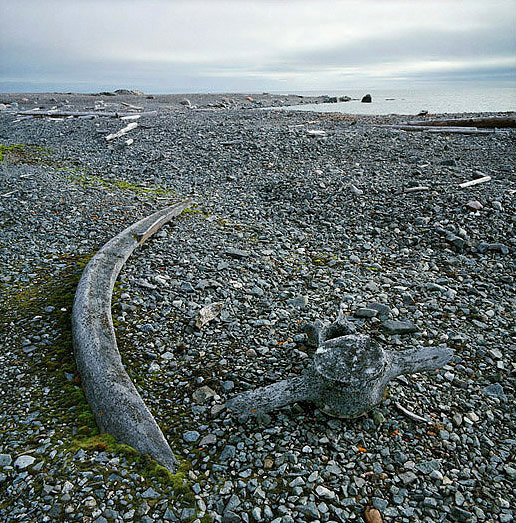
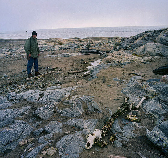
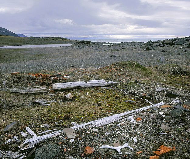
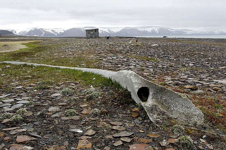
The first Walrus hunting at Svalbard started here in Kvalrossbukta on the S.E. side of Bear Island. Around 900 animals was killed annually by English hunting expeditions in the years 1605, 1606 and 1607. The killing was easy; they killed the animals closest to the sea for making a barrier of dead Walruses where the animals inside was unable to escape and could be killed.
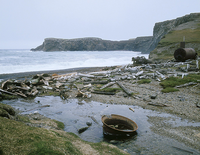
Kvalrossbukta, Bjørnøya: After Sven Foyn had obtained a patent for the grenade harpoon in 1873, whaling had flourished in Northern Norway until a whaling ban came in 1904. Then the business moved to Svalbard. Both at Spitsbergen and Bear Island there was a short period of Norwegian whaling. The whaling station here in Kvalrossbukta were associated with M.A. Ingebrigtsen and was in operation from 1905-08. In this period 230 whales were caught and slaughtered, which gave 6000 barrels of oil. Later the facility was used in conjunction with trapping and mining. The location is an important historical source.
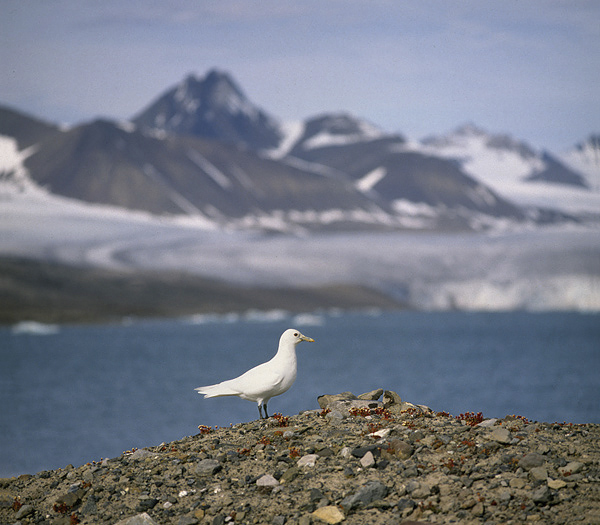
Kvalrossbukta seen from another angle. Several pairs of Glaucous Gulls are nesting here.
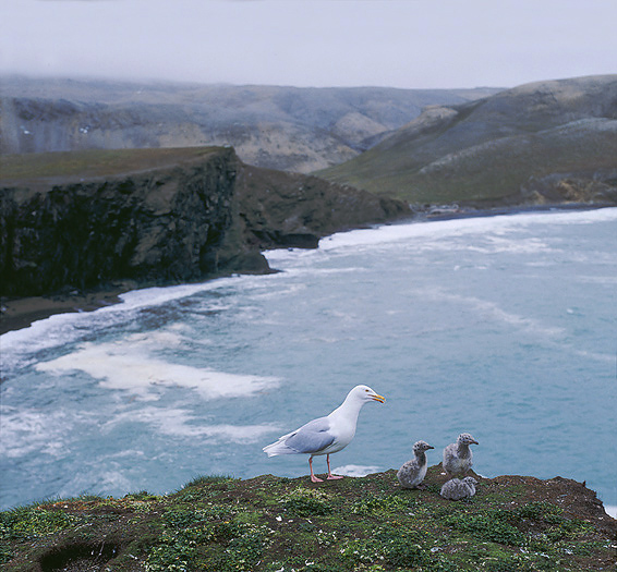
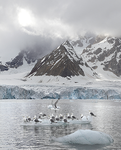
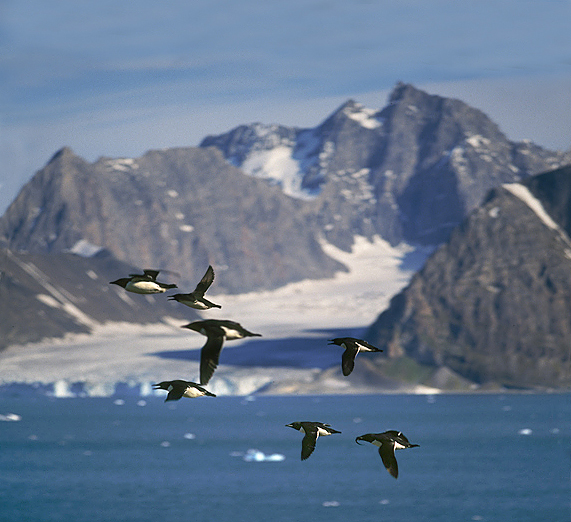
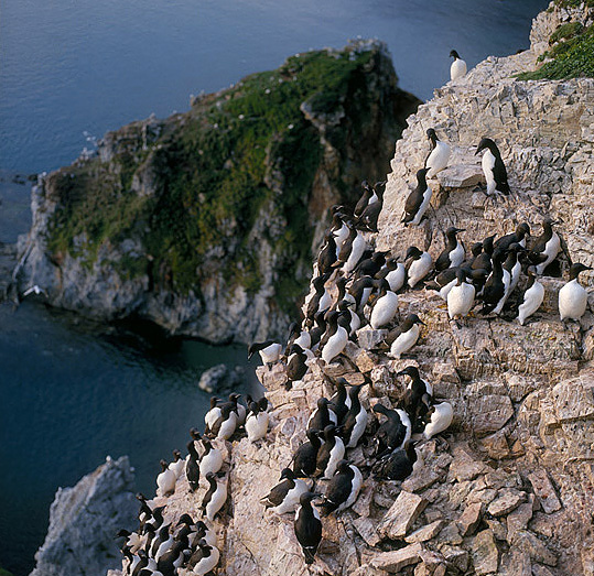
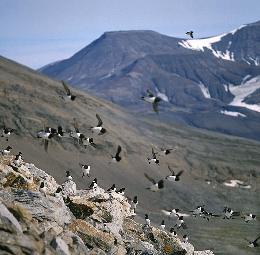
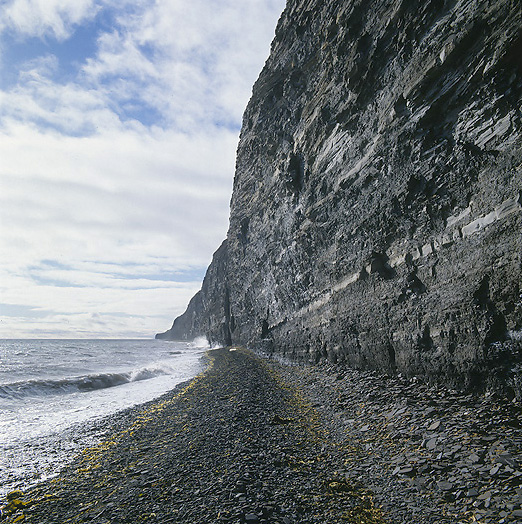
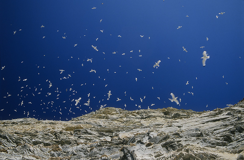
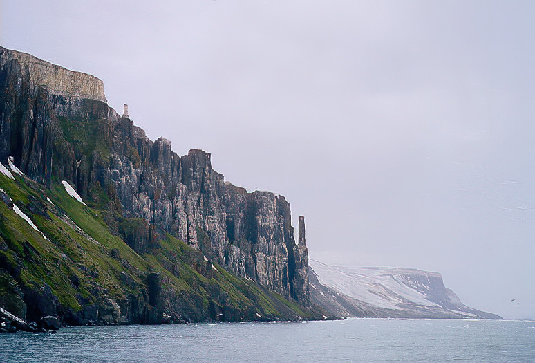
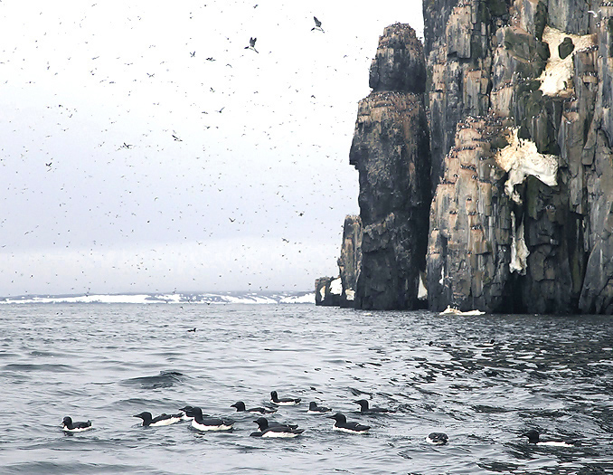
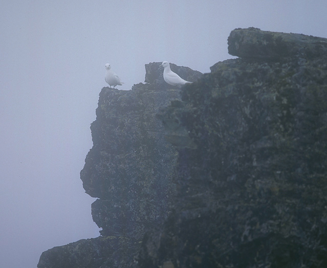
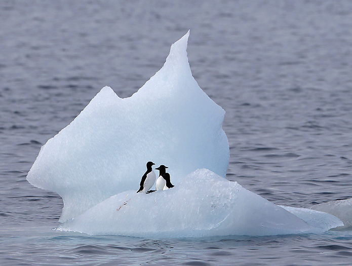
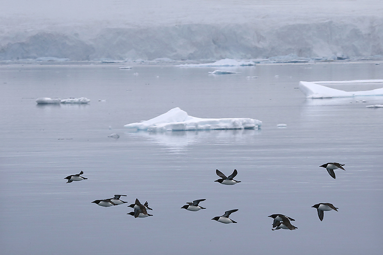
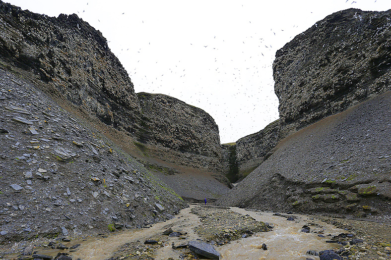
Along the steep cliff walls on the very the southern part of Bear Island there are several bird cliffs with a huge amount of Arctic seabirds dominated by Brunnich`s Guillemots, Little Auks, Black-legged Kittiwakes, Glaucous Gulls, Fulmars and Guillemots (the northernmost sizeable colony). But also less typical Arctic species as i.e. Puffins, Razorbills (northern most colony), Black Guillemots and Little Auks. During the nesting season the amount of seabirds can be as high as 1 million which make the colonies to be the largest on the Northern Hemisphere.
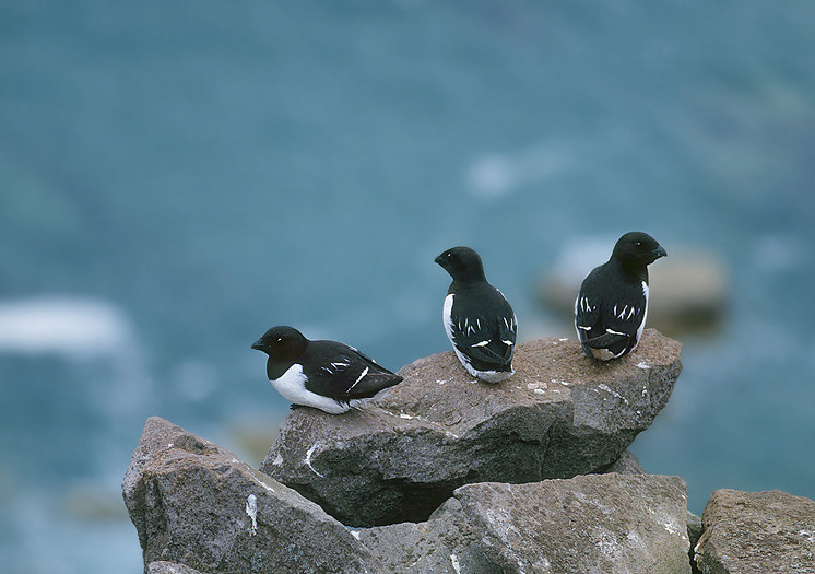
Little Auks at Hambergfjellet birdcliff, south west Bjørnøya.
After a short week at Bjørnøya we continue our journey northwards against Spitsbergen. We set course 330° including 6° deviation. At midnight we meet the first iceberg (75°, 16’N and 17° 40’E). The weather is excellent with sun and calm sea. When we approach a huge fog-bank early in the morning I suddenly see 10-20 Minke Whales searching for food some hundred meters ahead, I slow down and alert the 2 others on the ship, we stop and take a closer look at the beautiful big animals. One of them is actually coming over to the broadside of the ship, raise the head onto to ship-side and blew water in the air, -and noticed a fishy odor of the whale`s mouth. The same whale did that twice, -our understanding to this behavior was that the animal wanted to say hello to us…, – thank you, very nice !
When looking at the map we saw that there is a change of seabed level at this place, changing from 150 to 230m sea depth.
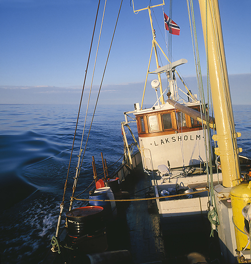
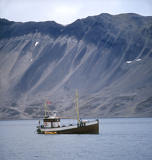
MS Laksholm sailng northwards from Bjørnøya at midnight. MS Laksholm was built in 1937 near Egersund (Andabeløy) in southwestern Norway as a fishing vessel and is 28,8 grt.
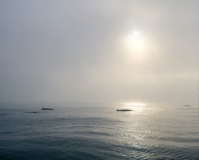
Minke Whales between Bjørnøya and Spitsbergen an early morning.
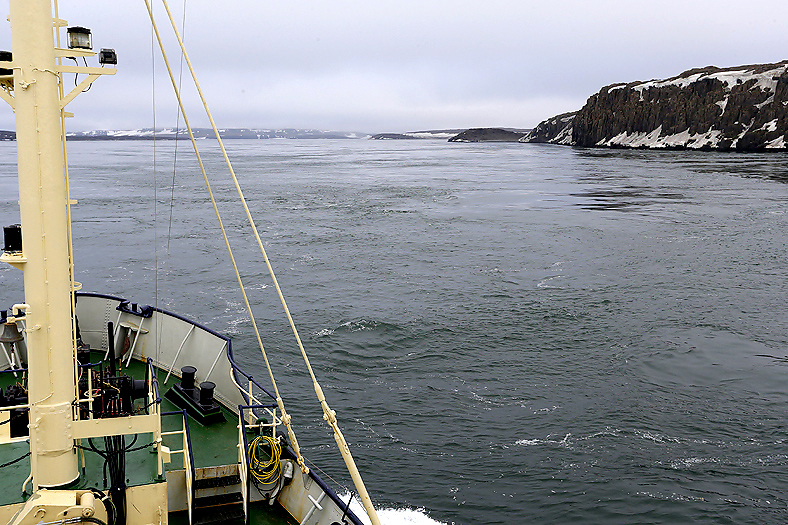
Sailing northwards again, the fog is increasing for ending up being continuous. We begin to see small icebergs, and many smaller icebergs/chunks of ice called Growlers. These mini icebergs are hardly visible above the surface and are very dangerous for the ship if we do not reduce the speed significantly. We reduce the speed a bit and place an “Ice berg” guard in the front. This was wise because we get thick for the rest of the stretch to Spitsbergen. Next afternoon we can see the southern tip of Spitsbergen on the radar at 18nm distance. Great navigated again Mr Skipper!
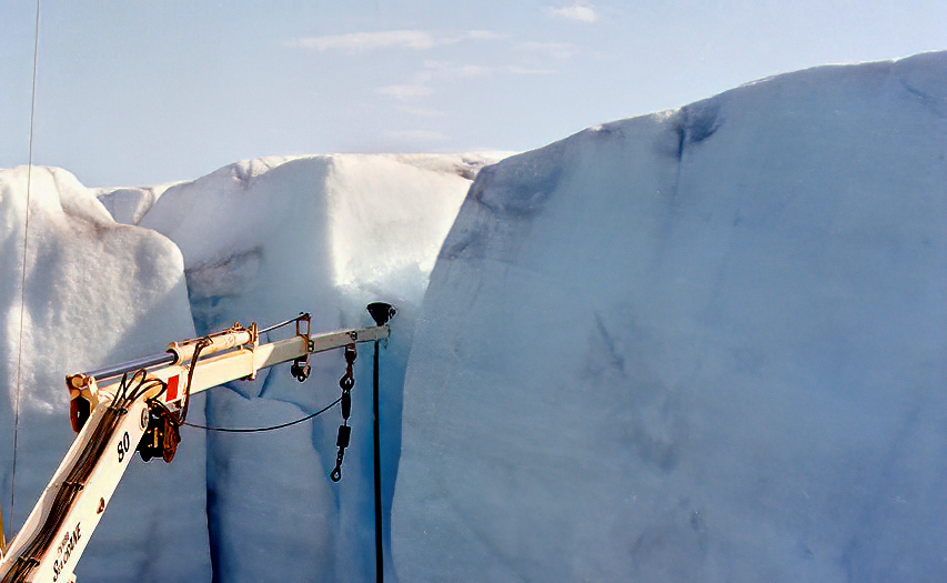
In the evening we anchored up in the bay of Gaashavna in Hornsund, still no land to see because of the fog. There are many glaciers in Hornsund where some of them ending in the sea. A couple of rather big icebergs are drifting by the boat, therefore we have to continue with having “Iceberg guard” during the night.
31 hours of sailing was logged from leaving Bear Island until reaching Hornsund.
Early next morning the fog disappeared and we got the first sight of Spitsbergen, -oh what a fantastic view, -overwhelming ! Alpine mountains and glacier at all three sides.
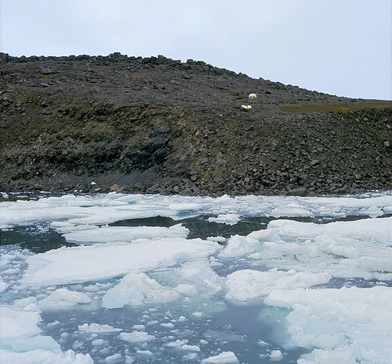
Hornsund have traditionally been a good area to see Polar Bears, also in summer. This caused by drift ice that follow the East-Spitsbergen stream southwards for so to turn northwards again at the southern tip of Spitsbergen. Hornsund is the first/southernmost fiord on the west coast and will the “receive” much of this ice. There are an old Polar Bear migratory route over land from Hornsund to East Spitsbergen. There are also big birdcliffs in the fiord, especially Sofiekammen on the northern side.
Here in Hornsund there are cultural remains from the first whaling period (Englishmen) at Spitsbergen, all the way down to the 1600`s. The fjord was named by the English whaler Jonas Poole, who wrote: “They brought a bit of an animal horn on board, which is why I called this sound Horne Sound.” Poole was on Spitsbergen several times only in the 17th century.
Subsequently, the area was first used by Russian pomors in the early 1800s, mainly on the south coast. Remains of a main hut and a number of bistros from the Pomor period have been found. In 1820 a shipwreck lodge was found with 13 dead Russians on board, and it is believed that the Russians did not use the area later than this.
In the early 1900s, Norwegians started fur trapping in Hornsund.
The barometer pressure have increased and show 1013 mbar, – what great start of the expedition along Spitsbergen!
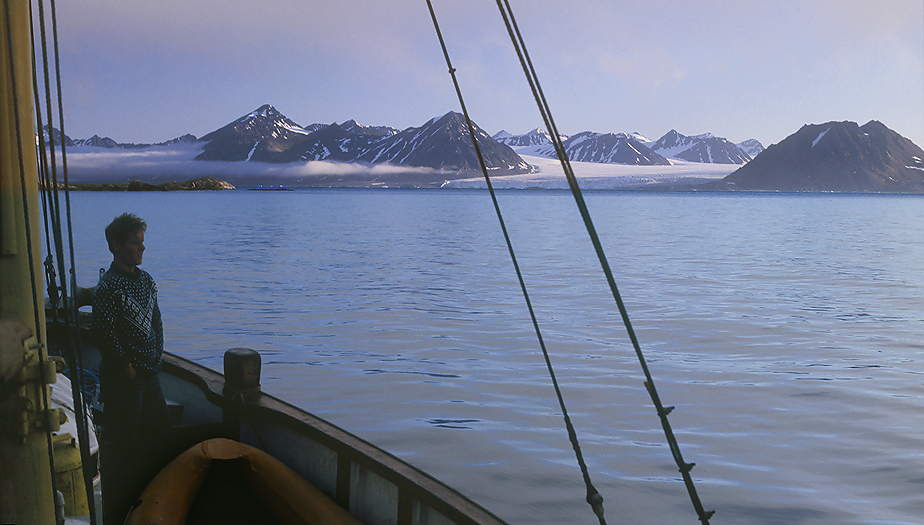
Waking up in the morning and get the first sight of Spitsbergen, -What a beautiful place here in Hornsund Fiord..
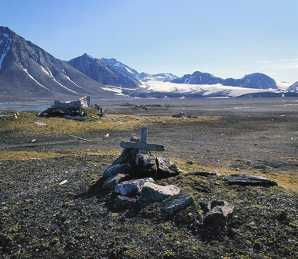
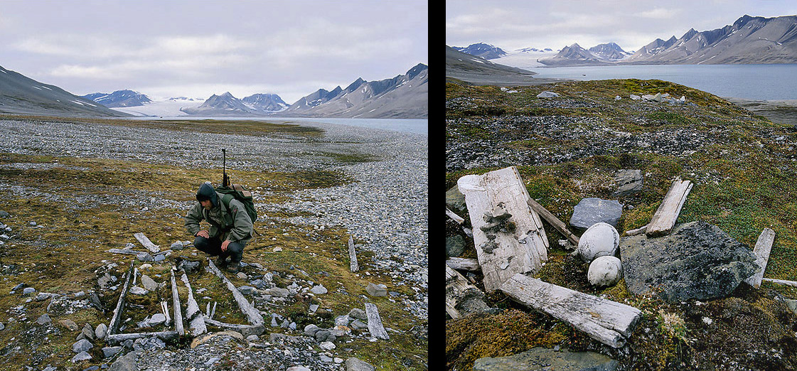
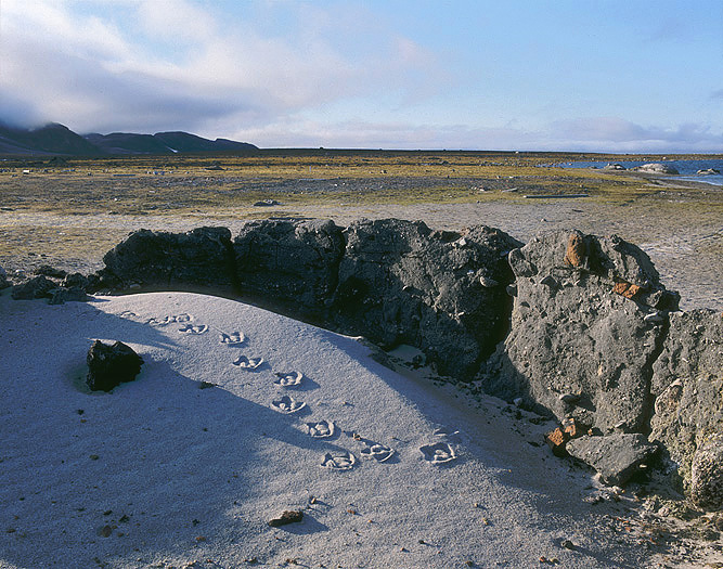
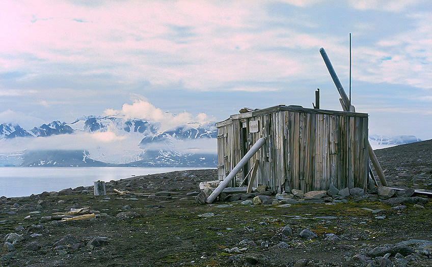
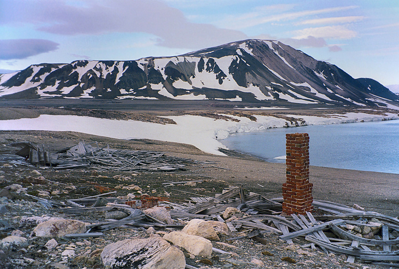
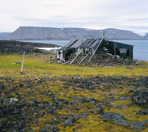
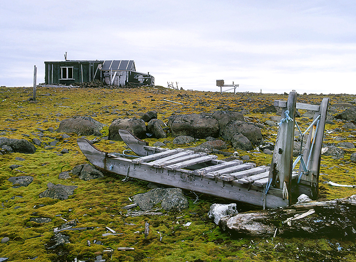
Grave and remnants of a Trappers cabin in Gaashavna. The cabin is built in 1906 by Oskar Grødahl and is placed inside an old whale blubber cooking site.
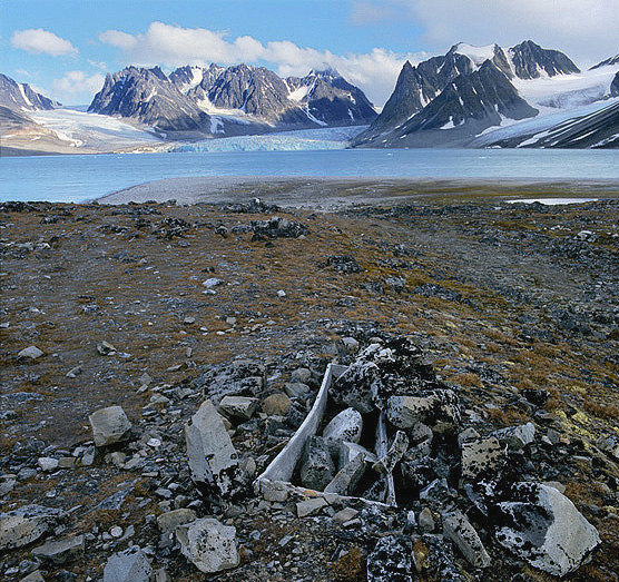
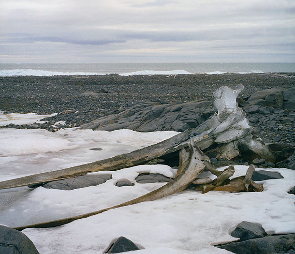
Bowhead Whale bone in Gaashavna, Hornsund.
Polar Bear by the Samarinbreen glacier front.
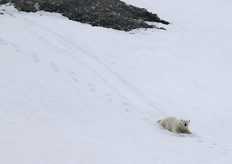
Playful Polar Bear slide down a snow patch by Samarinvågen.
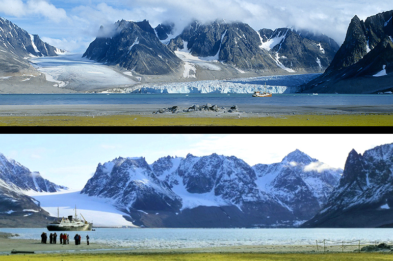
Part of Samarinvågen.
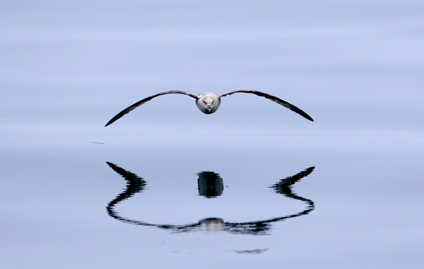
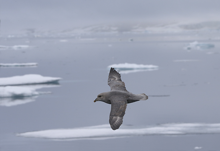
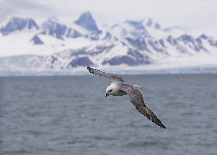
Fulmar.
The birdcliff contain thousands Brunnich Guillemots. Hornsundtind in the background.
After 3 days we leave the beautiful Hornsund fiord northwards along the southern part of Spitsbergens west coast. We are now heading for Bellsund which are the next fiord system north of Hornsund. Bellsund cuts into Spitsbergen south of the Ice Fjord and branches into the two large fjords Van Mijenfjorden and Van Keulenfjorden. The landscape is characterized by high mountains, where different geological layers are easily visible – partly in the form of impressive foldings. There are several large bird cliffs in the area, and the fertilization of the birds has led to rich vegetation in some areas. Bellsund has remains from many periods in Svalbard’s history of human exploration, hunting & trapping.
We go ashore on the north side of Bellsund, with the Ingeborgfjellet birdcliff and the NEC Gold mine at the foot of the mountain. We stayd in Bellsund for 3-4 days, and that was obviously the right time of the year for the annual happening at the Ingeborgfjellet bird cliff. By this it mean the single day of the year when all the Brunnich Guillemot juveniles are leaving the nests high up in the cliff and try to reach the sea shore below as fast as possible to avoid being eaten by the Arctic Foxes that live in the area. We knew something was going on in the early morning because thousands of Brunnich Guillemot parents was swimming in the sea just outside the shore calling for their young ones to come along. And the young ones did so, – but it was the first time they tried to fly, – and with varying success. In flight each of them was followed and supported (some times physically when the adult flew under in some way lifted the juvenile up a bit to avoid falling down to the ground not to for away from the sea. A great number of the unlucky juveniles that did not reach the sea was picked up by the Arctic Fox family that denned under the bird cliff. Only a few was eaten, but around 90% of them was killed and hidden away for being eaten later.
Playful White-beaked Dolphins along the coast against Bellsund.
Arctic Fox by Ingeborgfjellet bird cliff in Bellsund.
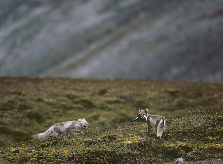
Arctic Fox that just have caught a juvenile Brunnich Guillemot juveniles that left the nest.
In 1906, the British prospector and later the leader of the NEC (“Northern Exploration Company”), Ernest Mansfield, had occupied all areas of Bellsund. The occupations besides Bellsund itself covered all areas around Van Mijenfjorden and Van Keulenfjorden. One of NEC’s houses in Vårsolbukta is Camp Bell. This was built as a base for exploration for gold and platinum in the summer of 1908, and Ernest Mansfield wintered in the cabin in 1908–09. In 1910, Mansfield built two houses at Camp Millar, just east of Camp Bell, to extract gold. The entrance to the quarry (horizontal mining) that was made to search for this precious metal is located about 150 meters from the shore at Millarodden
Camp Millar was once used in conjunction with gold exploration in the beginning of the 1900`s here in Vårsolbukta, Bellsund.
The entrance of the Gold Mine in Vårsolbukta.
Interesting geological structures in below Ingeborgfjellet bird cliff.
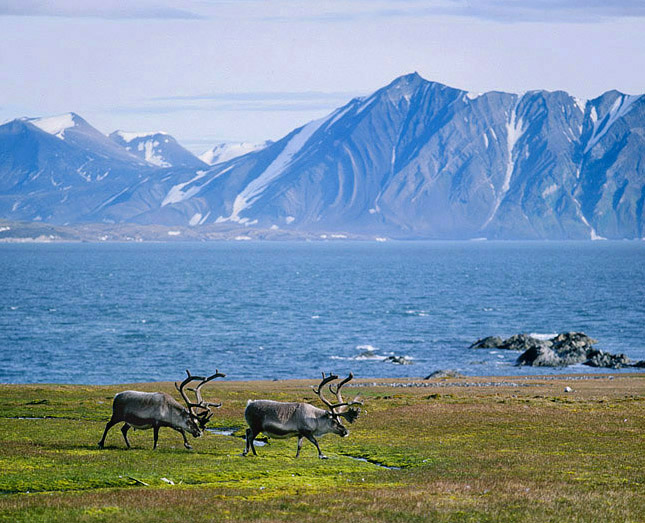
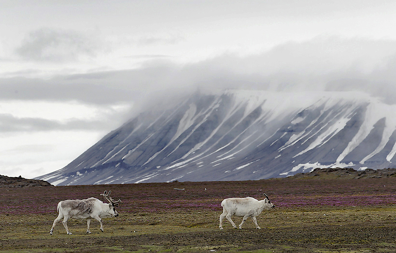
During the brief Summer in this High Arctic Land the Dwarf Reindeer manage to increase their weight significantly due to the extremely rich vegetation caused by the rich fertilization from hundreds of thousands of nesting seabirds here. The bird cliff colony is dominated by Brunnich Guillemots and Little Auks.
At Fridtjovhavna in the entrance of Van Mijenfjorden we say hello to one of the very few trappers left on Svalbard (Louis Nielsen). He recently caught a Ringed Seal, -and we could study a beautiful Ivory Gull the fed on the seal blubber. Fridtjovbreen glacier in the background.
Remnants of one of the many old traps that Norwegian Fur Trappers used for catching Arctic Fox in winter time when the fur was white and markedable. This one from Akselsundet at the entrance of Van Mijenfjorden.
Another place in the Bellsund area we go ashore for exploring the land is the beautiful Midterhuken. As one perhaps can imagine out of the name this some place in the middle, -and it is exactly that; in the middle of Inner Bellsund where the Van Mijenfjorden and Van Keulenfjorden meet each other.
Midterhuken is a mountain and a place with remnants from former Dutch hunting at the seventeenth century . There are remnants of buildings, whale oil cookeries, lookout arrangements and graves. There was also one of Hagerup’s fur trappers outstations from 1898. No one is allowed to go ashore here because of the cultural remains. The Governor of Svalbard conducts expanded supervision and maintenance of the site, which is part of the most prioritized cultural sites in Svalbard.
This small trappers outstation at Midterhuken is the oldest one on Svalbard. It was built in 1898 by A.Hagerup from Tromsø.
Also at Midterhuken we find huge bird cliffs. Here a colony of Brunnich Guillemots.
Little Auk colony in Forkastningsdalen, van Keulenfjorden.
Fleur de Lyshavna is outermost in Van Keulenfjorden, and is one of the best harbors in the area. Note the old wooden station (Pitnerodden) down in the bay.
Ingvald Svendsen’s station for hunting Belugas on Kvitfiskstranda in Van Keulenfjorden. The main building was built by Ingvald Svendsen around 1930. 1 house “Kjeftausa” is made of a vaulted boat supported with turf wall of 2 fur hunters who could not build a proper cabin before the winter came. Some of the bones from the Beluga hunting on the beach is shown in the photo. It is estimated that about 550 Belugas were killed here.
The expedition ship M/S Laksholm is slowly leaving Bellsund to set course northwards again.
Arriving Longyearbyen the next day for bunkering diesel, gasoline, water and food we
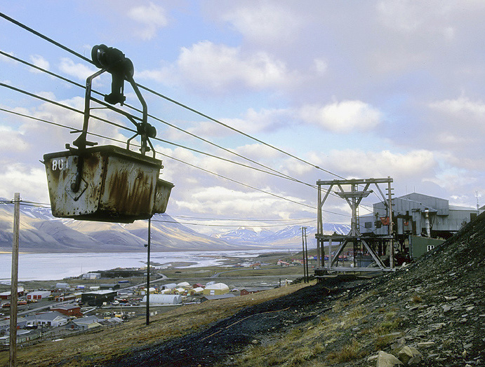
also meet friends that shall join us for the next 2 weeks on the west and north coast of Spitsbergen. Longyearbyen is still a mining town even if tourism is increasing.
From Longyearbyen.
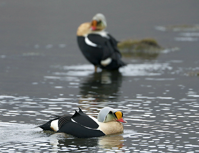
King Eiders in Adventdalen.
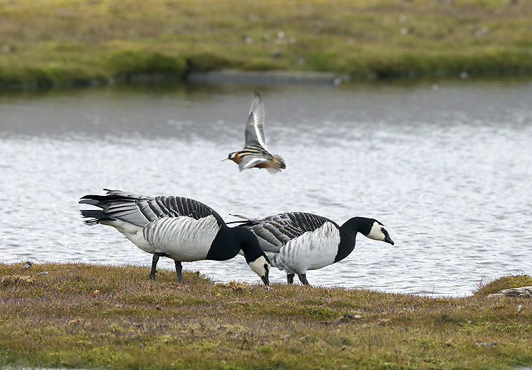
Barnacle Geese in Adventdalen.
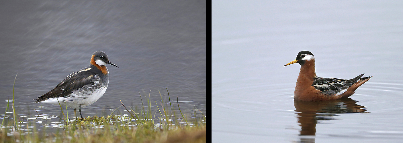
Both the arctic Red-necked Phalarope (left) and the high arctic Grey Phalarope (right) are found on Svalbard. The first one normally only along the western part of Spitsbergen.
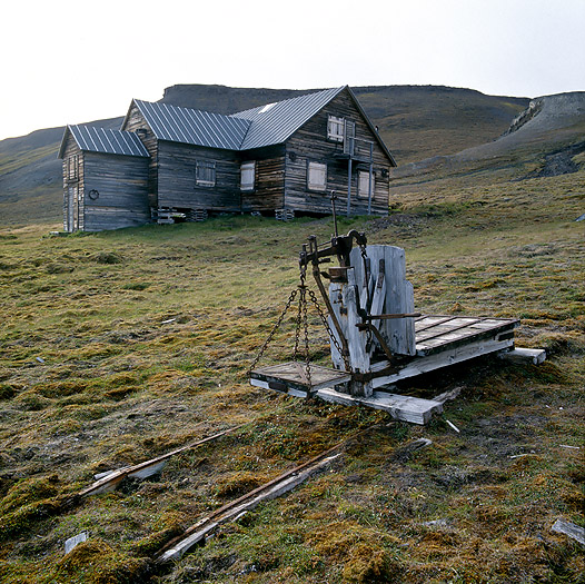
Mine 2B in Longyear Valley. A new part from Mine 2 was constructed here in 1937, it was bombed & burned during a German attack in Longyearbyen in 1943. The mine was operated again in 1947 and the mining lasted until 1968.
A tragic story from Isfjorden:
In the fall of 1872, 124 men were on board in many hunting boats at Gråhuken north on Svalbard. They waited for the walrus to land on Moffen island, and were ready for big catch. To late, they became aware that the drift ice suddenly was blocking the ships. It was winter, the cold was increasing. What was the first drift ice turned into a life-threatening trap for the men. 17 of the hunters departed from there on October 14, 1872. It took them seven days to row 350 kilometers southwards to a house they new existed. They and asked to stay in e house (a research station where Swedish Adolf Nordenskiøld was the manager) had set up at Kapp Thordsen. Here they could stay indoors in the winter that soon would arrive, and with a certain amount of food.
On October 1st, they arrived at the well-equipped house. All men arrived safely to this place where there was food, fuel and everything they needed for safe wintering. Here they would stay until a boat could pick them up next summer.
Twelve weeks after arrival, the first two die, among them Henrik Henriksen, who was the leader of the expedition. The others felt weak, but they were strong enough to bury the two men half a mile from the house. They feared an infectious disease.
Then one by one died. Most were lying in their beds, some on the floor. The men had no communication with the outside world, no one knew about the tragedy.
Only in the summer of 1873 did people come to the Swedish House. The sight that met them was cruel. Dead men were everywhere. Only two were buried. They found diaries written to the last, but nothing could shed light on what had happened.
– They died with severe pain and diarrhea. 15 were laid in a common grave, and a belief spread that the men had died of scurvy, says historian Kjell Kjær.
Almost 30 years before the drama at the Swedish House, the American Franklin expedition disappeared with 130 men. They were to find the Northwest Passage, and their disappearance led to many exploration actions and much speculation.
– It was later determined that many of the crews died of lead poisoning after drinking from lead-sealed canned food. Our theory that the same thing happened to the men in the Swedish House, we believe, according to our investigations, to be correct, says Kjell Kjær.
The Swede`s house at Kapp Thordsen is the only big 1880s house on Svalbard that still stands. Built by Nordenskiold in 1872 for his mining company “AB Isfjorden” with the aim of utilizing the phosphorous mineral coprolite. Remodeled and expanded in 1882. In the winter of 1872-73 17 men died of lead poisoning here.
Remains of astronomical observatories by the Swede`s house at Kapp Thordsen built by Adolf Nordenskiøld in 1882.
Steep cliffs at Kapp Thordsen make it often difficult to go ashore here. The huge open Isfjorden can generate quite high waves, – which we got to experience on our return back to the ship again. Soaked wet clothes and a Zodiac filled with water..
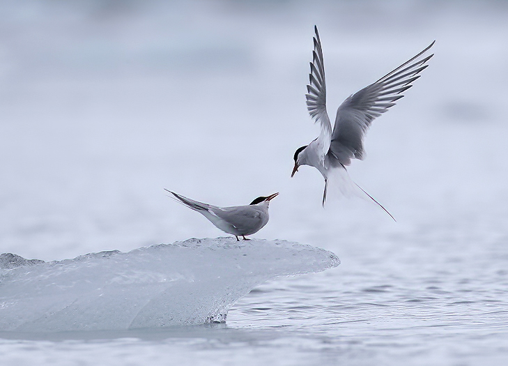
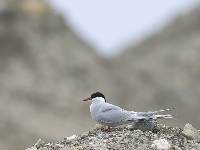
Arctic Terns in Borebukta, Isfjorden.
The journey continues and we arrive Trygghavna which originally called “Safe Harbor” by the Englishmen who operated here while hunting whales in the 1600 and 1700-hundreds. As the name says this is a safe harbor.
M/S Laksholm anchored up.
Remnants after one of the largest Russian hunting stations from the 1700-hundreds winterings here.
Several graves from the Russian hunters at the 1700-hundred we can also find here.
The area by Alkhornet here on the west coast of Spitsbergen is a beautiful place. The plain below is fertilized by bird droppings from the bird cliff above.
Kittiwakes at Alkhornet bird cliff.
Norwegian Fur Trappers Station, which was built during World War I by the Norwegian Karl Eliassen from Tromsø and sold to Hilmar Nøis in 1920.
Next stop is in the Kongsfjorden area with Ny Ålesund, worlds northernmost community. I will not describe the area here to much as it is among the most well known places in the archipelago. A couple of photos from the area:
At Kvadehuken in the out-skirts of Kongsfjorden we can find typical permafrost caused ground pattern. Tension/stress differences in the soil in an area of strong frost migration, in the case of groves and fine particles are sorted and distributed, with rocks pushing out to the sides and fine particles concentrating towards the middle. This is how the structures that are typical of those freezing field patterns occur.
Midnight over Garwood in Kongsfjorden.
Further north again and we arrive Magdalenafjorden on the northwest coast. Together with Kongsfjorden this is one of Svalbards most visited areas in modern times due to a magnificent scenery and remnants from the former Whaling period by mainly Dutch and British whalers. At the harbor there are whale blubber cooking sites (poorly preserved in the sand), and one of three large burial fields from the whaling period. The field dates from whaling in the 1600s and 1700s. Historical sources say that the English had a station at Gravneset which they called “Trinity Harbor”, the station was closed down in 1623.
The whaling was not done without problems among the participating countries (England, Netherlands, France, Spain, Germany and Denmark/Norway) due to significant financial gain on the European marked. So for the cause of the right todo the whaling and to control the whaling fields several occasions lead to regular war conditions at the whaling fields. As early as in 1614 these fields were for the first time split up after an agreement. The Dutch got the permission to
Hunt north of the Magdalenafjorden while the Englishmen controlled the areas south of Magdalenafjorden.
An old whalers grave in Magdalenafjorden.
The majority of the glaciers are now shrinking all over the globe. It is not commonly known that most of the glaciers on Svalbard has been shrinking during last hundred years from and well beyond that as well. This photo from Magdalenafjorden show 31 years of shrinking (from 1988 – 2019) of the Waggonwaybreen glacier`s western arm. The glacier front is 250m behind the cape on the right side of the bottom photo. The lower photo from 2019 is taken by Kjell Tysdal.
Soon we arrive the north west corner of Spitsbergen, the area here have a rich history, both regarding whaling and arctic exploring.
Regarding whaling, the well known “Smeerenburg” was a former whaling station located at the southeastern point of Amsterdamøya. The name comes from Dutch smear, fat or blubber “Blubber city”. In the first half of the 1600 hundreds Dutch whalers continued to live here during the summers and up to 17 buildings and 7 double ovens (huge blubber boilers of copper) were established on the sandy beach. About 200 men worked on land and many others on the ships. Whaling was a dangerous job and there are hundreds of graves at Smeerenburg and in the surrounding area. After 1640, the Greenland whale became less common in the fjords on Spitsbergen, and Smeerenburg fell into decay. Now there are only remains left showing where the blubber boilers and buildings once was placed, as well as graves.
Regarding arctic exploring, -In late 1800`s and early 1900`s the Arctic flight pioneers Salomon August Andree and Walter Wellman started their attempt to fly to the North Pole from Virgohamna on the Danskøya.
In 1896, Swedish engineer Solomon August Andrée established a base east of Virgohamn for his attempt to fly to the North Pole with a balloon filled with hydrogen. A round hangar was erected to protect the “Ørnen” balloon before departure and a few tons of iron filings and approximately 40 tons of sulphuric acid was transported to the site to make the hydrogen gas to fill the balloon.
The expedition waited during the summer for the southerly winds to carry the balloon against north. Meanwhile, Fridtjof Nansen’s ship “Fram” arrived with crew who had just come out of the ice after drifting across the Arctic Ocean in 1893-96. Nansen had experienced that the Arctic could not show much stable winds from south that Andree needed. There became no departure of the “Ørnen” that summer, but the following year Andrée decided to lift the balloon and “fly” no matter what happened (he felt forced to do so..). The balloon lifted July 11 with Andrée, Knut Frænkel and Nils Strindberg on board. On July 14, they landed on the ice 480 km northeast of Virgohamn and on October 5 they landed on Kvitøya where they died shortly after. The remains were not found until 1930 (author Per Michelsen: We will come back to this place later in this article).
It was clearly tempting to drift over the ice to the North Pole, and in 1906 American journalist Walter Wellman arrived in Virgohamn to try to reach the North Pole by airship. He built a large hangar to house the airship in 1906 and for attempts to “fly” northwards in 1907 and 1909. The attempts were half-hearted and little was achieved beyond at a later stage making place in Svalbard’s history. Today it is mainly the remains of Wellman`s North Pole airship attempts (hangar, and materials for hydrogen production etc) that is to be seen here along the beach in Virgohamn.
“Blubber cement” that is made of whale oil which once was spelt over the edges of the copper boilers while cooking was mixed with wind-blowing sand from the ground is the only remains of the production of Whale oil at Smeerenburg on Amsterdamøya in the 1600 hundreds.
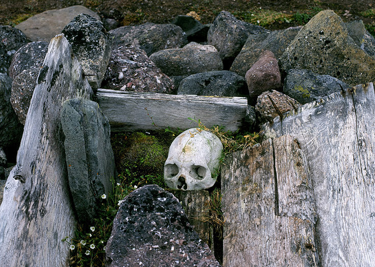
Dutch whalers grave on Danskøya. The permafrost prevented the coffins here from being dug particularly deep and freezing and thawing movements in the ground have gradually pushed up some coffins.
Old Mast of stranded sailing ship by the shore of Amsterdamøya.
Remnants of Wellman`s airships Hangar in Virgohamn.
Iron filings in Virgohamn for making hydrogen gas (together with sulphuric acid) for Wellman`s airship.
Broken containers in Virgohamn which once was filled with sulphuric acid for making hydrogen gas to Wellman`s airship
Well, -the voyage continues eastwards along the north coast of Spitsbergen with another ship / time due to the need of ship with high ice classification. We then head out to the desolate parts with traditionally considerably more sea ice. The mild Gulf Stream hit the Svalbard archipelago on the west side, leaving the northern and eastern parts significantly colder & icy. From now on it is important to be aware of the wind direction, where i.e. northerly winds can make the drifting ice that normally is not too far away from the coast to lock the ship in making it impossible to sail neither forth nor back.
The first fiord we meet when sailing eastwards on the north coast is the beautiful Raudfjorden. The ground here belongs mainly to the bedrock and consists largely of old, hard rocks such as granite, gneiss and magmatitis. On the south and east side of the Raudfjorden, younger, reddish Devonian sandstones is entering.
The landscape is shaped by glaciers, which still erode the bedrock so that the mountains end up with pointed ridges.
In Alicehavna, Raudfjorden, just south of Bruceneset this trappers simple cabin was put up later in the 1900 hundreds. The bay Alicehavna is named after the vessel Princesse Alice, which Prince Albert I of Monaco used during his oceanographic expeditions to Svalbard in the period 1898 – 1907. Albert was a benefactor to a number of polar scientists, including William S. Bruce, Fridtjof Nansen and Gunnar Isachsen. The latter started in many ways the modern Norwegian Svalbard research with the support of the prince.
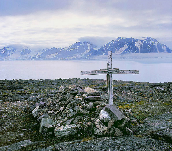
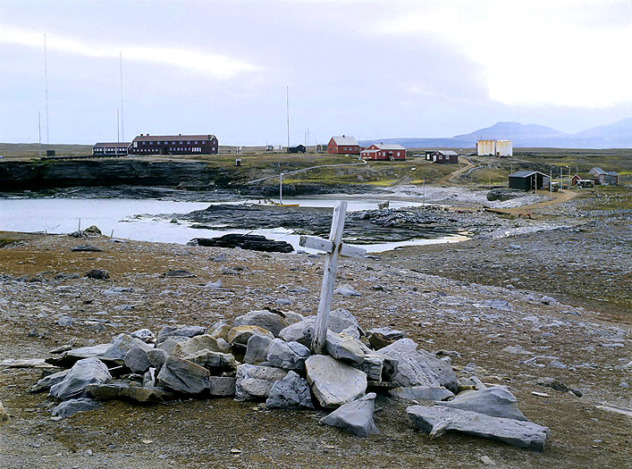
Things went wrong for the well known captain Erik Zakariassen Mattilas from Tromsø in the winter of 1907/08 here in Raudfjorden, and it should be his last wintering. He died of scurvey in the spring of 1908. His grave on the top of the small hill on Bruceneset – it is hard to imagine a more lonely and beautiful grave than this one.
A single grave that tells nothing about who is buried here north of Alicehavna, where he came from or when he died.
On the way out of the fiord we see numerous Harp Seals gathering together, -around 25-30 animals. And in the open sea outside the fiord we see several whales; 3 Minke and 2 Fin Whales and many more Harp Seals by the floe edge. We sail eastwards and pass the huge lowland of Reinsdyrflya before entering the next fiord which is Woodfjorden, This big fiord splits up in two smaller fiords; Liefdefjorden in the west and Bockfjorden in the southwest.
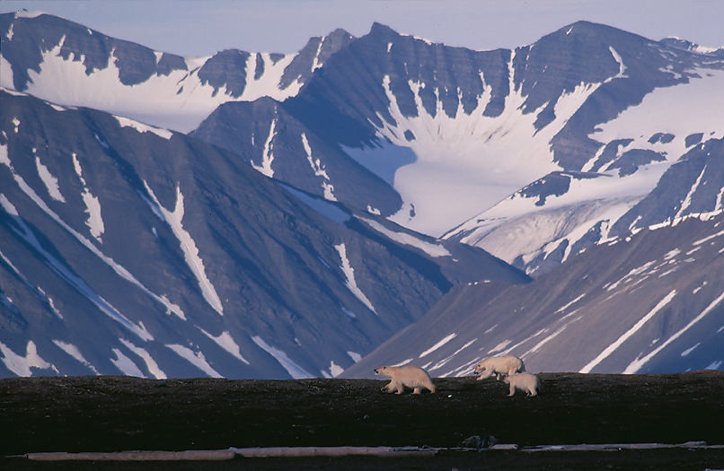
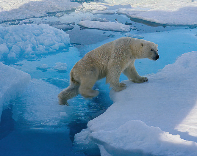
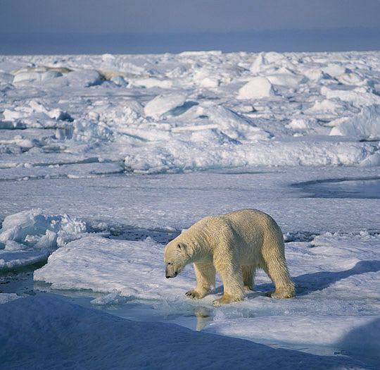
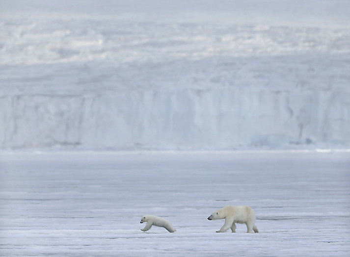
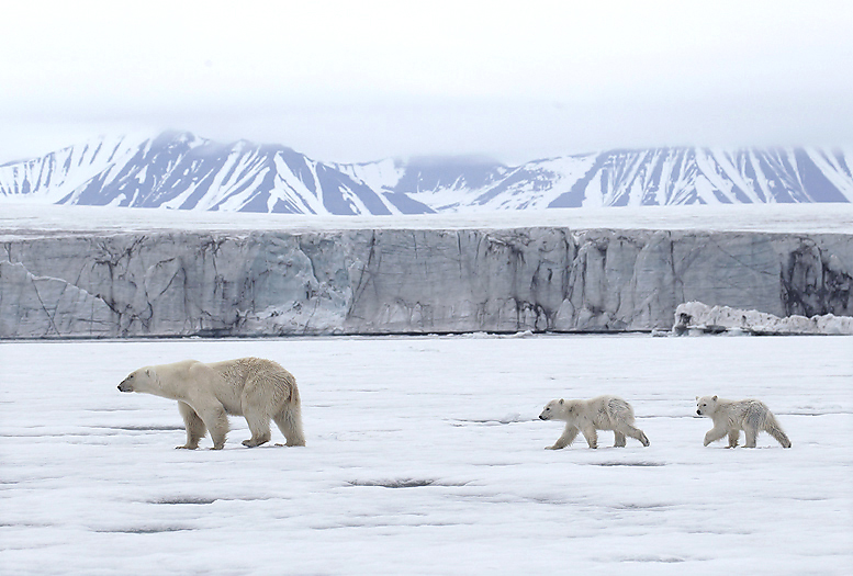
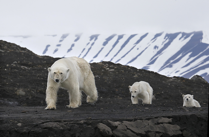
The area here is a land of contrasts. Here we find both alpine mountains of ancient granite (mainly on the west side), more eroded and red mountains of Devonian sandstone at the east side, and a young volcanic cone and hot springs in between in south. We have now arrived the areas which is commonly visited by Polar Bears. And this we should experience well, i.e. one day we saw 9 Polar Bears at the same time (3 mothers with 2 cubs each).
We first make a visit to Liefdefiorden surrounded by peaks and with the impressive Monaco Glacier calving in the sea.
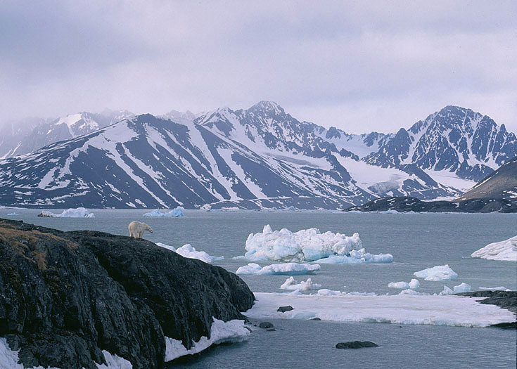
Polar Bear in Liefdefjorden.
Polar Bears in Liefdefjorden, -evening light.
Thereafter we sail into the small Bockfjorden. Here we can find hot springs: the Jotun springs and the Troll springs. These hot springs have probably existed since the volcano on Sverrefjellet was active between 100,000 and 250,000 years ago and is the northernmost of its kind in the world.
The hot spring water flows up from the ground, a very calcareous and slightly salty water that forms pools of various sizes around the terrain. The temperature in the springs easily matches the bathing temperature in the Oslo Fjord on a summer day and is around 25 degrees in summer. In winter, the temperature drops to around 10 degrees.
These very special, hot springs, located in polar surroundings, have created the conditions for a small group of exclusive species that basically belong in completely different places, hundreds of kilometers further south on the continent.
We are talking here about crown algae, a group of green algae that occur in freshwater and brackish water. They have a complicated shape, or morphology as scientists call it and are closely related to taller plants.
Crown algae are widespread on all continents except Antarctica. In Norway we find them all over the country – only basically not on Svalbard. Senior researcher Susi Schneider at the Norwegian Institute for Water Research (NIVA) has a very special interest in crown algae and their role in the ecosystem. It has been several years since she became interested in the crown algae on Svalbard, and she has long thought that there is something very special about these.
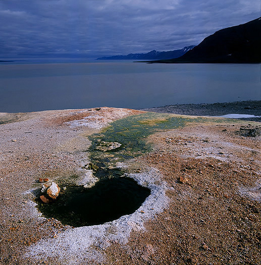
From the Jotun springs in Bockfjorden.
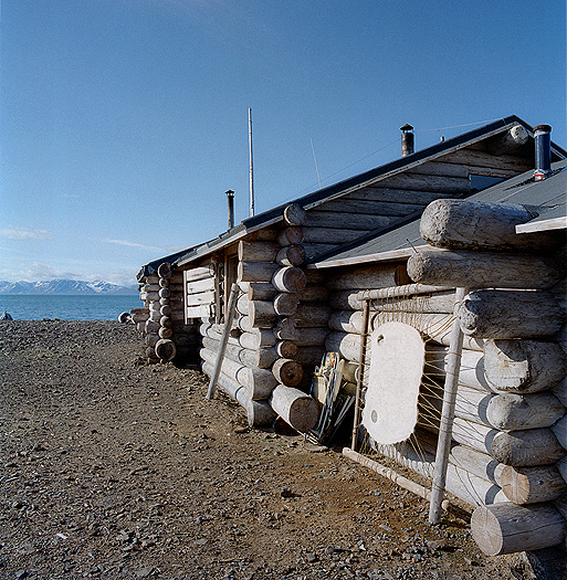
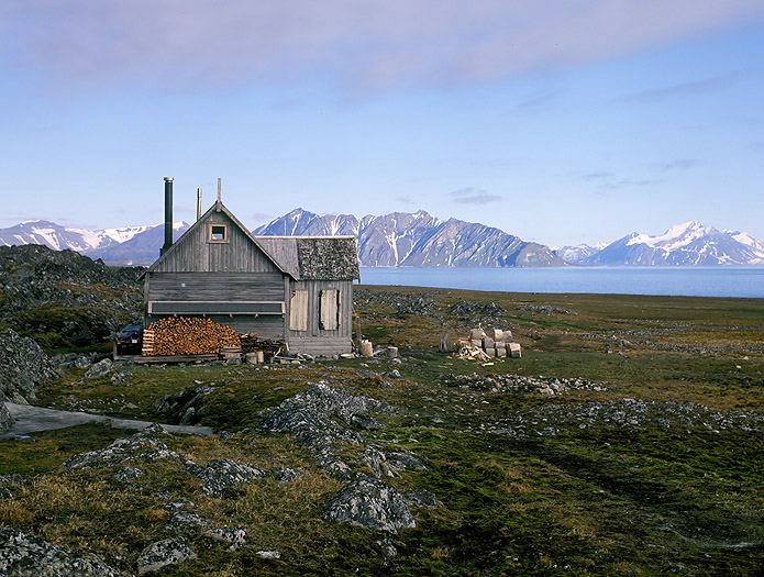
Mushavna trappers station on the east side of Woodfjorden is still in use, where the Norwegian trapper Kjell Reidar Hovelsrud are focused on Arctic Fox and seal. A Ringed Seal hide is prepared and buckled up to air dry.
Gråhuken trappers station at the eastern mouth of Woodfjorden, built in the early 1900 hundreds. We are very close to the “always present” drifting ice here on the north part of Spitsbergen and this was a very good place for trapping Polar Bears.
Departing Woodfjorden we continue against east. We pass by the huge Wijdefjorden, make a visit into Sorgfjorden before we enter the famous Hinlopen Stredet. Just south of the mouth of the Strait there are the Alkefjellet Bird Cliff. At arrival 03:30 we went out on the deck watching this impressive Bird Cliff containing mainly Brunnich`s Guillemots and Kittiwakes. Per the year 2018 the colony inhabits around 90 000 Brunnich`s Guillemots
Crozierpynten at Sorgfjorden with the ruins of the Swedish Arc-of-Meridian station from 1899. The station once consisted of Living Quarter, outbuildings and observatories. In the background we see the mountain Heclahuken. It was described by A. E. Nordenskiöld in 1863 and has given rise to the term Hecla Hoek rocks, which is used about the bedrock rocks on Svalbard
The Alkefjellet Bird Cliff is impressing with its basaltic hexagonal columns.
Part of the Alkefjellet Bird Cliff with the high Arctic Brunnich`s Guillemots.
Our original plan is to circumnavigate the Svalbard archipelago and does not continue southwards the Hinlopen Strait, so therefore we cross over the strait against north-east to Nordaustlandet and go ashore several places at the interesting Muchisonfjorden. There are a very interesting geology and also several cultural heritage remains from i.e. Russion Pomors trapping here in the 1700 hundreds.
Heavy pack ice blocked the entrance to Murchisonfjorden, but after some hours of working with the ice strengthened ship through the ice we were lucky and could finally enter the fiord. The land here is barren, very frost eroded and desert like with an overall yellowish color, except for some very colorful structures. Geologically speaking we are here in a transition zone between the bedrock and younger rocks with mostly limestone and dolomite stones from Carboniferous and Permian period.
Colorful bedrock in Murchisonfjorden.
A primitive trap-gun for killing Polar Bears in Murchisonfjorden. Perhaps the oldest one still standing at Svalbard. It is made of driftwood. The rifle (normally with a cut barrel) was mounted innermost in the v-shape where the outer widest part of the v-shape led the bear into the bait which was connected to the rifle. When the bear touched the bait, -the rifle went off.
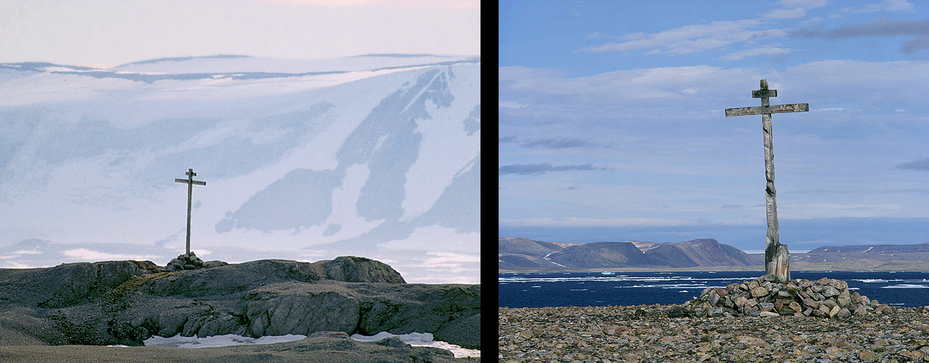
The only two original remaining and still standing Russian Pomor crosses on Svalbard. The left one is found on Depotøya in Murchisonfjorden, and the right one on Krossøya, also in Murchisonfjorden. We had to be very vigilant when being ashore studying the old cross on Krossøya because there were 4 Polar Bears walking around on this small island.
They are dated to be from the 1700 hundreds. Both crosses lack however the crossbars.
The expedition continues and we sail against north and north east. We will visit Sjuøyane (a small archipelago) with its characteristic, hat-like mountains north of Nordaustlandet where the northernmost point on Svalbard (and also for Europe) is located just below the 81° North parallel. The distance to the North Pole from here is 1033 km. Thousands of nesting seabirds give the hard granite mountains a green tinge of moss. Out in the straits between the islands and in the bays, the walrus dives for shells. Most of the islands are named after the English North Pole expeditions led by Phipps (1773) and Parry (1827).
We anchored up in the bay at the south side of Phippsøya. The “always present” Fulmars glide beside the ship. On land we can see 2 Polar Bears.
On this island there are a colony of Ivory Gulls. We walked 2-3km and up to the colony about 400m above sea level to observe the Gulls, but it was quite foggy so we could unfortunately not see the whole colony. They were quite noisy however, with lots of screaming inside the fog.
Next evening at 19:00 hrs we pull the anchor up and sail further eastwards and into extremely remote areas. The drift ice cause no serious problems for us so we reach the island of Storøya at the eastern side of Nordaustlandet next morning at 06:00. Storøya is a “mini-Kvitøya” with its glacier dome spreading out from the top of the island. The northern part, on the other hand, is ice-free, and consists of bedrock diabase, such as Kræmerpynten on the eastern side of Kvitøya. These rocks are – as part of the bedrock quite rare on Svalbard.
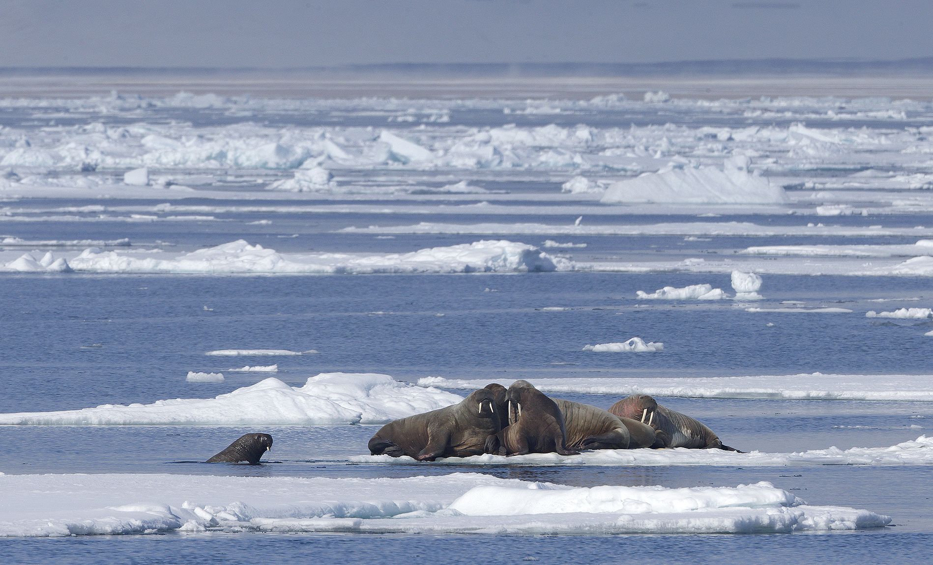
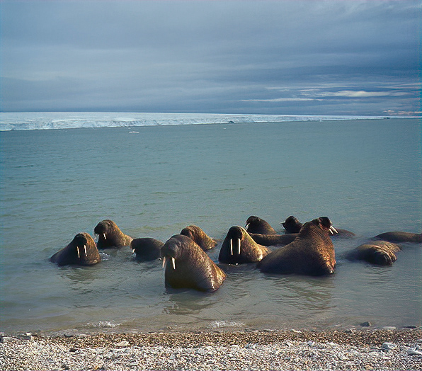
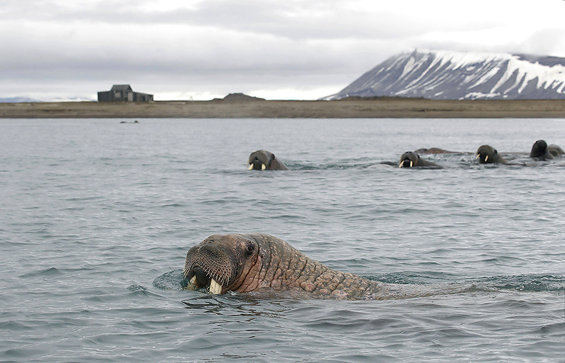
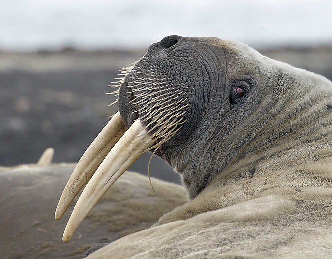
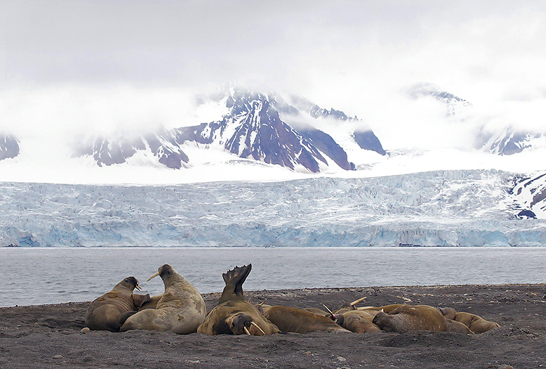
We go ashore as soon as we arrive the island. There are a herd of 40 Walrus including some small calves together with their mothers right outside the beach where we have anchored up. One quite big male Walrus like himself obviously better on land. We take a couple of photos and leave him in peace.
On the raised beach terraces we see many really old huge Whale bones, some of them where only parts visible above the gravel, including a big old Walrus tusk.Two Polar Bear skeletons lies high up on the beach. They lie around 10m away from each other, where both have damages in their skulls. After a closer study of them it seems clear that they have had a big fight with fatal outcome for them both.
In between the Whale bones some Eiders have found shelter for their nests.
Later we leave Storøya and sail further east against Kvitøya which are the most remote and traditionally difficult part of Svalbard to access. Kvitøya is located over 80 km east of Nordaustlandet in the Svalbard archipelago and so far east that it is at the same latitude as Istanbul. The waters here are packed with ice and it is very difficult to sail, even with a powerful engine and with our ice strengthened ship. It was first seen by the Dutchman Cornelius Giles in 1707, and bore on older maps the name Giles Land. The first reliable observation of the island is from 1876, by the Norwegian Johan Kjeldsen who gave the island its current name. Just under 60 km just east of the island Victoriaøya at the Russian high Arctic archipelago of Frans Josef Land is located.
Kvitøya is a rather big island (682 km2) and almost completed covered by a huge dome glacier, only two tiny areas are ice free; one on the west and one on the east side.
We manage to go ashore on the ice free area on the west side. We have to be very vigilante due to expected Polar Bears in the area. This place is named Andréneset and has a special history that is connected to the place Virgohamn which we visited earlier at the circumnavigation on the north west side of the archipelago: In the summer of 1930, the crew of the hunting vessel “Brattvåg” came across a boat made of canvas at this place. This quickly turned out to be the remains of the balloon expedition of the Swede Salomon August André. In 1897 he aimed to reach the North Pole with this balloon. The remains of the expedition members were found here on the ice-free western tip of the island. The crew did not have the equipment to survive the winter and died in the autumn of 1897. Until 1930, it had been a mystery what had happened to the expedition. The crew at Brattvåg found journals and rools of film which showed that the 3 expedition members died only a few weeks after they arrived on the island. The three dead polar pioneers were brought back to Sweden in 1930 with great honor. The journals could tell that the Air Balloon reached around 1/3rd way to the North Pole before they stranded in the pack ice and was unable to get up in the air again. Thereafter they walked against south for 3 months before reaching Kvitøya. It must have been an extremely tough and exhausting process southwards. They were not equipped to manage themselves through the cold and dark polar winter.
When ashore we found the place where the Swedes had arrived from their unsuccessful attempt to reach the North Pole in 1897 and put up their simple camp. A very few people have ever visited the place, and this year the snow patch that has been reported to always cover the camp was melted away. Of this reason we walked on “untouched ground” and found equipment and many artifacts from the Swedes camp back in 1897. We found i.e. The Polar Bear hide they slept on, Air Balloon canvas, ski sticks, clothes and medical glass bottles. The grave containing Nils Strindberg, -one of the 3 was just beside the camp. An old Polar Bear skeleton was also visible. Could this be the Polar Bear that they managed to kill and eat? It is unknown what the men died of (anticipated to be either hunger, trichinosis or killed by Polar Bears), but one thing is sure, and is that they were exhausted and not able to reach other areas in the archipelago with chances to meet other people and being rescued.
The author studies the camp at Kvitøya to the unsuccessful North Pole expedition to Salomon August André in 1897 where all expedition members died.
Part of a ski stick and stocking that once belonged to one of the unlucky Swedes at Andréneset on Kvitøya.
The grave of Nils Strindberg at Andréneset. It is believed that he got killed by a Polar Bear.
Polar Bear in the drift ice outside Kvitøya.
A Whale skeleton at the Kræmerpynten on Kvitøya. This is the archipelagos furthest most remote place and as far east as the city of Istanbul in Turkey.
After rounding the point furthest away on the circumnavigation the course is set south westwards against Bråsvellbreen glacier at Nordaustlandet. Heavy sea ice south west of Kvitøya cause however difficulties for us to sail. The ship is stuck in the ice for hours. We get company from a curious Polar Bear who come into the side of the ship and entertain us for a while before leaving out in the drift ice again. We look for the rare and exclusive Ross`s Gull, but all we see is Kitttiwakes. A Pomarine Skua is hanging over the ship for some seconds before flying away. Later in the evening the drift ice opens up a little bit here and there and we can slowly move against south west. Nordaustlandet have the biggest glacier (“Austfonna”) in the Svalbard archipelago, which also is the glacier with the biggest front against the sea on the northern hemisphere, -as long as 200km.
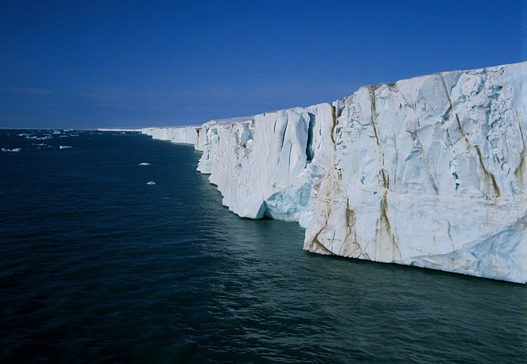
The impressive Glacier front of Austfonna with its 200km long glacier front/shelf is the longest front calving into the sea in the arctic.
Filling of fresh water from the surface melting of Austfonna glacier. It takes us 6 ½ hours to fill the tank this way.
Polar Bear.
We arrive the Hinlopen Strait from south and explore the land at the western edge of the Austfonna glacier on Nordaustlandet. This area here in Vibebukta is geologically very interesting with many fossils.
Walrus herd at Vibebukta at the western edge of Austfonna glacier on Nordaustlandet.
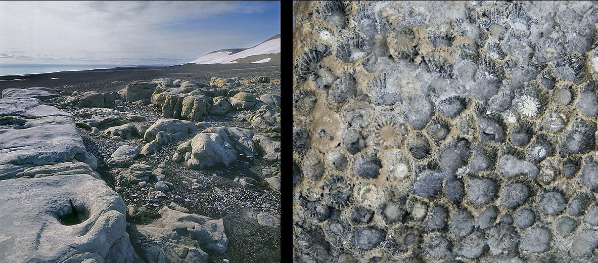
Part of Svartknausflya north of in Vibebukta with its geology from Carboniferous / Permian period. Fossilized Corals to the right. There are fossils everywhere here, most of sea shells, corals and ammonites.
The To see more of the Hinlopen Strait we sail northwards and explore the part of the strait that we missed when arriving the strait from the north a week ago. The Hinlopen Strait with normally much pack or drift ice are rich of wildlife, -birds and mammals.
Oh what a magnificent landscape there is here in the Hinlopen area !
Rounding the south west corner of Nordaustlandet we arrive Palanderfjorden. Here we come in close contact to curious Walrus.
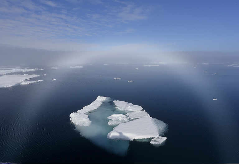
Fogbow in Hinlopen Strait. This bow is similar to a rainbow, but since the water droplets in a fogbow are very small, less than 0.05 mm, the individual colors will be scattered and mixed so much that a wide, whitish rainbow is formed.
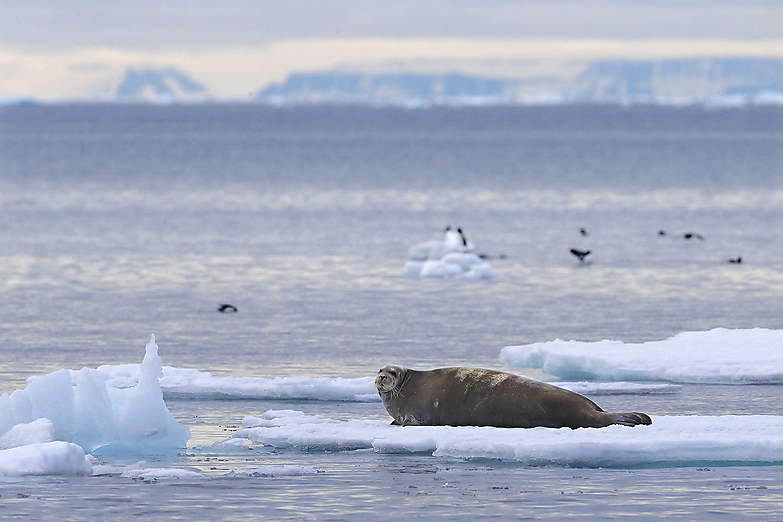
A Bearded Seal in the Hinlopen Strait.
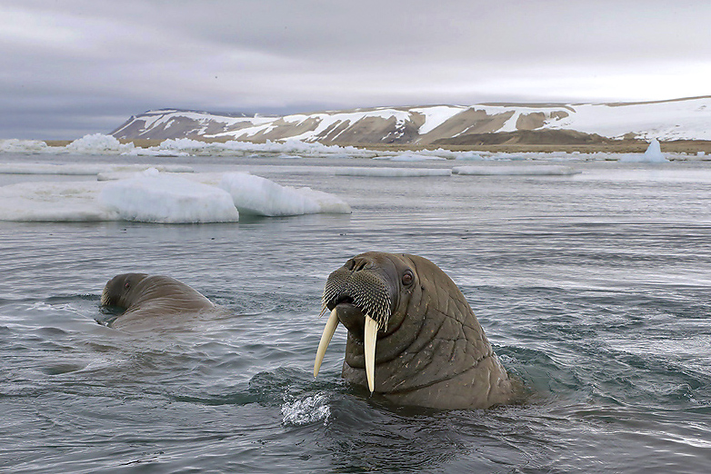
Walrus in Palanderfjorden , Nordaustlandet.
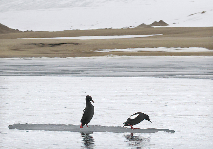
Black Guillemots in Palanderfjorden, Nordaustlandet
Brunnich`s Guillemots on an iceberg in the Hinlopen Strait.
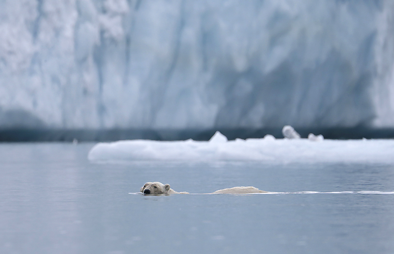
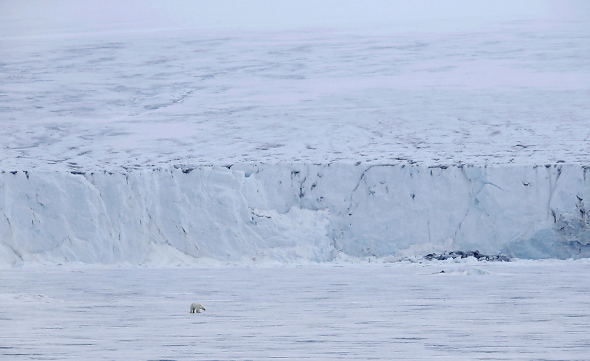
Crossing over to the east side of the southern part of the Hinlopen Strait we arrive another icy world, with several glaciers calving into the sea. This is areas that is favored by Polar Bears in the Summer time due to the often presence of seals on the solid sea ice outside the glacier fronts. We stay in the area for several days and see numerous Polar Bears.
Polar bear with cub in front of Hochstetterbreen glacier at Hinlopenstredet.
“Small Polar Bear” in big icy landscape, Hochstetterbreen at Hinlopenstredet.
Dark phased Fulmar near Hinlopenbreen glacier.
Brunnich`s Guillemots near Hinlopenbreen glacier.
After exploring the Hinlopen Strait we set course southward for entering the huge Storfjorden area between Spitsbergen, Barentsøya and Edgeøya. To come to this area we can either drive east of Barentsøya and Edgeøya for entering Storfjorden from the south or sail through one of the two historically feared straits; Heleysundet between Spitsbergen and Barentsøya or Freemansundet between Barentsøya and Edgeøya.
We choose Heleysundet which are the narrowest and most feared among the two straits. The current here can be as strong as 10 knots with huge vortexes spread over the entire strait. At the change between ebb and flow the current will be at it`s weakest. This occur twice a day and is very close in time so wait don`t have to wait long before this occur and we can pass through. Unfortunately we missed this important time with 2 hours, so the current was strong with huge vortexes so the ship moved quite a lot from side to side, at the most up to 90°. By the land at the north side of the strait the current was so strong that the water was like a roaring furious river. We had 7-8 knots of tide water against us, so our effective speed through Heleysundet was only 1-2 knots.
Finally through and the sea is soon calm again. We are now innermost in Storfjorden with another place with “always” sea ice”; Ginevrabotnen. On Lamontøya here there was a Polar Bear female with 2 cubs.
Part of Heleysundet with its extremely strong tide currents. The current on the photo is 7-8 knots.
Passing by Lamontøya in Ginevrabotnen, Storfjorden we see a Polar Bear family.
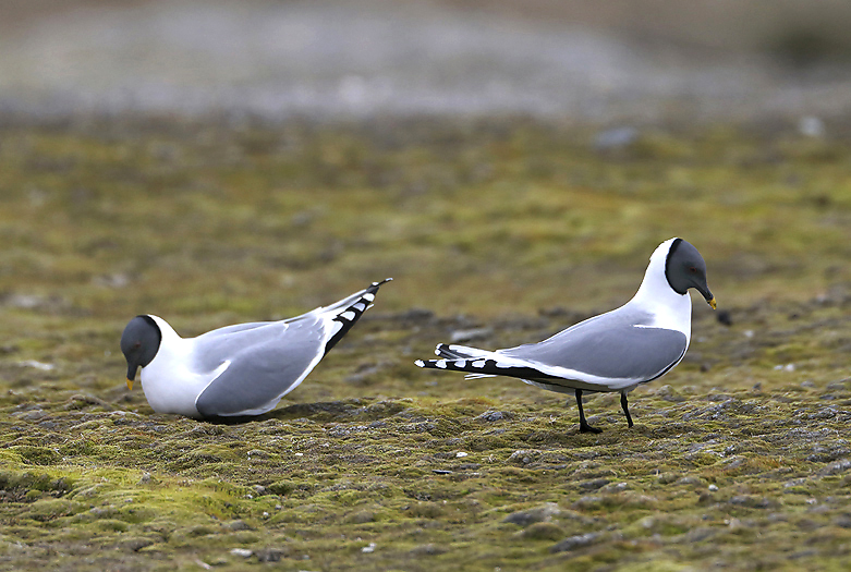
Sabine Gull display on an island in Storfjorden where we explored their colony. This special rocky island is small and difficult to access. It consists also of moraine mounds with tiny ponds in between. This island contains also a colony of 30-40 Arctic Terns, Grey Phalaropes, and Brent Geese (Bernicla, -dark phase). This island was by the wait “born” around 1965 when the huge glacier retreated and left land above the sea level.
The high arctic Sabine Gull with its typical black outer primaries (and their coverts) and fork-tailed shape.
Arctic Tern on the island in Storfjorden.
Dark bellied Brent Geese (B.Bernicla) is very rare at Svalbard, -this is the first time they are seen outside Adventdalen on the west coast. A foggy day by the way..
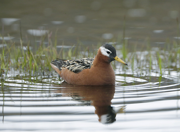
Grey Phalarope (PAP).
Part of this special island in Storfjorden where we found Sabine Gulls, Grey Phalaropes, Brent Geese and other interesting species.
We are now heading southwards in Storfjorden. On the west side we have Spitsbergen where numerous glaciers ends in the fiord stretches all the way south to Sørkapp (South Cape). We pass a magnificent and beautiful landscape that I know very well from several expeditions in winter time. With ref i.e. to the Travel Article “Svalbard in Winter Landscape.
We make at stop at Inglefieldbukta near half way down where the huge Inglefieldbreen glacier runs into the sea. Polar Bears are often seen there in the Summer time, so we go for a check. There are still winter ice in front of the glacier, and with a closer look we can see 5 Polar Bears; One mother with two cubs, and two other bears walking for themselves. Two Ringed Seals are on the ice, -so no wonder that there are bears in the area. A couple of Ivory Gulls are also to be seen here.
Polar Bear family on the winter ice in front of Inglefieldbreen glacier.
Polar Bear family at Inglefieldbukta.
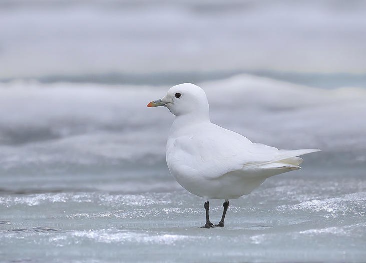
Ivory Gull at Inglefieldbukta. These Gulls are often found where there are Polar Bears. There they find left-overs from seal kills.
Back to Edgeøya again. On Edgeøya at the east side of Storfjorden there are several interesting places: The old Kapp Lee trappers station and the remnants of Pomor buildings at Dolerittneset on Edgeøya. Arriving Dolerittneset in early morning we were met by a herd of 20-25 Walrus in the sea. From a far distance they were observed laying on the beach, but was probably curious and went off shore before we arrived the bay. This is known to be one of the favorite Walrus haul out places on Svalbard, and they were hunted during the 1600 and the 1700 hundreds. This former slaughtering is visible when we going ashore where Walrus bones and skulls are spread over a big area vest of the station.
This is one of the strangest trappers stations on Svalbard. An octagonal cabin set up here in 1904 by the crew on the hunt Elina Kristine by skipper Fredrik M. Isaksen. It is a prefabricated building, a possible former dispatch house.
Ruins of Russian Pomor buildings from late 1700 hundreds on Dolerittneset, Edgeøya. Russian Pomors were very active by Edgøya at that time, and remnants from their presence can be found several places.
Further south on the west side of Edgeøya, at Diskobukta, -there is a special place. A canyon containing around 20 000 Kittiwakes. It is a bit troublesome to come ashore in Diskobukta because it is extremely shallow. The Zodiac touched bottom 300-400 from land and the last 100-meters I pulled the boat by hand into shore. The outboard propeller was damaged and needed to be replaced when we were back to the ship later that day.
On land there are several old bones of Greenland (Bowhead) Whale and a trappers station “Villa Disco” built in 1929 by Georg Bjønnes and the brothers Aldred Einar and Eldor Svendsen. Beside there is a newer building that belongs to the Norwegian Polar Institute.
The birdcliff canyon in the mountains east of Diskobukta, Edgeøya. It was as entering another world there. Extremely noisy and with Arctic Foxes that went under the cliffs hunting/searching for food. We saw in total 5 Arctic Foxes.
Arctic Fox at Diskobukta..
The Fox is seems to be quite hungry and hurry up to the birdcliff canyon in search of food.
Old bone of Greenland (Bowhead) Whale and a trappers station “Villa Disco” built in 1929 by Georg Bjønnes and others in behind
At the south west corner of Edeøya we find the well known place Andretangen. Here is also one of the favorite haul out places for Walrus on Svalbard, and a trappers station which have been much used due to traditionally good catches of Arctic Fox and Polar Bear. There are old bones scattered around in the landscape witnessing that this place (as at Kapp Lee) was a former slaughtering place for Walrus. Arriving the place we see a huge Walrus herd laying on the beach, and some in the water (including at least 5 calves), together around 60-70 animals. The Walrus does not show any fear so they admit us coming close to them, -a great experience.
The Trappers station here was built by Henry Rudi in 1946. However, there has been a hunting lodge on Kvalrossanden since Petter Trondsen’s expedition in 1904. There are also several cultural heritage sites at the place.
Andretangen trappers station built by Henry Rudi in 1946. Here we see an example of cultural heritage perishing, -there are 20 years between the 2 photographs.
Walrus by Andretangen, Edgøya.
Walrus on Andretangen, Edgøya.
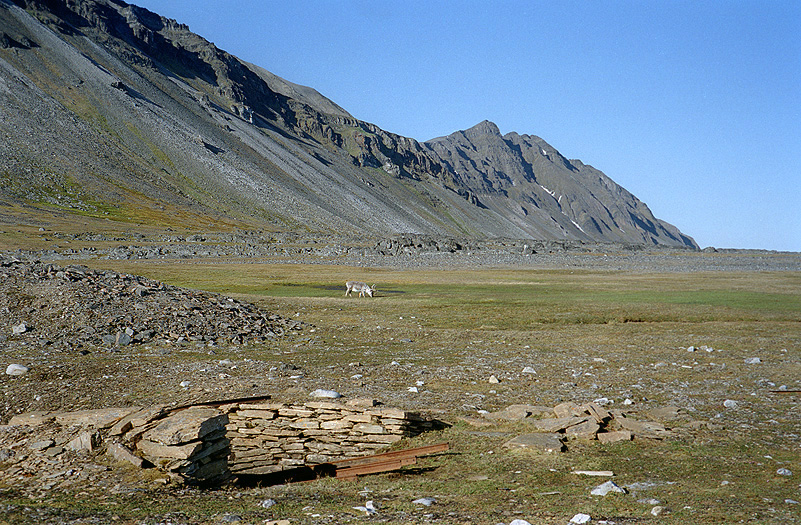
Svalbard Reindeer on Andretangen, Edgøya.
The perhaps most famous former fur trapping Station at Svalbard is “Bjørneborg” (= “Bear Castle”) on the small island Halvmåneøya (=Half Moon Island) beside the very southern tip of Edgøya. The trappers station has a history dating back to 1898. The main building at Bjørneborg is from 1904. It was later extended in 1935 and 1963. The station is very complete with warehouse and trap-gun for killing Polar Bears both out in the hunting ground and in the warehouse. The area was traditionally the best area for hunting Polar Bears on Svalbard. The largest catches taken in the entire Arctic through the ages and taken by ship to Norway comes from this small, flat windswept, naked island.
Henry Rudi is known as the “Polar Bear King” and shot in total 713 Polar Bears during his hunting career. Rudi spent the winter in the arctic for a total of 27 years (10 years on Greenland and 17 on Svalbard). Not only is he among the most experienced, but also one of the most mobile of all the winters. He spent the winter on Hopen, on Jan Mayen and on 7 different hunting territories on Svalbard. In Greenland; First in Northeast Greenland 1928–30, then in Southeast Greenland 1931–33 and 1939–42 again in Northeast Greenland. In recent years in Greenland, 1942–45, he belonged to a sledge patrol that under Danish command patrolled the coastal stretches looking for German soldiers.
In 1908, Henry Rudi stood as a young man (19 years) behind the counter in Tromsø’s first cooperative (Coop) when Fridtjof Nansen came to the city and was payd tribute as a hero by the mayor. In the shop, he heard Arctic skippers and trappers tell incredible stories about life on the ice, about dramatic heroic deeds and not least about the sound of numerous coins earned…
Henry Rudi spent his first winter on Svalbard in 1908-1909. The result, -90 polar bears, gave him more taste!
“Bjørneborg” is the trappers station on Svalbard that can best illustrate the equipment at a station for Polar Bear hunting up to the last years of the hunt. The last season the station was in use was the winter of 1969-70.
What only 50-60 years ago was perceived as brave, harsh and brave, today appears only as brutality and meaningless.

The “Polar Bear King” Henry Rudi in action by the station at Halvmåneøya. Historical photo by N.N.
The famous trappers station ”Bjørneborg” (Bear Castle) at Halvmåneøya (Half Moon Island).
The trappers station at Halvmåneøya wit the old sled. Note the trap-gun arrangement for killing Polar Bears in behind.
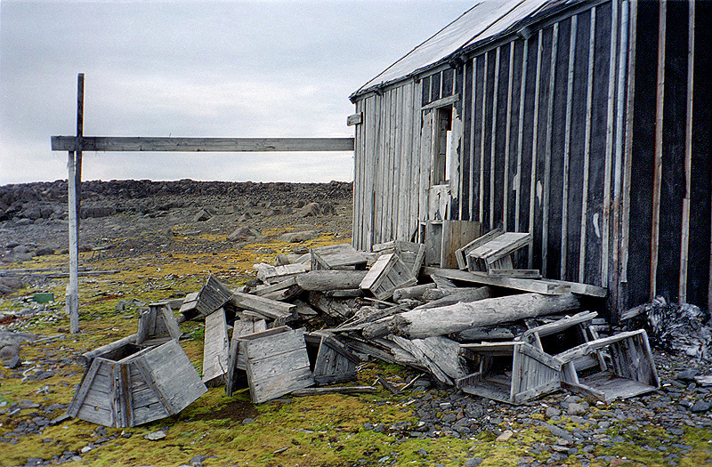
A pile of old Polar Bear trap-gun boxes beside the combined workshop/storage building belonging to the “Bjørnborg” station on Halvmåneøya.
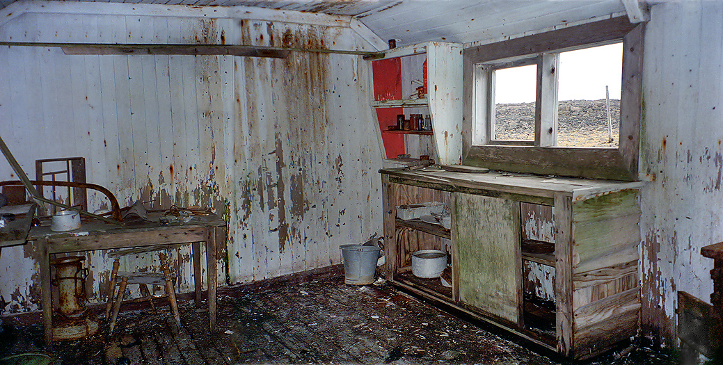
The interior of the kitchen in the the “Bjørnborg” station on Halvmåneøya. The very poor condition reflect that trapping of Polar Bears ended in 1974.
Storfjorden is a huge and wide fiord. The southern part can be rough and is near the same as being out on the open sea. Safely back to Spitsbergen again we anchored up at Isbukta which is far south on the east side of Spitsbergen, -just across land from innermost Hornsund which is entered from the west side of Spitsbergen. As the name says this is also “icy areas” with glaciers ending out in the sea as many other places along the east side of Spitsbergen. The waters here at Isbukta have not been thoroughly mapped and there are some dangerous shallow parts, especially on the north side, near Morenetangen. The landscape is rugged with many alpine peaks, -a beautiful place to be !
Resting Walrus on a small island in the Isbukta bay.
We observed many Eiders and King Eiders at Isbukta.
Fulmar, Isbukta and Haitanna mountain behind.
Passing Sørkapp (South Cape) on our way back to the mainland again we plan to take a break at the north side Bjørnøya (Bear Island).
It is autumn, and the days are getting shorter.
Bjørnøya Meterologial Station at Herwig Hamn.
Another sign of Autumn, -from Bjørnøya.
From the return voyage between Bjørnøya and the mainland, -but that is another story…
NOTE:
The Article is produced on the basis of multiple journeys to the archipelago.
All photographs of cultural sites, trappers huts etc in this article is in their original condition without any form of restoring.
Per Michelsen
Thanks to:
Kjell Tysdal, Ulf Prytz, Carl Emil Petersen, Susan Barr, Ole Jørgen Liodden/Roy Mangersnes.